August 4, 2020
Ready, Steady, Go — Here at Last Comes GLONASS-K
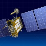
The third next-generation GLONASS-K navigation satellite, postponed several times, will now take place in late August or early September, according to reported statements by Russian space industry sources. This marks a long-delayed step along a road towards interoperability with other GNSS. The first GLONASS-K satellite was launched in 2011 and a second one in 2014.
By Inside GNSS