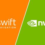
Roads and Highways Archives - Inside GNSS - Global Navigation Satellite Systems Engineering, Policy, and Design

Roads and Highways

February 7, 2022

GNSS and Earth Observation Market Report Finds 200 Billion Euro ($229 Billion) Revenue Generated in 2021

The European Union Agency for the Space Programme (EUSPA) has published its Earth Observation (EO) & GNSS Market Report, an outgrowth of its annual GNSS Market Report now that the agency has also taken on Earth observation among its administrative responsibilities. The Report is compiled and written for all those making these technologies part of their business plan and developing downstream applications.

Read More >

By Inside GNSS
[uam_ad id="183541"]
December 16, 2021

Swift Navigation Pairs with STMicro’s New Triple-Band Chip

Swift Navigation announced its support of the new STMicroelectronics Teseo V. The Teseo V family is a single-chip GNSS triple-frequency device for automotive use. Swift’s team has been working with ST to ensure the optimization of Swift’s precise positioning solution—comprised of the Starling positioning engine and Skylark precise positioning service—when paired with the STA8135GA Teseo V, the first single-chip triple-band GNSS IC (Integrated Circuit).

Read More >

By Inside GNSS
[uam_ad id="183541"]
October 13, 2021

GNSS, Inertial to Keep Scooters Off Sidewalks

A maker of electric scooters has developed a GNSS- and inertial-based technology to keep its own products off of city sidewalks. Bird, a provider of environmentally friendly electric transportation, announced a smart sidewalk protection technology developed in partnership with u-blox.

Read More >

By Inside GNSS
September 23, 2021

Webinar Examines Fastest-Ever Autonomous Vehicles Equipped with GNSS, Inertial, LiDAR and More

The fastest driverless speeds yet achieved will occur during the Indy Autonomous Challenge (IAC) on October 23. The autonomous competition will award a $1.5 million grand prize for the most successful R&D team that programs their driverless, GNSS-, inertial- and multisensor-equipped racecar to clock the fastest fifty-mile distance around the legendary Indianapolis Motor Speedway.

Read More >

By Inside GNSS
August 20, 2021

For PNT Integration, Timing Is Everything

GPS + inertial + camera + LiDAR + baro-altimeter = a very precise measurement, right? Not when the respective sensor output timings lack proper synchronization. Only when each piece of data carries an accurate timetag can they together enable optimal performance in multi-sensor fusion systems.

Read More >

By Inside GNSS
1 2 3 16
IGM_e-news_subscribe