November 18, 2025
Amberg Infra 7D’s GEOvis Integrates GNSS for Infrastructure Monitoring
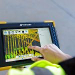
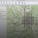
Amberg Infra 7D AG, part of the Swiss-based Amberg Group, has developed GEOvis, a cloud platform for collecting and visualizing geo-monitoring data across complex infrastructure projects.
By Peter Gutierrez