
New LiDAR System Expands Mobile Mapping Portfolio for Highway and Road Inspection
Trimble added to its mobile mapping portfolio with its new MX50 mobile mapping system for asset management and mapping.
By Inside GNSSGlobal Navigation Satellite Systems Engineering, Policy, and Design
Trimble added to its mobile mapping portfolio with its new MX50 mobile mapping system for asset management and mapping.
By Inside GNSS
Septentrio has partnered with XenomatiX, a provider of true-solid-state-LiDAR technology for autonomous applications and road management solutions, to enable high-accuracy GNSS-LiDAR solutions for road surveying and road management.
By Inside GNSS
The French company Geoflex demonstrated GNSS corrections-driven centimetric positioning in Brazzaville, Republic of Congo on July 8, at the national Stadium Alphonse Massamba-Debat. The demo employed a dual-frequency GNSS chipset receiving GPS and Galileo signals and the Geoflex corrections service via the Nigerian NIGCOMSAT-1R satellite on L Band
By Inside GNSS
The UK’s Royal Academy of Engineering presented its highest individual award to Dr Gladys West, whose mathematical modelling paved the way for the engineering innovation of GPS.
By Inside GNSS
Multi-antenna carrier-phase differential GNSS (CDGNSS)-based pose (position and orientation) estimation aided by monocular visual measurements and a smartphone-grade inertial sensor form the core of a system designed for micro aerial vehicles. It can be applied generally for low-cost, lightweight, high-accuracy, geo-referenced pose estimation.
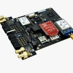
u‑blox and ArduSimple announced a partnership developing the SimpleRTK2B single-board computer (SBC). The device, built around up to three u‑blox ZED-F9P high-precision GNSS receivers, simplifies the development of centimeter-level positioning solutions supporting real-time kinematics (RTK)
By Inside GNSS
u-blox has introduced a service that offloads the position calculation from IoT devices into the cloud. The CloudLocate service will enable accurate positioning of IoT devices with constrained computing, communications, and energy resources.
By Inside GNSS
A consortium of European and Latin American organizations will establish and operate new Galileo Information Centre (GIC) for Mexico, Central America, and the Caribbean.
By Inside GNSS
The European GNSS Agency (GSA) together with the European Commission has published an Information Note on the Galileo High Accuracy Service, providing an overview of the main characteristics of the service
By Inside GNSS
Spaceopal has signed a contract for the development of the reference algorithm for the users of the Galileo High Accuracy service (HAS) and for a full-fledged user terminal.
By Inside GNSS
By Logan Scott
The U.S. Department of Transportation’s (DoT’s) “Complementary PNT and GPS Backup Technologies Demonstration Report” released this January has some excellent data on the relative performances of various systems in timing and positioning.
By Inside GNSS
On March 3 a Galileo Performance Workshop, open to anyone interested in GNSS and led by the European GNSS Agency (GSA), will offer an in-depth analysis of the performance of the Galileo constellation and signals and how they are evaluated for users.
By Inside GNSS
U.S. Senator Jim Inhofe, R-Oklahoma, wrote an opinion editorial piece at the close of 2020 warning any investors or potential investors in Ligado Networks that they face “massive risks.”
By Inside GNSS