July 19, 2021
Partners Field LiDAR/GNSS/INS Solution for Road Survey and Management
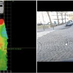
Septentrio has partnered with XenomatiX, a provider of true-solid-state-LiDAR technology for autonomous applications and road management solutions, to enable high-accuracy GNSS-LiDAR solutions for road surveying and road management.
By Inside GNSS