January 23, 2013
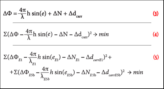
Equations 3, 4 & 5
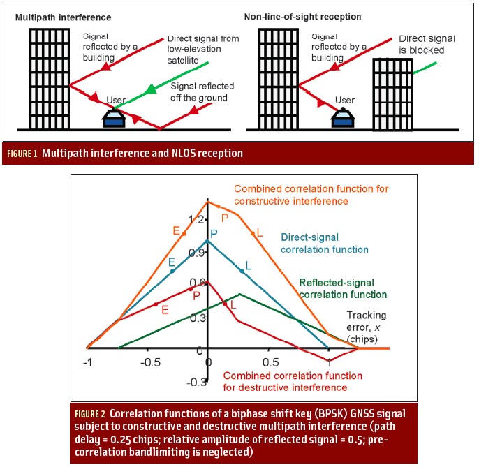
Galileo Altimetry Using AltBOC and RTK Techniques
Equations 3, 4 & 5Working Papers explore the technical and scientific themes that underpin GNSS programs and applications. This regular column is coordinated by Prof. Dr.-Ing. Günter Hein, head of Europe’s Galileo Operations and Evolution.
By Inside GNSS