
GPS Penetrates Underground, Concrete Structures with SubWAVE
South of Stockholm, Sweden, the new Haninge Bus Terminal has been equipped with SubWAVE GPS Coverage Extension from Syntony.
By Inside GNSSGlobal Navigation Satellite Systems Engineering, Policy, and Design
South of Stockholm, Sweden, the new Haninge Bus Terminal has been equipped with SubWAVE GPS Coverage Extension from Syntony.
By Inside GNSS
SAM PULLEN, Stanford University
A: Since at least 1997, the Global Positioning System (GPS) Control Segment (CS) has issued what are known as “Notice Advisor(ies) to NAVSTAR Users” or “NANU(s).”
By Inside GNSS
Multi-antenna carrier-phase differential GNSS (CDGNSS)-based pose (position and orientation) estimation aided by monocular visual measurements and a smartphone-grade inertial sensor form the core of a system designed for micro aerial vehicles. It can be applied generally for low-cost, lightweight, high-accuracy, geo-referenced pose estimation.

A consortium is preparing to ramp up production of Geonav IoT, a seamless indoor/outdoor positioning solution for sports applications, asset tracking and aiding drone traffic management. The GNSS module is a high-accuracy, dual-frequency system-on-chip with an integrated, low-power application processor.

Official broadcast for testing of the Galileo High Accuracy Service (HAS) has begun. Users equipped with a receiver that is capable of acquiring this signal and extracting its data content can start observing and testing specific aspects of the HAS service
By Inside GNSS
Gimbal, a location intelligence platform, and NextNav, a 3D geolocation provider, have partnered to makes the vertical dimension – the Z-axis – available for brands and retailers within their mobile applications.
By Inside GNSS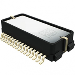
Murata has developed a new micro-electromechanical systems (MEMS) six degrees-of-freedom (6DoF) inertial sensor, the SCHA63T, for autonomous off-highway vehicles, dynamic inclination sensing and GNSS positioning support.
By Inside GNSS
Incidents of GNSS signals that contain phase anomalies in a way as to mimic ionospheric scintillation have been observed in the past years. Although it is challenging to differentiate an oscillator anomaly from ionospheric scintillation, their underlying physics are different and show different carrier frequency dependency. Machine learning models using extensive GNSS databases can automatically detect satellite oscillator anomaly events.
By Inside GNSS
EMCORE Corporation received a $1.1 million development contract from a major U.S. prime contractor to design and manufacture a high-end inertial measurement unit (IMU) for tactical intelligence and reconnaissance systems.
By Inside GNSS
The Department of Transportation Report on complementary and backup PNT technologies has good information but paints far from a complete picture. Several candidate technologies were not demonstrated, and market factors that will form an important consideration are not discussed.

Dr. Rui Hirokawa is Deputy General Manager, Space Systems Department, at Kamakura Works, Mitsubishi Electric Corporation. A fixture in today’s GNSS community, he manages several QZSS-related projects, including the centimeter-level augmentation service (CLAS), and has recently been deeply involved in the international standardization of high-accuracy GNSS.
By Peter Gutierrez
For years, both the Executive and Congress have expressed concerns over PNT vulnerabilities and clamored for solutions. Yet little has changed. Three important reports emerged at the tail end of the old regime. As new leadership takes the helm, in which direction will it take the PNT enterprise?
By Dawn M.K. Zoldi (Colonel, USAF, Ret.)
KVH Industries has upgraded its TACNAV 3D tactical navigation system with photonic integrated chip (PIC) technology in the P-1775 inertial measurement unit (IMU).
By Inside GNSS