June 16, 2015
Study: GPS Contributed More Than $68 Billion to the U.S. Economy
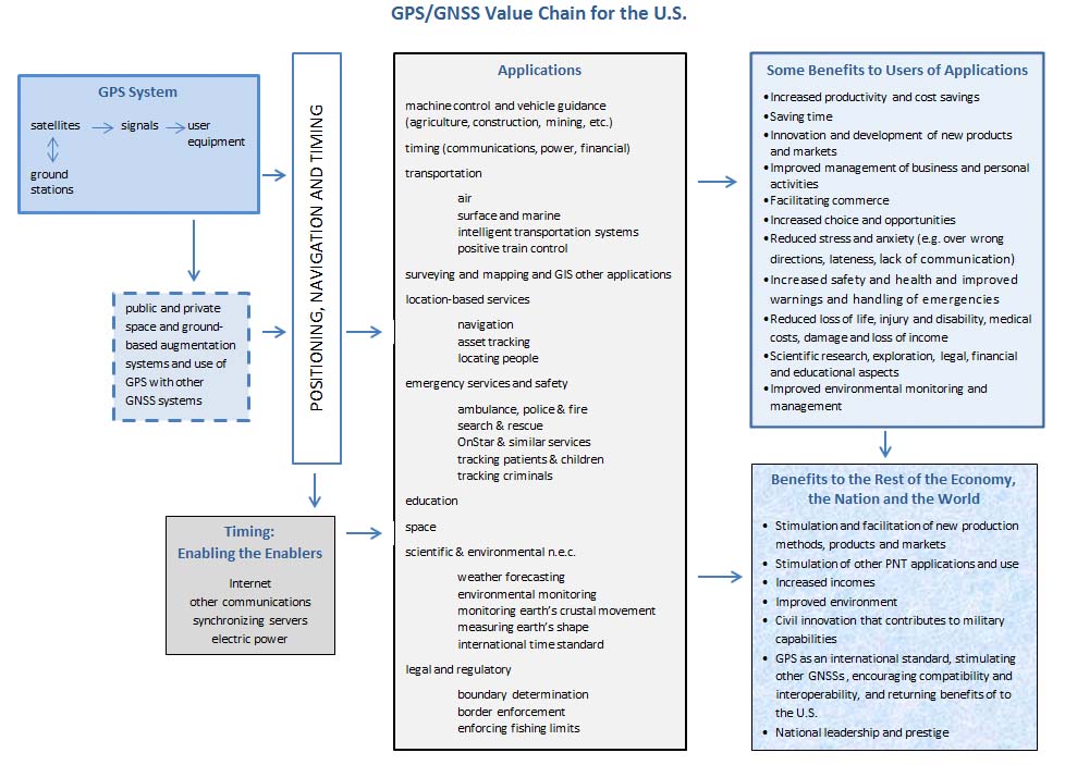
GPS contributed more than $68 billion to the U.S. economy in 2013, according to the preliminary results of a new study presented to the National Space-Based Positioning, Navigation, and Timing (PNT) Advisory Board.
And the study’s author, Irv Leveson, a consultant to ASCR Federal Research and Technology Solutions, LLC, described that figure as conservative because it did not fully incorporate a host of GPS applications including those depending on GPS timing information.
By Inside GNSS