B: Applications Archives - Page 128 of 145 - Inside GNSS - Global Navigation Satellite Systems Engineering, Policy, and Design

B: Applications

March 12, 2010

Bright Ideas Welcome at 2010 European Satellite Navigation Competition
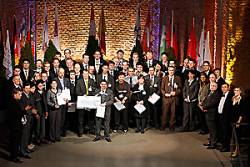
European Satellite Navigation Competition Awards 2009

The European Satellite Navigation Competition (Galileo Masters), now in its seventh year, is seeking the best ideas for satellite navigation applications from companies, entrepreneurs, research institutes, universities, and individuals. Prizes total more than €500,000.

The 2010 contest begins on May 1, when competitors may register and submit their ideas online at the secure ESNC website. It closes on July 31.

Read More >

By Inside GNSS
February 26, 2010

Raytheon Wins $1.5-Billion GPS OCX Contract

Raytheon Corporation graphic

Officials from the Space and Missile Systems Center’s Global Positioning Systems Wing announced today (February 25) the award of the Next Generation GPS Control Segment (OCX) contract to Raytheon Company, Intelligence & Information Systems, Aurora, Colorado.

With a baseline duration of 73 months, the OCX development contract has option years for sustainment worth a potential total of $1,535,147,916. Raytheon teammates include Boeing, ITT, Braxton Technologies, Infinity Systems Engineering, and the Jet Propulsion Laboratory.

Read More >

By Inside GNSS
[uam_ad id="183541"]
February 24, 2010

2010 International Symposium on GPS/GNSS

The theme of the 2010 International Symposium on GPS/GNSS is "At a Turning Point." It will take place at Howard International House in Taipei, Taiwan on October 26-28.

National Cheng Kung University is organizing and hosting the event. The symposium will be held in English.

The annual forum is open to innovative ideas on GNSS systems, techniques, applications and opportunities by researchers and engineers from academia and industry.

Read More >

By Inside GNSS
February 16, 2010

Ready to Navigate!

After three decades of increasingly widespread use, satellite navigation-based services have changed significantly, especially for general users in the mass market. New technology enablers such as assisted GPS (A-GPS), the use of massively parallel correlation, and the application of advanced positioning techniques have significantly enhanced the time-to-first-fix (TTFF) and sensitivity of today’s receivers.

Read More >

By
February 15, 2010

1 Antenna, 3 Dimensions

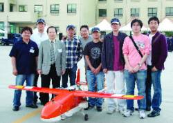
SNUGL team members: From left to right, Byungjoon Park (BJ Hobby Craft), Jihoon Kim, Prof. Changdon Kee, Am Cho, Bosung Kim, Dongkeon Kim, Noha Park, Sanghoon Jeon, and Donghwan Bae

GPS has been widely used as a navigation sensor for numerous applications including unmanned aerial vehicles (UAVs). Many researchers have devoted considerable efforts to expand the role of GPS in guidance, navigation and control to determining an aircraft’s attitude. That would enable us to use a GPS receiver as a sensor for an automatic control system as well as a navigation sensor.

Read More >

By
[uam_ad id="183541"]

Wide-Area RTK

A common assumption in real-time kinematic (RTK) techniques is that the differential ionospheric delay between a GNSS transmitter and each of the roving or reference receivers is negligible. However, increased position uncertainty — spatial decorrelation — is usually allocated to the baseline receivers as baseline distances increase.

A refinement of this assumption comes with the network RTK (NRTK) using a set of permanent receivers to mitigate atmospheric dependent effects, such as the ionospheric delay, over distance.

Read More >

By

Taking Positioning Indoors

Wireless local area networks (WLANs), popularly known as Wi-Fi, were originally designed for data applications. Over the past decade or so, WLAN infrastructure has been implemented for high-speed wireless Internet access in homes, “hot-spots,” university campuses, and corporate buildings. Hundreds of millions of Wi-Fi access points (APs) are deployed in major urban areas worldwide.

Read More >

By
February 11, 2010

First GPS Block IIF Satellite Moves to Cape Canaveral: Launch Window Opens Mid-May

First Block IIF Satellite (Boeing)

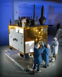
[updated Februaary 16] The first Block IIF satellite is undergoing final launch preparations after arriving at Cape Canaveral Air Force Station in Florida aboard a Boeing-built C-17 Globemaster III airlifter.

Space Vehicle 1 (SV-1), the first of 12 GPS IIF satellites for the U.S. Air Force, will lift off on a United Launch Alliance Delta IV vehicle later this year, with the first launch window in mid-May.

Read More >

By Inside GNSS
January 29, 2010

Septentrio Announces AsteRx3 Multi-GNSS Receiver

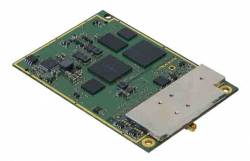
AsteRx3 Receiver from Septentrio

Septentrio has launched the AsteRx3, a compact multi-frequency GPS/GLONASS/Galileo and Compass/Beidou-ready receiver.

AsteRx3 is specially designed for integration in demanding precision positioning, navigation, and automation applications such as land and maritime survey, machine control, and unmanned aerial vehicle (UAV) payloads.

Read More >

By Inside GNSS
January 28, 2010

New LMCO SV Lab Will Support GPS IIIA Production

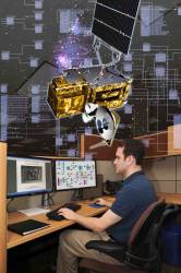
Inside the LM Space Vehicle Integration Laboratory. Lockheed Martin photo

Lockheed Martin has announced that its new Space Vehicle Integration Laboratory (SVIL) near Denver, Colorado, has achieved initial operational capability and is supporting the company’s satellite development program activity, including the production run of the next-generation GPS IIIA spacecraft.

Read More >

By Inside GNSS

ESA, Industry Sign Galileo FOC Contracts

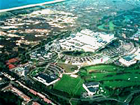
Aerial view of ESA-ESTEC facility at Noordwijk, The Netherlands. ESA photo by A. Van Der Geest

René Oosterlinck, the European Space Agency’s director of the Galileo program and navigation-related activities, and company representative signed the first three contracts for the Galileo full operational capability (FOC) phase on January 26. The event marks the official start of building the Galileo operational infrastructure.

Read More >

By Inside GNSS
IGM_e-news_subscribe