May 30, 2017
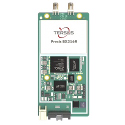
Precis-BX316R GNSS PPK board. Photo source: Tersus GNSS.
Tersus GNSS Launches Precis-BX316R GNSS PPK Board
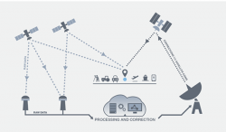
Precis-BX316R GNSS PPK board. Photo source: Tersus GNSS. Tersus GNSS, Inc., a GNSS RTK manufacturing company based in Shanghai, China, recently launched its new GNSS Post-Processing Kinematic (PPK) Board, the Precis-BX316R.
By Inside GNSS


 & Carnegie Robotics CTO Chris Osterwood (R).jpg)


_and_Fergus_Noble_(R),_co-founde-e240cc279eaa83b2be814504fc94555b.jpg)
