A: System Categories Archives - Page 160 of 196 - Inside GNSS - Global Navigation Satellite Systems Engineering, Policy, and Design

A: System Categories

September 14, 2010

2010 UN-IAF Workshop: GNSS Applications for Human Benefit and Development
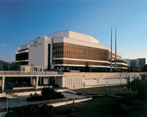
Prague Congress Centre

The workshop on GNSS Applications for Human Benefit and Development is sponsored by the United Nations Office for Outer Space Affairs and the International Astronautical Federation (IAF).

It is the 20th joint UN-IAF workshop and will be held at the Prague Congress Centre (PCC) in Prague, Czech Republic just before the 61st International Astronautical Congress that runs from September 27-October 1.  Participants at either event are welcome at the other.

Read More >

By Inside GNSS
September 11, 2010

“Michibiki,” Japan’s First QZSS Navigation Satellite, Reaches Quasi-Zenith Orbit

QZSS satellite separaes from the launcher (photo by Mitsubishi Heavy Industries)

(UPDATED September 27) Japan’s first quasi-zenith satellite launched successfully from the Tanegashima space center on September 11, 2010 and reached its quasi-zenith orbit on Monday, September 27.

Michibiki means to guide or lead the way, appropriate for the first entry into Japan’s satellite augmentation program that will vastly improve GNSS accuracy over Japan and the rest of East Asia.

Read More >

By Inside GNSS
September 10, 2010

Oregon: More GPS Product Design and GNSS-related Industry Here Than You May Think

The Portland skyline with a GPSIIF satellite is featured in the Inside GNSS booth at ION GNSS 2010

by Glen Gibbons

Few would mistake Oregon for the beating heart of GNSS. Still,  for a medium-sized U.S. metro area in the Pacific Northwest, Portland  and Oregon’s I-5 corridor has enough relevant involvement with the industry to justify hosting the Institute of Navigation’s 2010 GNSS conference and exhibition.

Oregon has FLIR Systems, Cloud Cap Technology, TriQuint, Intel, Garmin and Inside GNSS magazine.

Read More >

By Inside GNSS
[uam_ad id="183541"]
September 7, 2010

When GNSS Goes Blind

A completely GPS-based navigation solution is generally not feasible in GNSS signal–challenged environments such as urban canyons. However, even in these difficult environments a partial set of GPS signal measurements may still be available. For instance, one or two satellites are generally still visible even in dense urban canyons.

Read More >

By Inside GNSS

NaviForum Shanghai 2010

A close brush by a passing typhoon on its opening day aside, NaviForum Shanghai 2010 mustered an impressive slate of senior executives from Chinese companies working in the navigation and telematics/location based services (LBS) field.

Read More >

By Inside GNSS
[uam_ad id="183541"]
August 27, 2010

GLONASS-M Satellite Launch Highlights Ambitious Promotion of Russia’s Revitalized GNSS

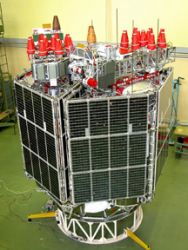
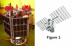
GLONASS-M satellite. Figure/photo, JSC “Academician M.F. Reshetnev “Information Satellite Systems”

A Proton-M carrier rocket successfully launched three GLONASS-M satellites into orbit early this morning (September 2, 2010, Moscow time) from the Baiknour space center in Kazakhstan. Another launch on November 30 will send three more M-type satellites into orbit, and the first GLONASS-K is scheduled to go up on December 25.

The imminent completion of a full constellation by the end of the year is accompanied by a vigorous policy initiative to promote Russia’s revitalized GNSS.

Read More >

By Inside GNSS

SVN62, the First GPS IIF Satellite, Is Set Healthy

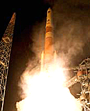
SVN62 launch (ULA)

The U.S. Air Force declared the first GPS Block IIF satellite (SVN62) operational today (August 27, 2010), changing the spacecraft’s navigation signal status to healthy at about 10:10 a.m. (EDT or 4:10 a.m. UTC). 

Launched May 28, the satellite became the responsibility of the USAF 50th Space Wing on August 26,

Read More >

By Inside GNSS
IGM_e-news_subscribe