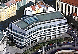
A: System Categories Archives - Page 161 of 195 - Inside GNSS - Global Navigation Satellite Systems Engineering, Policy, and Design

A: System Categories

August 2, 2010

European Union Conference: A New Space Policy for Europe

The European Parliament will hold a high-level conference for industry and political decisionmakers on European space policy at the European Parliament Hemicycle in Brussels, Belgium on October 26 and 27, 2010. It is organized by Business Bridge Europe (BBE) and Parliament’s Sky and Space Intergroup.

Invited speakers for the opening session include:

Read More >

By Inside GNSS

New GPS Module from Sierra Wireless

Sierra Wireless, headquartered in Richmond, British Columbia, Canada, has announced the availability of a new GPS module and supporting software, optimized for wireless applications based on Sierra Wireless AirPrime Intelligent Embedded Modules.

The new AirPrime XM0110 GPS Module is based on integrated SiRFstarIV GPS technology from CSR plc, and an OEM design optimized for wireless asset tracking and automotive applications.

Read More >

By Inside GNSS

Topcon Releases Software for IP

Topcon Positioning Systems (TPS) has announced the release of Spatial Factory software.

The software interface allows users to work with the combination of point cloud, trajectory, and panoramic image data that comes from the Topcon IP-S2 3D mobile mapping system.

Read More >

By Inside GNSS
[uam_ad id="183541"]

Hemisphere Launches GPS Vector II OEM Board

Hemisphere GPS has announced its Crescent Vector II OEM board and a series of related Crescent Vector II GPS compass products.

The new OEM board, targeted for system integrators, brings a series of new features to the company’s patented Crescent receiver technology, including heave, pitch, and roll output; more accurate timing, lower phase noise, and an improved accelerometer.

The Crescent Vector II design provides precise heading and positioning accuracy even while a mobile platform is motionless.

Read More >

By Inside GNSS
August 1, 2010

50th Civil GPS Service Interface Committee (CGSIC) Meeting

The 50th Civil GPS Service Interface Committee (CGSIC) Meeting will be held on Monday, September 20 and Tuesday, September 21 at the Oregon Convention Center in Portland just before the 2010 Institute of Navigation GNSS conference at the same location.

For the first time, the CGSIC meeting will be hosted by ION and the CGSIC plenary session will be on the main agenda of the larger conference.

CGSIC subcommittee meetings will be held on Monday and the plenary session on Tuesday, a reversal of the usual order.

Read More >

By Inside GNSS

China Launches 5th Compass (Beidou-2) Navigation Satellite — First IGSO

Fifth Beidou-2 satellite launched. Xinhua/Du Cai photo

[Updated August 1, 2010] China’s state news agency has reported that the fifth Compass (Beidou-2) satellite — the system’s first inclined geostationary orbit (IGSO) spacecraft — was launched successfully at 5:30 a.m. Sunday (August 1 — local time) from Xichang Satellite Launch Center in southwestern Sichuan Province

This was the third Compass satellite put into orbit this year, following launches in June and January 2010.

Read More >

By Inside GNSS
[uam_ad id="183541"]
July 30, 2010

China’s BeiDou Nav Satellite System to Cover the World in 2020

[Reprinted with permission NAVIBIZ, Issue Date: 2010-6-7]

China is building up its global satellite navigation system BeiDou (COMPASS) that is intended to cover the world by 2020. That’s the word from the country’s first Satellite Navigation Conference, in Beijing. Developed and operated by China, BeiDou is designed to provide accurate real-time military and civil service to national security, social and economic development.

Read More >

By Inside GNSS

China Launches 4th BeiDou Navigational Satellite

A Compass/Beidou-2 geostationary satellite is lifted into space from China’s Xichang space center. (China Academy of Launch Vehicle Technology photo)

[Reprinted with permission from NAVIBIZ, Issue Date: 2010-6-18]

At 23:53 on June 2, China successfully launched the 4th BeiDou navigational satellite into the pre-designated orbit with the "Long March 3C" carrier rocket at the Xichang Satellite Launch Center, symbolizing that China has made another important step forward in building the BeiDou (COMPASS) Navigation Satellite System. The construction of COMPASS follows the principles of openness, independency, compatibility, and gradualness.

Read More >

By Inside GNSS
July 27, 2010

Meet GINA

GINA On-Board Unit (OBU)

For at least the past two decades, managing traffic on Europe’s road networks has been a growing concern for European policy makers and citizens alike. While demand for transport has consistently increased over the years, Europe’s road network capacity has failed to keep pace, leading to increasing levels of congestion and pollution.

Read More >

By Inside GNSS

Help from Above

During flight testing, Boeing technical personnel have historically used a differential GPS (DGPS) system as the position truth reference for validating various production systems on the airplane. The majority of those tests occur on or near remote runways to capture specific environmental conditions.

Read More >

By Inside GNSS
July 22, 2010

Topcon Promotes O’Connor to Managing Executive Officer

Ray O’Connor, Topcon Positioning Systems

Topcon Corporation has announced the promotion of Ray O’Connor to managing executive officer for the company.  

O’Connor is president and CEO of Topcon Positioning Systems (TPS), based in Livermore, California, and chairman of the board of Topcon Europe Positioning. He will continue to fill these and other positions within the corporation while taking on additional managerial oversight of various corporate projects and initiatives.

Read More >

By Inside GNSS
IGM_e-news_subscribe