November 14, 2014
 Implementation of code-Phase structures for GLONASS signals ?/?, L2C and L3
Topcon Engineers Track New GLONASS Signal
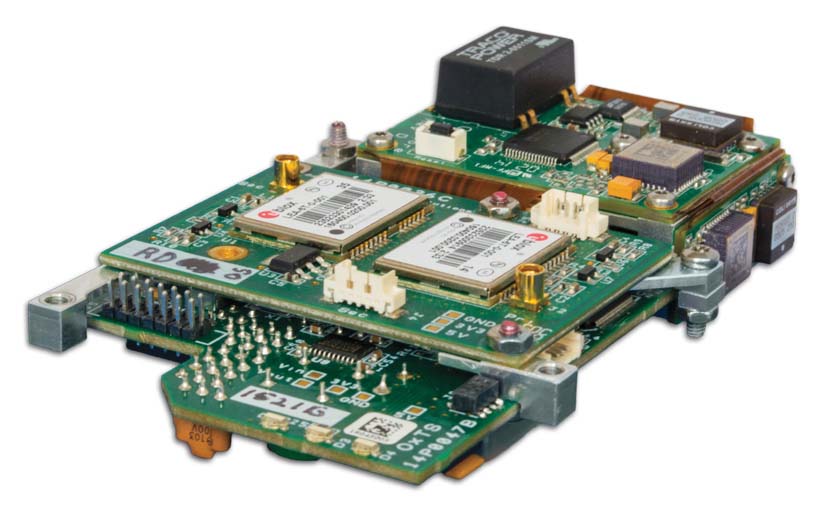
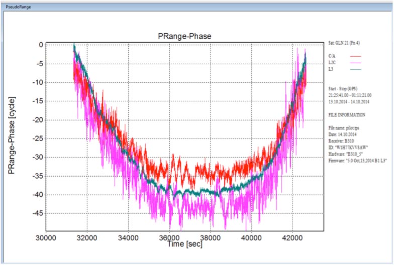
Implementation of code-Phase structures for GLONASS signals ?/?, L2C and L3Topcon Positioning Group has announced that its latest GNSS reference receiver has tracked a new signal from the GLONASS constellation.
The GLONASS-M 55 satellite was launched in June and is equipped
with an experimental payload capable of transmitting CDMA signals in the
Russian GNSS system’s L3 frequency band centered at 1202.025 MHz. According to the company, Topcon engineers successfully tracked the signal using the NET-G5
receiver during a series of recent tests at the Topcon Technology Center
in Moscow, Russia.