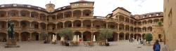
GLONASS Archives - Page 9 of 31 - Inside GNSS - Global Navigation Satellite Systems Engineering, Policy, and Design

GLONASS

December 16, 2014

Official: Foreign GNSS Signals Need FCC Authorization for Use in United States

Ronald Repasi, deputy chief of the FCC’s Office of Engineering and Technology, speaking at a 2012 hearing of House Energy & Commerce Subcommittee on Communications and Technology

A rule largely aimed at opening trade in telecommunication services will require Russia and other international providers of GNSS services to apply for authorization before their navigation signals can be legally used in the United States, a Federal Communications Commission (FCC) official has told GPS experts on the Space-based Positioning, Navigation, and Timing (PNT) Advisory Board.

Read More >

By Inside GNSS
December 2, 2014

Intelligent Transportation Systems: 22nd ITS World Congress

The Convention Centre Bordeaux

The 22nd World Congress and Exhibition on Intelligent Transport Systems and Services will be held at the Convention Centre Bordeaux and Exhibition Centre Bordeaux in Bordeaux, France on October 5 – 9, 2015. It will focus on how achieving intelligent mobility will change our lives, and the benefits space can bring to ITS applications.

The theme for this year’s event is “Towards Intelligent Mobility – Better Use of Space”, and will offer Plenary, Executive, Technical/Scientific, Special Interest and Interactive Sessions.

Read More >

By Inside GNSS
[uam_ad id="183541"]

9th Baška GNSS Conference 2015

The 9th annual conference on the Croatian Adriatic aims at GNSS experts and focuses on GNSS resilience and GNSS applications development. It will take place at Baška on the resort island of Krk in Croatia from May 10 – 12, 2015.

The deadline for abstracts is January 20, 2015.

Registration information can be found on the RIN website.

Topics include:

Read More >

By Inside GNSS

2nd GLONASS-K1 Finally Reaches Space

GLONASS-K1 at ISS-Reshetnev

Russia launched the second and final GLONASS-K1 flight-test satellite on Sunday (November 30, 2014) from the Plesetsk cosmodrome on board a Soyuz 2-1B rocket.

Built by ISS-Reshetnev, the satellite broadcasts five navigation signals in three frequency bands – L1, L2 and L3. A civil CDMA signal is among those to be transmitted in the L3 band. The spacecraft also carries new equipment to support the international search and rescue system COSPAS-SARSAT: a payload that can relay signals from users in distress.

Read More >

By Inside GNSS
November 23, 2014

GNSS Hotspots | November 2014

One of 12 magnetograms recorded at Greenwich Observatory during the Great Geomagnetic Storm of 1859
1996 soccer game in the Midwest, (Rick Dikeman image)
Nouméa ground station after the flood
A pencil and a coffee cup show the size of NASA’s teeny tiny PhoneSat
Bonus Hotspot: Naro Tartaruga AUV
Pacific lamprey spawning (photo by Jeremy Monroe, Fresh Waters Illustrated)
“Return of the Bucentaurn to the Molo on Ascension Day”, by (Giovanni Antonio Canal) Canaletto
The U.S. Naval Observatory Alternate Master Clock at 2nd Space Operations Squadron, Schriever AFB in Colorado. This photo was taken in January, 2006 during the addition of a leap second. The USNO master clocks control GPS timing. They are accurate to within one second every 20 million years (Satellites are so picky! Humans, on the other hand, just want to know if we’re too late for lunch) USAF photo by A1C Jason Ridder.
Detail of Compass/ BeiDou2 system diagram
Hotspot 6: Beluga A300 600ST

1. Tariffs
Beijing, China

Read More >

By Inside GNSS
November 22, 2014

Year 10

Every so often, anthropologists — and maybe a few mathematicians — have a field day puzzling over the origins of our positional base-10 numeral system.

Oh, not the historical origins themselves, the Hindu-Arabic innovations beginning in the 5th and 6th centuries. That’s all pretty much agreed.

No, I’m referring to the possible physiological inspirations, the readily visible digits at the ends of our limbs: 10 fingers, 10 toes.

Coincidence? Does nature have coincidents, or does it abhor them like vacuums — o horror vacui?

Read More >

By Inside GNSS
[uam_ad id="183541"]
November 17, 2014

Europe Prepares Its Part of GNSS-Enhanced Search & Rescue Service

Cospas–Sarsat’s extension to MEOSAR (Medium Earth Orbit Search and Rescue) will extend its search and rescue coverage (the area outlined in red). On the ground the Galileo programme is contributing a Toulouse-based test bench, and a networked trio of MEOSAR ground stations – known as Local User Terminals (LUTs) – to cover Europe, based in Svalbard in the Norwegian Arctic, Cyprus and the Canary Islands. Existing LUTs are distributed on a per country basis, but it is an advantage of MEOSAR that fewer ground stations will be needed for greater coverage. Cospas-Sarsat illustration

The European Space Agency (ESA) has announced completion of tests that indicate the readiness of the European component of a modernized, GNSS satellite–aided search and rescue service known as Cospas-Sarsat.

ESA has completed construction and testing of a trio of located on three islands at the far corners of the continent, ready to pick up distress calls via satellite from across Europe and its surrounding waters.

Read More >

By Inside GNSS

Evaluating the Performance of Navigation Payloads

As a navigation satellite transmits multiple signals on single frequency (e.g., Open Service and Restricted Service over L5 Band), these are combined on a common carrier to comprise a composite signal. This composite signal passes through navigation payload subsystems such as an up-converter, traveling wave tube amplifier (TWTA), filters, and so on. These subsystems may introduce adverse effects on the signal, such as amplitude and phase distortion, nonlinear effects, gain imbalance, IQ imbalance, and phase noise.

Read More >

By Inside GNSS

Higher Aspirations for GNSS

GPS Space Service Volume (SSV) Requirements/Performance Parameters

New space missions such as the robotic repair and recovery of damaged or errant communication satellites may become possible with the aid of an emerging class of receivers that is able to use GPS signals for navigation in orbits thousands of kilometers above the middle Earth orbit (MEO) GPS constellation itself.

Read More >

By Dee Ann Divis

EU and Russia: Lost in Space?

Russia’s involvement in the Ukraine crisis has turned much of public opinion in the West against that country, in particular souring the relationship between the European Union (EU) and Russia. And, while the ceasefire signed in September technically is still in force, the EU-Russia rift is far from smoothed over.

Read More >

By Peter Gutierrez
November 14, 2014

Topcon Engineers Track New GLONASS Signal

Implementation of code-Phase structures for GLONASS signals ?/?, L2C and L3

Topcon Positioning Group has announced that its latest GNSS reference receiver has tracked a new signal from the GLONASS constellation.

The GLONASS-M 55 satellite was launched in June and is equipped
with an experimental payload capable of transmitting CDMA signals in the
Russian GNSS system’s L3 frequency band centered at 1202.025 MHz. According to the company, Topcon engineers successfully tracked the signal using the NET-G5
receiver during a series of recent tests at the Topcon Technology Center
in Moscow, Russia.

Read More >

By Inside GNSS
1 7 8 9 10 11 31
IGM_e-news_subscribe