Industry View Archives - Page 8 of 12 - Inside GNSS - Global Navigation Satellite Systems Engineering, Policy, and Design

December 11, 2018

u-blox, Arvento Develop Treyki Mini that Relies on Positioning and Wireless Communication Technologies

Thalwil, Switzerland-based u-blox , a provider of positioning and wireless communication technologies, has announced a successful partnership with Arvento Mobile Systems, a Turkey-based top leading fleet telematics company, to develop a compact people and asset tracking device with a long battery life. The Arvento Treyki Mini has eight operating modes, including special settings for tracking kids (with Geofencing), senior citizens (with an integrated fall sensor), and for use in sports, racing, and asset management. It can also be used as an emergency beacon.

Read More >

By Inside GNSS
December 4, 2018

STMicroelectronics’ GNSS Module Leverages Teseo III Chip

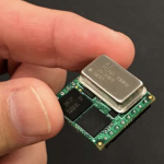
STMicroelectronics has made its Teseo III satellite-navigation receiver accessible to a wider designer community by introducing the Teseo-LIV3F module, which integrates essential features to speed application development and also adds up to 16Mbit of Flash memory for firmware updating or data logging without a backup battery.

Read More >

By Inside GNSS
November 27, 2018

Lockheed Martin, Amazon Web Services Team to Make Downlinking Satellite Data Easier and Less Expensive

Today at AWS re:Invent, Amazon Web Services (AWS), an Amazon.com company, and Lockheed Martin announced a strategic collaboration to integrate the new AWS Ground Station service with Lockheed Martin’s new Verge antenna network. AWS and Lockheed Martin are bringing these two highly capable systems together to provide a solution that addresses customer needs for resilient satellite uplinks and downlinks.

Read More >

By Inside GNSS

Septentrio’s AIM+ Designed to Overcome RF Interference on GNSS Signals

GNSS signals are exceptionally vulnerable to radio frequency interference which can happen by accident – think of an amateur radio operator broadcasting locally – but also occur intentionally by jamming and spoofing devices. No matter the application, the stakes can be extremely high when GNSS signals are lost due to radio interference.

This could mean a loss of position in cars, taxis, trucks or robotic vehicles, emergency response vehicles, but also construction machines, marine survey, drone inspection or even financial transaction synchronization, food delivery and ride-sharing services. Interference is not some new phenomenon but with the many markets —demanding reliable positioning — it has become a priority today.

For more than 15 years Septentrio has been developing and perfecting unique interference mitigation techniques to address interference threats on GNSS. The countermeasures employed include adaptive notch filtering, pulse blanking, and unique wide band interference mitigation. Together, these measures along with other analogue and digital advancements form Septentrio’s AIM+ (Advanced Interference Mitigation) technology.

The company has an informational brochure designed to address the ever-increasing number of connected devices operating across the increasingly crowded RF spectrum that can cause unintentional interference of GNSS signals. Maintaining position accuracy, reliability and availability is a serious challenge both today and tomorrow for GNSS receivers operating in this crowded RF interference environment. As more and more new applications for GNSS are developed, challenges grow as more complex forms of interference appear worldwide. Identifying and overcoming interference with the application of advanced mitigation technologies is critical to ensure the quality of GNSS measurements and positioning.

You can download  your free 20 pages GNSS interference brochure and find out how we can help you monitor and mitigate interference in your everyday work and life.

Septentrio has developed a sophisticated RF interference monitoring and mitigation system (AIM+). To mitigate the effects of narrow-band interference, 3 notch filters can be configured either in auto or manual mode. These notch filters effectively remove a narrow part of the RF spectrum around the interfering signal. The L2 band, being open for use by radio amateurs, is particularly vulnerable to this type of interference. The effects of wideband interference, both intentional and unintentional, can be mitigated by enabling the WBI mitigation system. The WBI system also reduces, more effectively than traditionally used pulse-blanking methods, the effects of pulsed interferers.

By Inside GNSS
November 26, 2018

NASA JPL, Lockheed Martin Successfully Land on Mars

NASA has a new spacecraft operating on the surface of Mars. This afternoon, the InSight Mars Lander, which was designed, built and tested by Lockheed Martin, navigated the dramatic entry and descent through the Martian atmosphere and touched down on Elysium Planitia in the equatorial region of Mars. Lockheed Martin is the prime contractor responsible for the complete spacecraft system – cruise stage, aeroshell and the lander itself.

Read More >

By Inside GNSS
November 13, 2018

Garmin Refreshes Popular Handheld GPSMAP Series

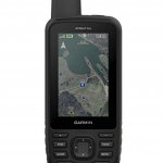
Garmin International recently announced two additions to its popular outdoor GPS handheld series – the GPSMAP 66s and the GPSMAP 66st. The GPSMAP 66 handhelds can log raw measurements in RINEX form. These updated premium handhelds bring expanded wireless connectivity, direct-to-device access to BirdsEye Satellite imagery and a larger 3-inch sunlight-readable color display. The GPSMAP 66st offers preloaded topographic maps for the United States and Canada.

Read More >

By Inside GNSS
November 12, 2018

Garmin’s Instinct GPS Watch Features Multi-GNSS Support

Garmin International, Inc., has launched Instinct, a strong and durable GPS watch with built-in 3-axis compass and barometric altimeter plus multiple global navigation satellite systems (GPS, GLONASS and Galileo) support and wrist-based heart rate. In addition to key GPS data, ABC and heart rate sensors, Instinct includes built-in sports apps, smart connectivity and wellness data.

Read More >

By Inside GNSS
November 8, 2018

u-blox Collaborates with ERM on Vehicle Tracking Device with Built-in Wi Fi Hotspot

Thalwil, Switzerland–based u‑blox today announced the StarLink TrackerWi‑Fi, an advanced vehicle tracking device produced by ERM Advanced Telematics, a provider of device-based telematics solutions. The device combines u-blox GNSS, 4G and Wi-Fi Technology eliminating the need to equip vehicles with a separate mobile Wi‑Fi hotspot. The StartLink TrackerWi‑Fi has wide-ranging solutions for applications in connected car, telematics and vehicle diagnostic, fleet management, vehicle security, usage-based insurance, and rental and leasing service companies.

Read More >

By Inside GNSS
November 7, 2018

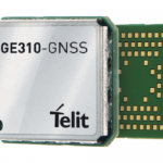
Telit GE310-GNSS IoT Module Caters to Sustained European Demand for GSM/GPRS Compact Form Factors

Telit has announced the GE310-GNSS, the first Internet of Things (IoT) module with GSM/GPRS, multi-constellation satellite positioning and Bluetooth functionality, all in a 270 mm2 form factor. The GE310-GNSS enables original equipment manufacturers (OEMs) and system integrators in application areas such as asset management, utilities and telematics, to meet strong demand for low-cost, highly compact devices without tradeoffs in performance, reliability and functionality, particularly in regional markets like Europe where 2G is forecast to remain in strong growth in a number of IoT connections for many years.

Read More >

By Inside GNSS
October 31, 2018

Imagination Technologies Introduces Comprehensive GNSS IP Core

Imagination Technologies today announced the offering of the Ensigma Location GNSS IP core that supports GPS, GLONASS, Galileo, and BeiDou as well as several Satellite-Based Augmentation Systems (SBAS) including WAAS and EGNOS. Designed for ultra-low power consumption, the IP is designed to optimize battery powered remote IoT sensors and edge devices, wearables, health monitors, consumer mobile products, automotive after-sales products such as insurance boxes and road tolling equipment, and asset tracking devices.

Read More >

By Stan Goff
1 6 7 8 9 10 12
IGM_e-news_subscribe