Industry View Archives - Page 12 of 12 - Inside GNSS - Global Navigation Satellite Systems Engineering, Policy, and Design

June 15, 2018

ION’s 2018-’20 Satellite Division Nominations and Voting Announced

Online voting for the Institute of Navigation’s Satellite Division Officers will be available after July 16, and ION is currently accepting additional nominations.

The Satellite Division Nominating Committee, chaired by Dr. John Betz, has submitted the following nominations for Satellite Division Officers:

Chair: Dr. Chris Hegarty, The MITRE Corporation; Vice Chair: Ms. Patricia Doherty, Boston College; Ms. Sandy Kennedy, Hexagon Positioning Intelligence/NovAtel, Canada; Secretary: Dr. Zak Kassas, The University of California, Riverside; Dr. Jason Rife, Tufts University; Treasurer: Mr. Tim Murphy, Boeing; and Dr. Alex Stratton, Rockwell Collins.

Pursuant to Article IV of The Institute of Navigation Satellite Division Bylaws, “Additional nominations may be made by petition signed by at least 25 members entitled to vote for the office for which the candidate is nominated.” All additional nominees must fulfill nomination requirements as indicated in the ION Satellite Division Bylaws and the nomination must be received at the ION National Office by July 13, 2018.

Online voting for the ION Satellite Division Officers will be available after July 16, and completed ballots must be received at the ION office by August 6, 2018 in order to be counted.

Election results will be announced during the 31st International Technical Meeting of the ION Satellite Division being held September 24-28, 2018 in Miami, Florida.

ION GNSS+ Slated for Sept. 24-28 in Miami

The newly elected officers will take office on September 28, 2018 at the conclusion of the meeting and will serve for two years. Election results will be reported in the ION Newsletter.


By Inside GNSS
June 14, 2018

First Dual-Frequency GNSS Smartphone Hits the Market

Xiaomi has launched the world’s first dual-frequency GNSS smartphone, the Mi 8. This smartphone represents a breakthrough in GNSS technology as it is the first commercial deployment of Broadcom’s revolutionary BCM47755 chip. It provides up to decimeter-level accuracy for location-based services and vehicle navigation, according tothe European GNSS Agency (GSA).

Read More >

By Inside GNSS
June 13, 2018

Jenny to Retire as RTCA President

RTCA President Margaret T. Jenny has informed the Board of Directors of her intention to retire from RTCA this August, at the end of her second 5-year contract. RTCA’s Board will initiate a search process to identify a successor for her.

Read More >

By Inside GNSS
June 8, 2018

Inertial Labs Introduces Dual Antenna GNSS-Aided INS

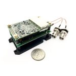
Inertial Labs, Inc., a developer and supplier of inertial sensors & systems, has released an affordable, multi GNSS constellation, 1 cm RTK accuracy dual-antenna GPS-Aided Inertial Navigation System (INS).

The “INS-DL” and the OEM version “INS-DL-OEM” are multi-constellation (GPS, GLONASS, Galileo, BeiDou) GPS-Aided INS designed to achieve 1 cm Position and 0.05° Heading, Pitch & Roll accuracy. These highly precise and high-accuracy INS are available for around $5,000 USD.

Designed for developers of autonomous and unmanned systems; vehicles and small robots for precision agriculture; payloads for remote sensing and survey applications, the GPS-Aided “INS-DL” and “INS-DL-OEM” are compact and deliver high performance.

The “INS-DL” can be supplied as a classic Inertial Navigation System, which outputs Position, Orientation and IMU data for real-time and post-processing operation, or as an advanced, GPS-Aided Motion Reference Unit, which outputs Position, Velocity, Heading, Pitch, Roll, Heave, Surge, Sway and Significant Wave Height data for survey, hydrography, bathymetry and motion control.

“GPS-Aided INS-DL is a result of significant efforts of our R&D team. It is a market-oriented solution, geared towards applications, requiring the best combination of high performance and low cost” said Jamie Marraccini, Inertial Labs’ CEO & President, in a press release.

This year, Inertial Labs celebrates its 17th anniversary of supplying inertial sensor-based solutions for land, marine and aerospace applications. Since 2001, thousands of inertial systems, as well as those fused with other technologies like optical, laser, and GNSS systems, have been successfully delivered to customers for AGV, UAV, AUV, UUV, robots, land vehicles etc.

By Inside GNSS
May 31, 2018

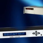
EndRun’s Meridian II Precision TimeBase Combines GPS, 5071A Cesium and Ionospheric Corrections for Optimal Time and Frequency Standard

Precision time and frequency solutions provider EndRun Technologies recently announced the release of a new Cesium Control Module for the Meridian II Precision TimeBase designed to combine the extraordinary benefits of GPS, 5071A Cesium Primary Frequency Standard, and Ionospheric Corrections.  The unique and powerful integration of these technologies provides a time and frequency standard with unparalleled accuracy, stability and holdover performance for the most demanding applications including communications and metrology, according to the company.

Read More >

By Inside GNSS
May 29, 2018

Commercial UAV EXPO Returns to Las Vegas in October


Commercial UAV EXPO Americas 2018 takes place October 1-3 at The Westgate in Las Vegas, Nevada. If you register by May 31, you can save $300 and also enter for a chance to win two free hotel nights.

A successful drone operation depends on reliable and up-to-the minute information. It’s not easy to keep up when the technology and regulations are constantly evolving. Fortunately, this event brings together the key people, the newest technology and the education you need for success — Commercial UAV Expo Americas. 

Here’s a sample of the conference programming:

Plenaries:

  • Regulatory & UTM Updates
  • IPP Update & Progress to Date
  • Powering Drones — Latest Developments
  • Security: Data, Hacking, Counter-Drone & Privacy
  • Drone Programs: In-House or Outsource?
  • Urban Air Mobility: What the Sky will Look Like in the Future

Vertical Industry “Deep-Dive” Tracks:

  • Construction
  • DOTs & Infrastructure
  • Mining & Aggregates
  • Precision Agriculture
  • Process & Power
  • Public Safety
  • Surveying & Mapping
  • Utilities
  • Wind Turbines, Cell Towers, Large-Scale Solar

Below is a selection of confirmed speakers:

  • Greg Agvent, CNN
  • Assel Ayapova, AES
  • Jaz Banga, Airspace Systems, Inc.
  • Sam Billingsley, Ragan-Smith Associates
  • Robert Blair, Three Canyon Farms
  • David Boardman, Stockpile Reports
  • Philip Buchan, Cyberhawk Innovations
  • Andrew Carey, Rio Tinto Kennecott Utah Copper
  • Gary Cathey, California Department of Transportation
  • Darshan Divakaran, North Carolina Department of Transportation
  • Todd Domney, Sumac Geomatics
  • Douglas Spotted Eagle, Sundance Media
  • Lisa Ellman, Hogan Lovells & Commercial Drone Alliance
  • Dan Elwell, FAA
  • Richard Fields, Los Angeles Fire Department
  • Dyan Gibbons, Trumbull Unmanned
  • Shayne Gill, AASHTO
  • Jason Goodick, Entergy Services, Inc
  • Lewis Graham, AirGon LLC
  • Chad Karlewicz, Renton Police Department
  • Young Kim, Digital Harvest
  • Matthew Klein, US Bureau of Reclamation
  • Brad Koeckeritz, US Department of the Interior
  • Richard Lopez, Hensel Phelps
  • Jeff Lorton, Duke Joseph Agency
  • Daniel Marek, Nevada Highway Patrol
  • George Mathew, Kespry
  • Harold Miller, Entergy Services, Inc.
  • Scott Mlakar, Willoughby Fire Department / Lake County UAS
  • Anil Nanduri, Intel
  • Michael Perry, DJI
  • Harrison Andrew Pierce, San Diego Homeland Security
  • Art Pregler, AT&T
  • Michael Ralston, Menlo Park Fire District
  • Michael Singer, DroneView Technologies
  • Colin Snow, Skylogic Research
  • Dave Truch, BP
  • Callum Walter, Queens University
  • Gretchen West, Hogan Lovells & Commercial Drone Alliance
  • Tracy Wilkinson, Renton Police Department
  • Mike Winn, DroneDeploy

Precision measurement professionals rely on Commercial UAV Expo to deliver the high-level content and quality programming they need for complex projects.

Check www.expouav.com for continual updates and here to register.


By Inside GNSS
May 11, 2018

SkyTraq Introduces L5 NavIC + L1 GPS/GAGAN Receiver Module

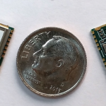
SkyTraq Technology Inc., a provider of GNSS positioning technology, recently introduced S1216F8-GI2, a NavIC + GPS/GAGAN receiver module for the emerging Indian market. It integrates L1/L5 RF front-end and baseband processor capable of receiving up to 14 L5 NavIC signals and up to 20 L1 GPS/GAGAN signals simultaneously. With currently usable 6 NavIC signals and 3 GAGAN signals, it offers a total of 18 ~ 23 usable signals for navigation compared to 9 ~ 14 usable signals with conventional GPS receivers. This is designed to provide improved accuracy in urban canyon environments with signals often blocked by high buildings, according to the company.

Read More >

By Inside GNSS
1 10 11 12
IGM_e-news_subscribe