surveying Archives - Page 3 of 5 - Inside GNSS - Global Navigation Satellite Systems Engineering, Policy, and Design

surveying

NavCom Introduces Multi-GNSS SF-3040 Receiver

NavCom Technology’s SF-3040 Receiver

NavCom Technology, Inc., has launched its 66-channel, SF-3040 pole-mount receiver, featuring StarFire/real-time kinematic (RTK) multi-GNSS capabilities and optimized for surveying and mapping applications.

NavCom says its new product provides real-time kinematic (RTK)–level accuracy up to 40 kilometers away from the base station or decimeter-level accuracy anywhere in the world when using the company’s StarFire global satellite-based augmentation system (GSBAS).

Read More >

By Inside GNSS
April 7, 2011

Hexagon 2011 International Conference

A number of user conferences for customers of Hexagon AB’s precise measurement brands and products will be combined in the Swedish corporation’s first international conference this summer.

It will take place at Orlando World Center Marriott Resort in Orlando, Florida from June 6 through June 9, 2011.

The theme is "Building a Smarter World," and will include 200 technical and training sessions and an industry exhibition.

Read More >

By Inside GNSS
[uam_ad id="183541"]
March 14, 2011

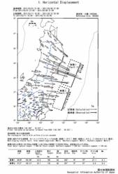
Japan Researchers Use GPS Permanent Array to Find Large Position Shifts From Devastating Earthquake

Based on data from Japan’s GPS Earth Observation Network System (GEONET), researchers at the Geospatial Information Authority of Japan (GSI) reported today (March 14, 2011)  that the 9.0 magnitude Tohoku earthquake on March 11 in northeast Japan caused an estimated displacement of between roughly 6 and 28 meters along two fault blocks totaling nearly 400 kilometers (248 miles).

Read More >

By Inside GNSS
March 11, 2011

ASCE -SPAR Geomatics Continuing Education Seminar

Marriott Convention Center

The American Society of Civil Engineers will offer a day-long program on Monday, March 21 at SPAR International 2011 that will focus on real-time GNSS positioning and using the 3D Global Spatial Data Model

Bill Henning, senior geodesist for the National Geodetic Survey, will lead  the morning session. With more than 43 years of experience in all phases of surveying technology, he is helping to develop guidelines and support methodology for real time GNSS position with state, national, and international organizations.

Read More >

By Inside GNSS
January 17, 2011

InterGEO 2011

Nuremberg Pilatushaus and castle

The 2011 InterGeo conference and trade fair for geodesy, geoinformation and land managment will take place at the CNN CongressCenter Nürnberg in Nuremberg, Germany from September 27 to 29, 2011.

It is organized by DVW e.V. – German Society for Geodesy, Geoinformation and Land Management.

The conference language is German.

Read More >

By Inside GNSS
[uam_ad id="183541"]
January 9, 2011

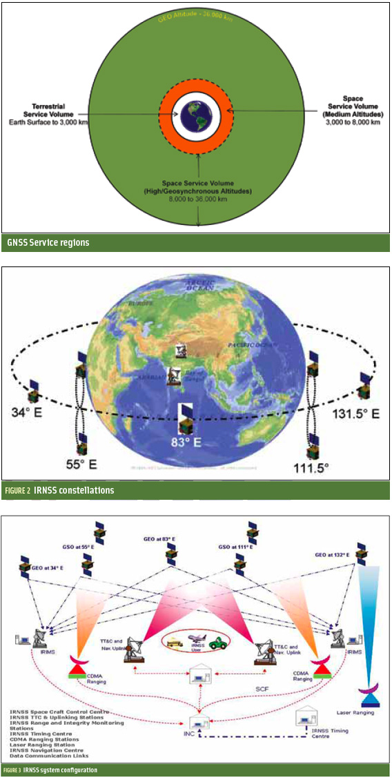
Indian Regional Navigation Satellite System

FIGURES 1, 2 & 3

For the complete story, including figures, graphs, and images, please download the PDF of the article, above.

In satellite navigation, a GNSS receiver must account for several sources of error such as relativistic effects, atmospheric propagation delay, offset of satellite clocks from system time and satellite ephemeris. In order to accurately compute user position, velocity, and time (PVT), these errors need to be predicted/estimated precisely.

Read More >

By Inside GNSS
September 15, 2010

2010 AGU Fall Meeting

Moscone Center

The 2010 American Geophysical Union Fall Meeting will be held at the Moscone Convention Center in San Francisco, California from Monday, December 13 to Friday, December 17.

There are dozens of GNSS-related presentations at this AGU mega-meeting of 16,000 space and earth scientists. The preliminary program lists 770 scientific sessions in climate change, space weather, planetary exploration, volcanism and seismology, Earth’s magnetic field and more.

Read More >

By Inside GNSS

ITN 2010: Infrastructure, Telematics and Navigation

Lingotto Fiere, Turin/Torino, Italy

The second European conference and exhibition on smart infrastructures, infomobility, telematics and Galileo and other GNSSes will take place at Lingotto Fiere in Turin, Italy on November 11-12, 2010.

Presenter abstracts are due by October 7, 2010.

These subjects will be covered in the conference and/or the exhibit area:

Read More >

By Inside GNSS
July 5, 2010

Trimble Dimensions 2010

The Trimble Dimensions conference covers real-world applications of positioning technology in the survey, construction, mapping and GIS, utility, mobile mapping, mobile resource management, GNSS infrastructure and construction asset management industries.

Of particular interest to Inside GNSS readers will be the Infrastructure Track; it includes high-accuracy positioning information for a wide variety of applications and industries.

Read More >

By Inside GNSS
IGM_e-news_subscribe