 Marriott Convention Center
The American Society of Civil Engineers will offer a day-long program on Monday, March 21 at SPAR International 2011 that will focus on real-time GNSS positioning and using the 3D Global Spatial Data Model
Bill Henning, senior geodesist for the National Geodetic Survey, will lead the morning session. With more than 43 years of experience in all phases of surveying technology, he is helping to develop guidelines and support methodology for real time GNSS position with state, national, and international organizations.
Earl Burkholder, professor emeritus with New Mexico State University, will lead the afternoon session. He has dedicated himself to educating the surveying community on the benefits of using the Global Spatial Data Model, including publishing a book on the topic, and he is the recipient of the ASCE’s 2010 Surveying & Mapping Award.
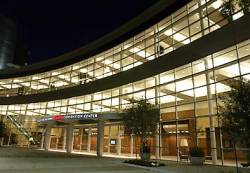
The SPAR 2011 International conference and exhibition, 3D imaging for construction, engineering, manufacturing and security, takes place at the Marriott Woodlands Waterway Hotel in Houston, Texas. It runs from Sunday, March 21 to March 24 2011.


