surveying Archives - Page 2 of 5 - Inside GNSS - Global Navigation Satellite Systems Engineering, Policy, and Design

surveying

June 6, 2014

AfricaGEO 2014

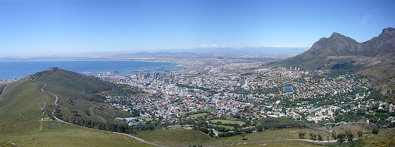
City Bowl area of Capetown (photo by Martin Power)

Developing geomatics for Africa with a focus on doing business in Africa and African land reform is the theme of this conference, first held in 2011.

The event will take place at The Cape Town International Convention Centre (CTICC) in Capetown, South Africa on July 1, 2 and 3.

The program consists of plenary and technical sessions, panel discussions, educational workshops on surveying, geo-information, remote sensing and aerial imagery.

Read More >

By Inside GNSS
March 20, 2013

SASGI 2013: SA Surveying + Geomatic Indaba 2013

SASGI 2013 will take place at the Emperors Palace in Gauteng, South Africa on July 22, 23 and 24. The theme is Geospatial Solutions for National Development Planning.

This is the annual South African conference of surveying, geo-informatics, GIS, mapping, remote sensing and location-based business.


The conference is wide-ranging and will cover:

Read More >

By Inside GNSS
[uam_ad id="183541"]
October 12, 2012

Trimble Introduces Next Generation GNSS Survey, Datalink, Mapping Solutions

Trimble R10 rover

Trimble has introduced its next-generation GNSS surveying solution — the Trimble R10, a small, lightweight receiver that introduces new features and technologies, including Trimble HD-GNSS, Trimble SurePoint, Trimble 360, and Trimble xFill, to provide increased productivity.

Announced at the Intergeo 2012 conference in Hannover, Germany, this week, introduction of the Trimble R10 was accompanied by new versions of its field and office software — Trimble Access 2012.20 and Trimble Business Center 2.80 to extend Trimble’s Connected Site survey solution.

Read More >

By Inside GNSS
May 31, 2012

GSA Issues Second GNSS Market Report: 1.1 Billion Units by 2020

The European GNSS Agency (GSA) has published its second GNSS market report, including a special focus on maritime and surveying application markets and refining its projections of unit and sales revenue volumes through 2020.

According to the new GSA report, the worldwide GNSS market is growing rapidly with total market size expected to increase at an average of 13 percent per year until 2016. At that point, increasing market saturation, price erosion, and platform convergence will reduce the growth rate.

Read More >

By Inside GNSS
April 26, 2012

NASA Backs Test of Real-time GPS Earthquake Mitigation Network

Location of real-time GPS monitoring stations in the western United States that make up part of the Real-Time Earthquake Analysis for Disaster Mitigation Network. The networks stations are overlain on a U.S. Geological Survey seismic hazard map showing areas forecast to have a 10-percent probability of exceeding a certain level of ground shaking within the next 50 years. (Areas in shades of red have the strongest shaking, while areas in green shades have the weakest shaking.) Image credit: USGS/UC Berkeley/Scripps Institution of Oceanography

Evolution of real-time GNSS reference networks and data processing has evolved to the point that NASA-backed researchers believe they can soon implement large-scale demonstration tests to provide earthquake and tsunami alerts to the general public and emergency responders.

Read More >

By Inside GNSS
[uam_ad id="183541"]
April 21, 2012

Geospatial World Forum 2012

Pres. A. P. J. Abdul Kalam, the “Missile Man of India,” in 2008. (wikicommons)

The 2012 Geospatial World Forum will be held at the Amsterdam RAI Exhibition and Convention Center from April 23 to April 27. The venue is in the south part of the city and close to the airport.

A. P. J. Abdul Kalam, president of India 2002-2007 and one of the country’s most famous space scientists, will give the keynote talk. Kalam, called the "People’s President" was also known as the "Missile Man of India" for his work on development of ballistic missile and space rocket technology.

Read More >

By Inside GNSS
February 16, 2012

Topcon Introduces Full-Spectrum GNSS Geodetic Antenna

Topcon CR-G5 GNSS antenna

Topcon Positioning Systems (TPS) announced the company’s new CR-G5 high-performance, GNSS choke ring antenna.

Based on the company’s new TA-5 full-spectrum GNSS antenna element, the CR-G5 geodetic antenna offers excellent vertical phase center stability over the GNSS frequency band superior performance in tracking low elevation satellite signals, according to the company.

Read More >

By Inside GNSS
September 14, 2011

Locata Passes USAF CDR, Technology Adopted by Leica, Launches at ION GNSS 2011

Leica’s Jigsaw Positioning System with LocataLite

Locata Corporation and the U.S. Air Force have announced that the Australia-based company has successfully completed the critical Design Review (CDR) contract phase for a Locata network that will enable the U.S. Air Force to deploy a new ground-based, centimeter-accurate "truth-reference level" positioning system for use in GPS-denied environments.

Read More >

By Inside GNSS
August 1, 2011

Australian Satellite Navigation and Positioning Lab Founder to Head IAG

Chris Rizos

The founder of Australia’s largest concentration of GNSS research and development efforts has been named head of the International Association of Geodesy, part of the International Union of Geodesy and Geophysics (IUGG) 

Chris Rizos put together the Satellite Navigation and Positioning laboratory (SNAP) at the University of New South Wales in the 1990s.  He has been researching and writing about high precision technology and applications of GNSS since 1985 and is a professor and head of the surveying and spatial information school at the university.

Read More >

By Inside GNSS
July 5, 2011

UAV-g 2011: Unmanned Aerial Vehicle in Geomatics

ETH Hönggerberg from the south (Hannes Röst photo)

The Swiss Federal Institute of Technology (ETH) sponsors this conference and exhibition on UAVs and geomatics at Campus Science City (Hoenggerberg) in Zurich, Switzerland from September 14 through 16, 2011.

UAV-g 2011 will bring together experts in photogrammetry, surveying, robotics, computer vision, artificial intelligence and aerospace engineering.

Researchers, developers, service and systems providers and users are invited to exhibit and demonstrate their UAV systems in geomatics at at the Birrfeld airfield on Thursday, September 15.

Read More >

By Inside GNSS
April 19, 2011

Trimble Announces Plans to Buy Ashtech

Continuing a series of acquisitions in recent years, Trimble announced today (April 19, 2011) that the Sunnyvale, California–based company has entered into a definitive agreement to acquire privately held Ashtech S.A.S.

In announcing the its plans, Trimble said that it expects the acquisition of the Carquefou, France, company and its affiliates will expand the U.S. company’s Spectra Precision portfolio of survey solutions and allow the company to better address emerging markets worldwide.  

Read More >

By Inside GNSS
IGM_e-news_subscribe