Main Categories

Advanced Receiver Processing of GNSS Signals: NavtechGPS

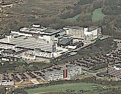
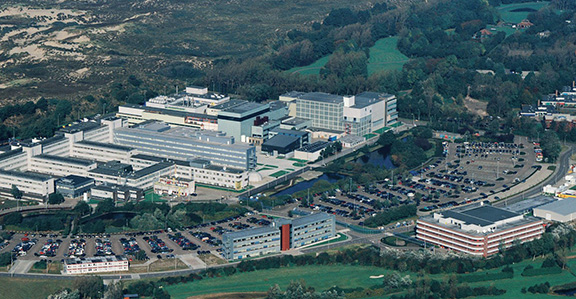
European Space Agency’s ESTEC in Noordwijk

NavtechGPS will offer a four-day public venue course from March 5 though 8 at the European Space Agency’s Space Research and Technology Center (ESA/ ESTEC) in Noordwijk, Netherlands.

"Advanced Receiver Processing of GNSS Signals" (Course 541) will be taught by John Betz, MITRE and James Sennott, Tracking and Imaging Systems, Inc.

Read More >

By Inside GNSS
January 14, 2012

2012 International Satellite Navigation Forum/ NAVITECH

Plenary session at a previous Satellite Navigation Forum.

The sixth International Satellite Navigation Forum will take place during the NAVITECH exhibition at the Expocentre Fairgrounds in Moscow, Russia on April 17 and 18, 2012.

The purpose of the forum is to discuss GLONASS and other GNSSes in the economy of Russia, developing commercial and civic uses for GLONASS, Russian national policy on the use of GLONASS, regional systems, new equipment and services and the development of single international standards in the field of satellite navigation.

Read More >

By Inside GNSS
[uam_ad id="183541"]

Code Tracking and Pseudoranges

FIGURE 2: Pseudorange computation based on transmission. On the left side, the satellites are transmitting mes¬sages synchronously. On the right side, the four subframes are received asynchronously, due to the different propagation time. The TLM word is taken as a referene. The time differences ?i are computed on the basis of the relative arrival times of the front of the first bit of the TLM word.

Q: How can pseudorange measurements be generated from code tracking?

A: Every GNSS receiver processes the received signals to obtain an estimate of the propagation time of the signal from the satellites to the receiver. These propagation times are then expressed in meters to solve for the user position using trilateration.

Read More >

By Inside GNSS

New Austerity Squeezes GPS as DoD Tightens Its Belt

Embracing the need for debt-driven discipline, the White House has revised its strategy for the nation’s defense, taking a more fiscally constrained approach that reduces the number of troops and future spending on defense systems.

The new plan, formally announced January 5, was already being put into effect last summer. “The strategic guid­ance was the compass by which we steered the budget review leading to the president’s budget for fiscal year ‘13 and the years thereafter,” Deputy Secretary of Defense Ashton B. Carter told reporters.

Read More >

By Dee Ann Divis

Contact!

A photo of the NavSAS group (December 2011)

On December 12, 2011, one of the two Galileo in-orbit validation (IOV) satellites launched on October 21 — the Galileo- ProtoFlight Model (PFM) spacecraft — started transmitting its payload signal on the E1 band over Europe.


That same day NavSAS researchers were able to acquire and track the E1 signal (Galileo Code Number 11) beginning at 14:46:15 CET. Two days later, on December 14, the E5 signal became available as well.

Read More >

By Inside GNSS
[uam_ad id="183541"]

Winging It

FIGURE 1: Competitive group skydiving is currently judged by overlaying a grid on a photo and evaluating location of divers within its cells. Photo by Mark Harris.

»NovAtel Inc. wingsuit video

In 1589, at the age of 25, Galileo Galilei toiled up the 294 steps of a 55-meter bell tower in Pisa, Italy, where he was tutoring math students at the time.

According to his pupil and later biog­rapher, Vincenzo Viviani, Galileo carried with him two cannonballs, one twice the weight of the other. When he reached the top of the tower, he went to the lower balcony of the tilted structure and dropped the two balls simultaneously.

Read More >

By Inside GNSS
January 12, 2012

2012 Indoor Positioning and Indoor Navigation (IPIN)

UNSW, the conference venue, is 4.3 miles (7 km) from Sydney city center.

The 2012 International Conference on Indoor Positioning and Indoor Navigation (IPIN) will take place at the University of New South Wales in Sydney, Australia From November 13 to 15.

The keynote, by Google’s Waleed Kadous, is "The Indoor Tipping Point: Lessons from Indoor at Scale." 

Read More >

By Inside GNSS

2012 Ubiquitous Positioning Indoor Navigation and Location Based Service (UPINLBS)

The Hilton Helsinki Strand at night

UPINLBS 2012 will take place on the Gulf of Finland waterfront at the Hilton Strand in Helsinki, Finland on October 3 and 4. The conference venue is 1/2 mile (0.8 km ) from the center of the city.

John Raquet, U.S. Air Force Institute of Technology ; Mark Petovello, University of Calgary and Rafael Lucas, GNSS Evolution and Strategy Division, European Space Agency will deliver the keynotes.

The topics are:

Read More >

By Inside GNSS
January 11, 2012

ICL-GNSS 2012: Localization and GNSS Conference

Lake Starnberg

The 2012 International Conference on Localization and GNSS will take place from June 25 to 27 in Starnberg, near Munich, Germany. 

ICL-GNSS 2012 will address the latest research on satellite-based and complementary positioning techniques for use outdoors and indoors, and on different platforms such as stand-alone
navigators, PDAs and mobile devices.

Abstracts may be submitted online beginning in February. The deadline for submission is Friday, March 2, 2012.

Topic areas include:

Read More >

By Inside GNSS
IGM_e-news_subscribe