mapping/GIS Archives - Page 4 of 7 - Inside GNSS - Global Navigation Satellite Systems Engineering, Policy, and Design

mapping/GIS

July 11, 2011

China Satellite Conference 2011

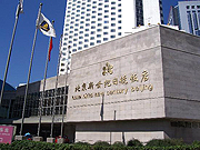
Hotel Nikko New Century in Haidian, Beijing

This officially sanctioned conference and equipment exhibtion addresses applications, technologies and trends for China’s satellite communications, broadcasting, remote sensing, navigation and positioning.It will be held at Hotel Nikko New Century in Beijing on October 26.28, 2011.

Subjects of most interest to Inside GNSS readers include:

Read More >

By Inside GNSS
July 5, 2011

UAV-g 2011: Unmanned Aerial Vehicle in Geomatics

ETH Hönggerberg from the south (Hannes Röst photo)

The Swiss Federal Institute of Technology (ETH) sponsors this conference and exhibition on UAVs and geomatics at Campus Science City (Hoenggerberg) in Zurich, Switzerland from September 14 through 16, 2011.

UAV-g 2011 will bring together experts in photogrammetry, surveying, robotics, computer vision, artificial intelligence and aerospace engineering.

Researchers, developers, service and systems providers and users are invited to exhibit and demonstrate their UAV systems in geomatics at at the Birrfeld airfield on Thursday, September 15.

Read More >

By Inside GNSS
[uam_ad id="183541"]
April 12, 2011

Geneq Announced Dual-Frequency RTK GPS, OmniSTAR HP Receivers

Geneq SXBlue IIIL

Geneq Inc., a Montreal, Quebec, Canada, manufacturer, has introduced two new GPS products.

The SXBlue III-L is a compact GPS L1/L2 receiver in the world designed for use with OmniSTAR’s HP service to attain decimeter accuracy worldwide. Targeted at GIS mapping/surveying applications, the receiver measures 14 x 8 x 5.6 centimeters (5.57 x 3.15 x 2.22 inches) and weighs 517 grams (1.14 pounds) including battery.

Read More >

By Inside GNSS

NavCom Introduces Multi-GNSS SF-3040 Receiver

NavCom Technology’s SF-3040 Receiver

NavCom Technology, Inc., has launched its 66-channel, SF-3040 pole-mount receiver, featuring StarFire/real-time kinematic (RTK) multi-GNSS capabilities and optimized for surveying and mapping applications.

NavCom says its new product provides real-time kinematic (RTK)–level accuracy up to 40 kilometers away from the base station or decimeter-level accuracy anywhere in the world when using the company’s StarFire global satellite-based augmentation system (GSBAS).

Read More >

By Inside GNSS
[uam_ad id="183541"]
April 7, 2011

Hexagon 2011 International Conference

A number of user conferences for customers of Hexagon AB’s precise measurement brands and products will be combined in the Swedish corporation’s first international conference this summer.

It will take place at Orlando World Center Marriott Resort in Orlando, Florida from June 6 through June 9, 2011.

The theme is "Building a Smarter World," and will include 200 technical and training sessions and an industry exhibition.

Read More >

By Inside GNSS
March 11, 2011

ASCE -SPAR Geomatics Continuing Education Seminar

Marriott Convention Center

The American Society of Civil Engineers will offer a day-long program on Monday, March 21 at SPAR International 2011 that will focus on real-time GNSS positioning and using the 3D Global Spatial Data Model

Bill Henning, senior geodesist for the National Geodetic Survey, will lead  the morning session. With more than 43 years of experience in all phases of surveying technology, he is helping to develop guidelines and support methodology for real time GNSS position with state, national, and international organizations.

Read More >

By Inside GNSS

GlobalGEO/ International Geomatic Week

Fira de Barcelona, Monjuic venue

The GlobalGEO Fair will take place in the Monjuic Venue, Hall 6 at Fira de Barcelona exhibition center in Barcelona, Spain from March 15 to March 17. 

The fair features the latest products for GPS navigation, 3D mapping, geographic information systems, photogrammetry, teledetection, geodesics, topography, satellite navigation, intelligent transport systems and communications.

Read More >

By Inside GNSS
January 17, 2011

InterGEO 2011

Nuremberg Pilatushaus and castle

The 2011 InterGeo conference and trade fair for geodesy, geoinformation and land managment will take place at the CNN CongressCenter Nürnberg in Nuremberg, Germany from September 27 to 29, 2011.

It is organized by DVW e.V. – German Society for Geodesy, Geoinformation and Land Management.

The conference language is German.

Read More >

By Inside GNSS
January 11, 2011

Topcon and DICKEY-john Form Alliance Around Ag System Development

Topcon X30 controller

Topcon Positioning Systems (TPS) and DICKEY-john Corporation, an agricultural systems and machine control manufacturer based in Auburn, Illinois, have formed a strategic relationship in the agriculture industry.

Headquartered in Livermore, California, TPS recently unveiled its System 350 machine control system, which employs the company’s new X30 control console and its AGI-3 receiver for autosteering.

Read More >

By Inside GNSS
IGM_e-news_subscribe