mapping/GIS Archives - Page 6 of 7 - Inside GNSS - Global Navigation Satellite Systems Engineering, Policy, and Design

mapping/GIS

June 4, 2009

Applanix Introduces New Aerial Digital Photogrammetric System

Applanix
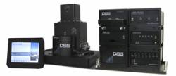
has introduced the POSTrack 410 flight management and direct
georeferencing system designed for use with the latest generation of
medium-format airborne digital photogrammetric camera.

The POSTrack 410 incorporates Applanix’s POS AV GNSS-inertial navigation
system (INS) and POSPac Mobile Mapping Suite (MMS) office software,
featuring the IN-Fusion technology and SmartBase module. This system
can process both GPS and GLONASS signals as well as those from
satellite-based augmentation systems.

Read More >

By Inside GNSS
June 3, 2009

Pacific Crest Picks GNSS Industry Veteran to Head OEM Effort

Pacific Crest Corporation has  appointed GPS/GNSS industry veteran Don Speedy to head business development and sales for North America. With more than nine years of successful experience in business development and OEM GNSS, geographic information systems (GIS) and survey sales, Speedy will be responsible for driving strategic partnerships in OEM GNSS and data link communications while maintaining regional relationships.

Read More >

By Inside GNSS
April 9, 2009

earthmine Launches 3D Mapping System Driven by GPS, Inertial

John Ristevski

Privacy rebellions such as recently drove a Google Street View crew from Broughton, England, or security-oriented legislation that would require blurred features or position accuracy in commercial imagery is just part of the market environment for 3-D mapping company earthmine, Inc., which is moving out of beta mode into full-fledged operations.

Read More >

By Inside GNSS
[uam_ad id="183541"]
March 24, 2009

OnPOZ Offers Free ArcPad GNSS Driver Extension

Montreal, Quebec, Canada–based OnPOZ Precision Positioning has released, GNSS Driver for ArcPad, a new extension to the ESRI product that allows GNSS post-processing using different GNSS receiver brands.

The receiver-independent extension can significantly improve GNSS/GIS data accuracy and reliability, logging real-time positions, metadata, and all GNSS observations in order to increase the reliability and accuracy of GNSS positions by post-processing ESRI Shapefiles.

Read More >

By Inside GNSS
December 29, 2008

Applanix Upgrades POS, POSpac Products

Applanix Corporation has launched the POSPac MMS (Mobile Mapping Suite) 5.2, the latest release of its GNSS-aided inertial post-processing software for mobile mapping and surveying applications in multiple environments.

Applanix has announced that its POS AV products now support on-board OmniSTAR XP real-time differential GPS corrections using a purpose-built GNSS+L-band aircraft antenna and an embedded BD960 GNSS receiver.

Read More >

By Glen Gibbons
November 25, 2008

OnPOZ Precision Positioning Releases new GNSS Post-Processor with GLONASS Compatibility

OnPOZ Precision Positioning, a VGI Solutions division, has announced its new EZSurv GNSS Post-Processing version that offers full compatibility with GLONASS satellite signals.

According to the Montreal, Quebec, Canada–based company, EZSurv is compatible with most of the raw GNSS data formats on the market. The software computes high-accuracy geodetic results, enabling seamless data postprocessing among different brands of GNSS receivers and as a companion software for high-precision GNSS OEM receivers.

Read More >

By Glen Gibbons
[uam_ad id="183541"]
July 22, 2008

Applanix Adds Camera, LIDAR Options to Its DSS 439 RapidOrtho Airborne Mapping System

Applanix DSS 439 System

Applanix has launched a dual-camera version of its Digital Sensor System (DSS) 439 RapidOrtho airborne mapping solution and introduced full LIDAR integration options for fixed wing and helicopter installations.

The DSS 439 RapidOrtho DualCam produces a directly georeferenced, four-band ortho-imagery in a single pass, according to the company. The new product offering adds a second DSS camera with a monochromatic charge-coupled device (CCD) array specifically configured to capture near infrared (NIR) imagery.

Read More >

By Glen Gibbons
May 7, 2008

Applanix Launches POS AV with Integrated Trimble GNSS, Upgraded DSS RapidOrtho

Applanix has announced the availability of a high altitude tactical mapping option for its DSS RapidOrtho system as well as the integration of the Trimble BD960 GNSS receiver module for its POS AV airborne position and orientation system.

With the GNSS module, POS AV products now support GPS L1/L2 and GLONASS L1/L2 processing, both in real-time and post-mission. The BD960 will also be able to receive and process the next-generation GPS L2C and L5 signals.

Read More >

By Inside GNSS
February 1, 2008

Pole Star Launches Navigation Overlay Products

NAO Campus schematic

The French engineering consultancy Pole Star SARL has expanded the firm’s development activities with the launch of its first products — NAO City and NAO Campus, designed to improve the robustness of GNSS positioning in urban and indoor environments with a focus on location-based services.

Read More >

By Glen Gibbons
IGM_e-news_subscribe