January 11, 2021
GNSS-Inertial Package for Delivery Robots and Drones
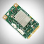
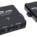
Parker LORD Microstrain Sensing debuted its new all-in-one navigation system this month, which includes onboard RTK and built-in dual antenna GNSS receivers.
By Inside GNSS