Technical Article

November 17, 2014

Reliable GPS-Based Timing for Power Systems
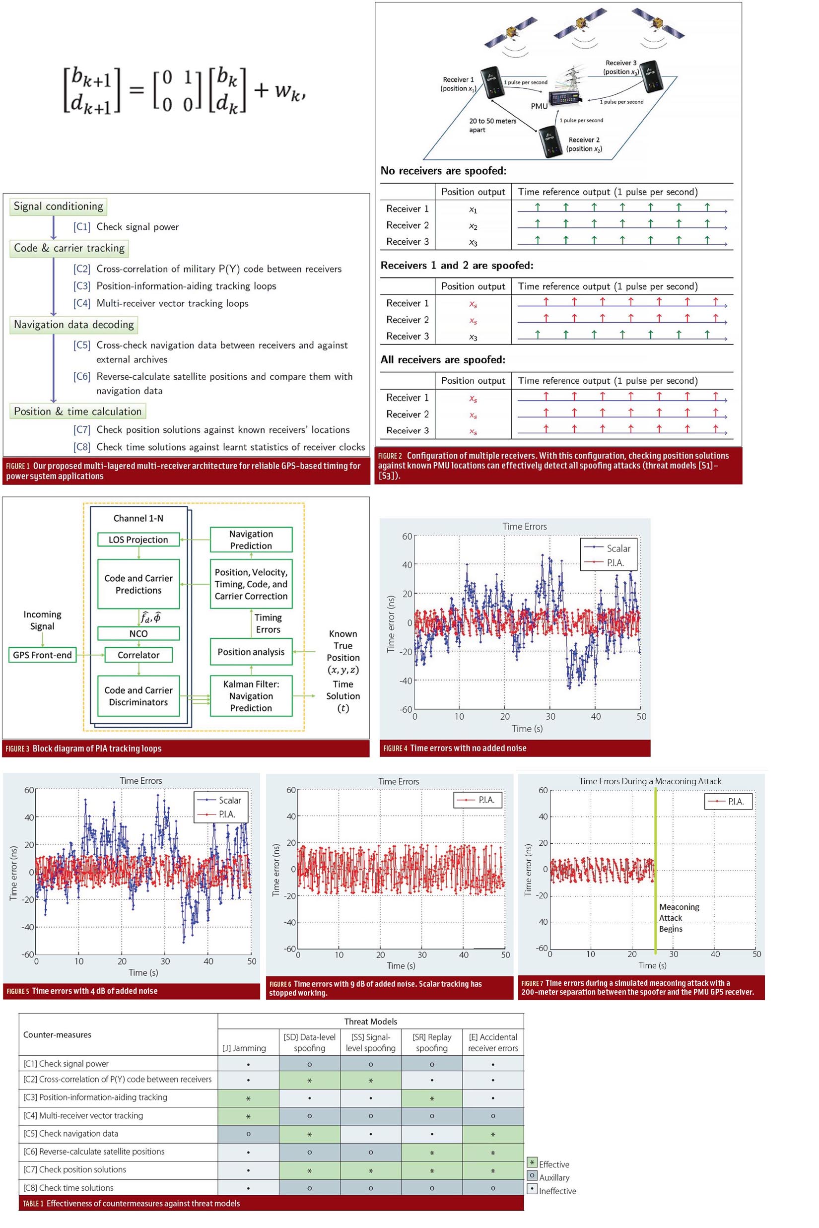
Efficient power transmission and distribution would benefit from synchronized near–real-time measurements of voltage and current phasors at widely dispersed locations in an electric power grid. Such measurements also could enable effective real-time system monitoring and control, which are considered to be the key to preventing wide-scale cascading outages like the 2003 Northeast Blackout.

Read More >

By Inside GNSS

Evaluating the Performance of Navigation Payloads

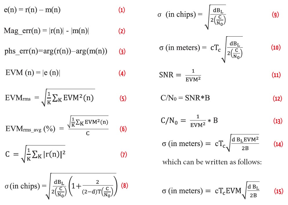
As a navigation satellite transmits multiple signals on single frequency (e.g., Open Service and Restricted Service over L5 Band), these are combined on a common carrier to comprise a composite signal. This composite signal passes through navigation payload subsystems such as an up-converter, traveling wave tube amplifier (TWTA), filters, and so on. These subsystems may introduce adverse effects on the signal, such as amplitude and phase distortion, nonlinear effects, gain imbalance, IQ imbalance, and phase noise.

Read More >

By Inside GNSS

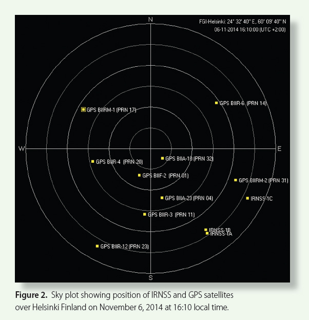
Tracking IRNSS Satellites

Figure 2: Sky plot showing position of IRNSS and GPS satellites over Helsinki Finland on November 6, 2014 at 16:10 local time.

The Indian Regional Navigation Satellite System (IRNSS)] is designed as a stand-alone regional navigation system with a primary service area extending up to 1,500 kilometers from the Indian land mass. Finland lies north of 60°N latitude more than 5,000 kilometers away from India, as shown in Figure 1 (see photo at the top of this article).

Read More >

By Inside GNSS
[uam_ad id="183541"]
September 17, 2014

SAGAIE

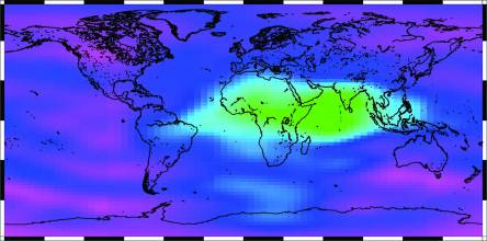
Scintillation — rapid RF signal frequency and amplitude changes due to signal propagation path changes and phase shifting caused by solar turbulence in the ionosphere — is well known in the GNSS community. However, conclusive scientific studies that cover the whole extent of the question are hard to find. Galileo In-Orbit Validation Experiment (GIOVE) data processing confirmed the effects of scintillation on GNSS receivers, as described in the paper by J. Giraud listed in the Additional Resources section near the end of this article.

Read More >

By Inside GNSS
July 21, 2014

A Universal GNSS Software Receiver Toolbox

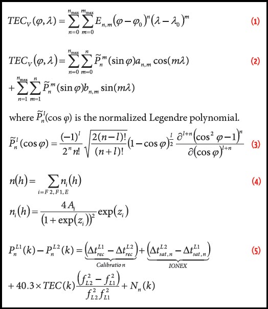
In recent years, numerous, relatively inexpensive hardware platforms for conducting scientific research using the software defined radio (SDR) paradigm have become commercially available. The Manufacturers section near the end of this article lists examples of several of these. In turn, this has spurred universities and research groups around the world to adopt this technology for advanced GNSS signals-based research and development.

Read More >

By Inside GNSS

Environmental Sensing

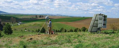
In the past 20 years GPS has simultaneously revolutionized both our modern infrastructure (by providing real-time navigation, mapping, and timing support) and our geodetic/surveying capabilities (by providing millimeter/centimeter-level positioning). At this point, most of the GNSS innovations we expect to see in the next decade will come from calculating positions more accurately and faster, while expanding from GPS to use of all available GNSS signals.

Read More >

By Inside GNSS
May 6, 2014

Location Authentication

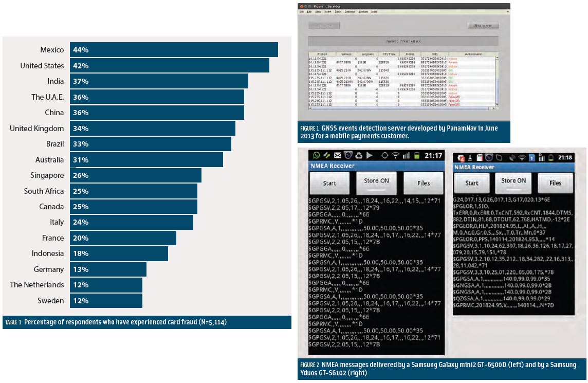
Table 1, Figures 2 & 3

Smartphone apps represent the most prominent market for GNSS. No other device or community of users has achieved a larger growth and market penetration in the period 2008–2013.

Apple introduced the first GPS capability on a smartphone in June 2008 with the iPhone3, and one year later Samsung introduced its Samsung Galaxy, incorporating the first GPS receiver for this brand.

Read More >

By Inside GNSS
[uam_ad id="183541"]
March 17, 2014

Galileo Works!

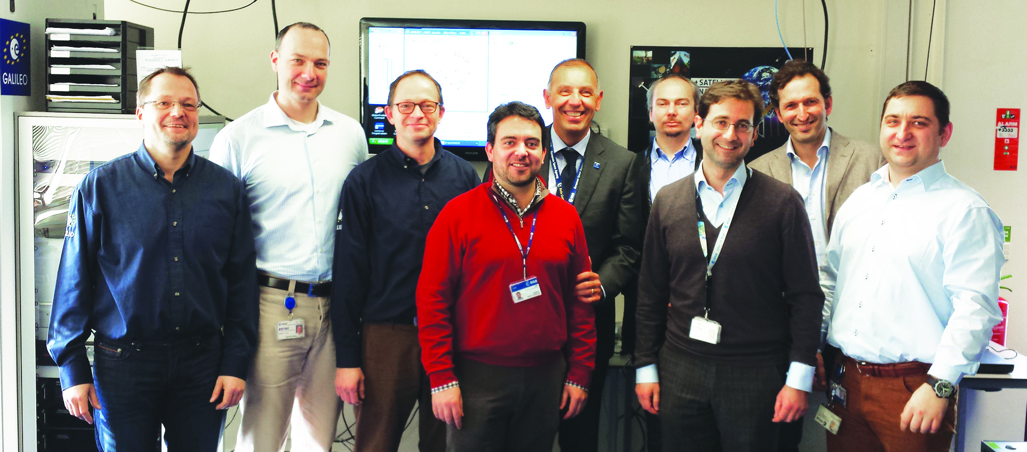
ESA Galileo IOV Test campaign authors, from left: Jörg Hahn, Stefano Binda, Edward Breeuwer, Roberto Prieto-Cerdeira, Marco Falcone, Alexander Mudrak, Gustavo Lopez- Risueño, Francisco Javier Gonzalez Martinez, and Daniel Blonski.

The objective of the IOV phase was to launch the first four operational Galileo satellites and to deploy the first version of a completely new ground segment. During this phase, the European Space Agency (ESA) needed to validate — in the operational environment — all space, ground, and user components and their interfaces, prior to full system deployment. With the assistance of industry partners, ESA had to analyze the performance of the Galileo system and its components with the objective to refine the full operational capability (FOC) system.

Read More >

By Inside GNSS
IGM_e-news_subscribe