Magazine Department Archives - Page 7 of 35 - Inside GNSS - Global Navigation Satellite Systems Engineering, Policy, and Design

Magazine Department

May 29, 2016

Boubeker Belabbas’ Compass Points

COMPASS POINTS

Engineering specialties

Performance analysis of different GNSS configurations (multi-frequency multi-constellation) with and without augmentation. Integration of receiver subsystems starting with antenna design, receiver processing, interference and multipath mitigation algorithms, PVT including integrity monitoring, and hybridization using MEMS-based inertial sensors.

GNSS Event that most signified to you that GNSS had "arrived"

Read More >

By Inside GNSS
May 19, 2016

Re-Baseline This!

So, if everything had gone as planned, we would have a new ground control segment (OCX) operating a new generation of satellites (GPS III) as they launch into an expanded constellation in support of modernized military GPS user equipment (MGUE).

But then the best-laid plans. . . .

Read More >

By Inside GNSS

The “Brussels View” from Prague

Carlo des Dorides, GSA Executive Director

Last October, the European GNSS Agency (GSA) Administrative Board reelected Carlo des Dorides as executive director of the GSA, giving him a second — and final — four-year term in charge of this key agency responsible for supporting the effective operation, maintenance, and security of Europe’s satellite navigation systems. We met with him recently at the GSA office in Prague to learn how he plans to see out his mandate.

Read More >

By Peter Gutierrez
[uam_ad id="183541"]

Military GPS Receiver Advances Could Help Trim Satellite Costs

Advanced military receivers using the sort of modern multi-channel, multi-constellation capabilities already available commercially, could enable the Air Force to focus its anti-jam efforts on the ground, simplifying future GPS satellites and lowering their cost. Moreover, experts told Inside GNSS, the cutting-edge receivers could be deployed years before the anti-jam capability planned for the new GPS III satellites would be fully available.

Read More >

By Dee Ann Divis

Inter-Signal Correction Sensitivity Analysis

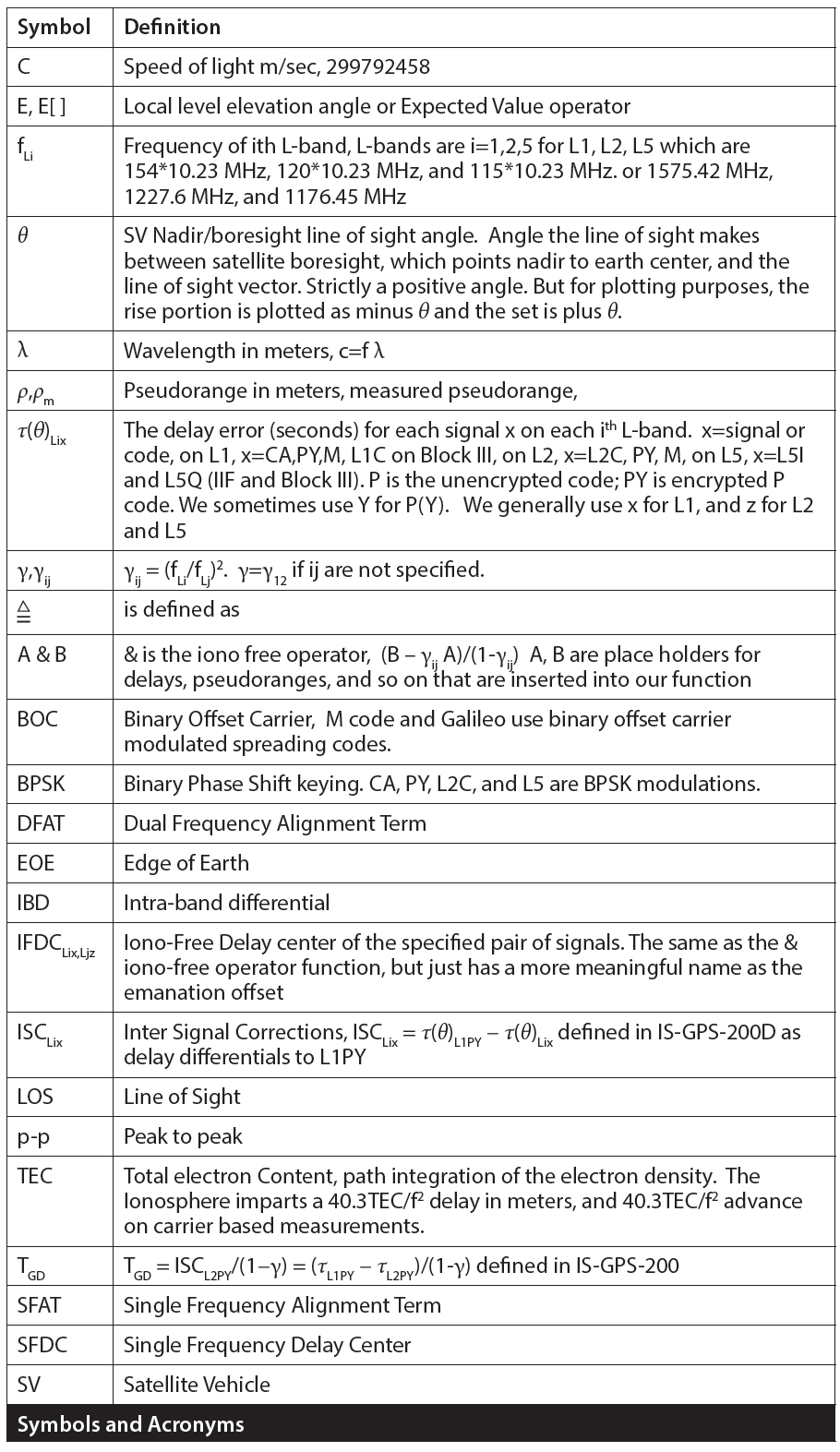
Symbols and Acronyms

Modernized GPS satellites give civil users the ability to achieve dual L1/L2 PY accuracy using dual L1CA/L2C ionosphere-free measurements and, with IIF satellites, dual L1/L5 signals. Because broadcast GPS ephemeris data is based on an ionosphere-free pseudorange calculated from dual L1PY/L2PY measurements and the civil signals are not all perfectly aligned to it, new broadcast parameters and a new modernized dual-frequency algorithm are needed in order to align new signals with the dual L1/L2 PY signal.

Read More >

By Inside GNSS

Listening for RF Noise

GNSS signals are vulnerable to interference due to being extremely weak when received on Earth’s surface. Therefore, even a low-power interference signal can easily disrupt the operation of commercial GNSS receivers within a range of several kilometers.

Read More >

By Inside GNSS
[uam_ad id="183541"]

GNSS Evolutions for Maritime

Trends for marine accidents show rising numbers and costs that are mainly associated with collisions and groundings. Research indicates that about 60 percent of these accidents are caused by human error. The majority of them could have been avoided by providing suitable input to the navigation decision-making process, according to a 2008 report by the International Maritime Organization (IMO) Marine Safety Committee. (See IMO 2008 in Additional Resources section near the end of this article.).

Read More >

By Günter W. Hein
May 1, 2016

FCC Opens GPS-Adjacent Ligado Proposal for Comment

The Federal Communications Commission (FCC) is officially asking for feedback on a proposal by Ligado Networks to repurpose frequencies near the GPS band for a terrestrial broadband network. The long-delayed public notice and comment period is a step in the approval process, although there is no assurance that Ligado’s plan for a new wireless service — which may still cause interference to GPS receivers — will get the go-ahead.

Read More >

By Dee Ann Divis
March 28, 2016

Up in the AIRR

Anyone who has sat through several iterations of a slide presentation by the Federal Aviation Administration (FAA) can’t help but wonder if there isn’t a better way to do things.

As speakers flip through an exhaustively vetted series of PowerPoint slides, squeezing out a new bullet point or two from one version to the next six months later, watching paint dry seems like a more productive — and briefer — use of one’s time. The agency sometimes brings a whole new meaning to the concept of geological time.

Read More >

By Dee Ann Divis
March 27, 2016

Sandy Kennedy’s Compass Points

Return to main article: Sandy Kennedy: Here to Stay

COMPASS POINTS

Engineering specialties

Algorithm development, Kalman filtering, GNSS/INS integration, digital signal processing, embedded software, system integration

Favorite equation

Kennedy really likes the foundational differential equation, the basis of Kalman filtering, because it can become so many different things:

Read More >

By Inside GNSS
March 18, 2016

Sandy Kennedy: Here to Stay

Sandy Kennedy and her husband Arlin Amundrud

>>Sandy Kennedy’s Compass Points

Sandy Kennedy grew up in Miami. Miami, Manitoba, Canada, that is — a town of 150 people with a school, a café, a defunct railroad station, and an ice skating rink.

Now she’s director and chief engineer in charge of receiver core cards at NovAtel Inc., a developer and manufacturer of high-precision GNSS products headquartered in Calgary, Alberta. It’s a long way from where she started, but then again, maybe not.

Read More >

By Inside GNSS

GLONASS and PNT in Russia

The legal and regulatory framework of the Russian Federation covers not only the GLONASS system, but the country’s overall positioning, navigation and timing (PNT) system as well.

The term PNT is a synonym for navigation activities as defined in the Federal Law on Navigation Activities. The PNT system in the Russian Federation is defined as the combination of administrative and technical means that provide spatial and time data to all user groups, with GLONASS as a key element.

Read More >

By Ingo Baumann
1 5 6 7 8 9 35
IGM_e-news_subscribe