GNSS Hotspots | January 2016
Catching thieves in California, Galileo satellites test Einstein, Russian space agency remodel, and 911 training for operators who can’t read maps.
By Inside GNSSCatching thieves in California, Galileo satellites test Einstein, Russian space agency remodel, and 911 training for operators who can’t read maps.
By Inside GNSS
GAGAN — India’s SBAS
Redefining Navigation over the Indian Region
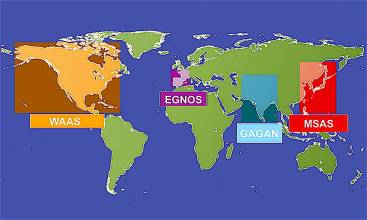
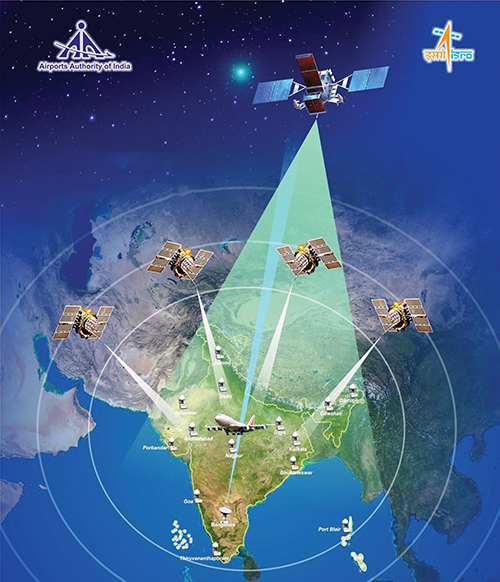
Recognizing the potential benefits of satellite-based augmentation systems, India took the early initiative to create its own SBAS called GAGAN — GPS Aided Geo Augmented Navigation.
Europe’s space community rang in the New Year with two of its brightest annual fixtures: the European Union (EU) Space Policy conference in Brussels and the European Space Agency (ESA) media briefing in Paris.
The events brought out all of the relevant voices and served to illustrate not only the disposition of materiel and troops but also their intent and even the level of morale.
By Peter GutierrezWorking Papers explore the technical and scientific themes that underpin GNSS programs and applications. This regular column is coordinated by Prof. Dr.-Ing. Günter Hein, head of Europe’s Galileo Operations and Evolution.
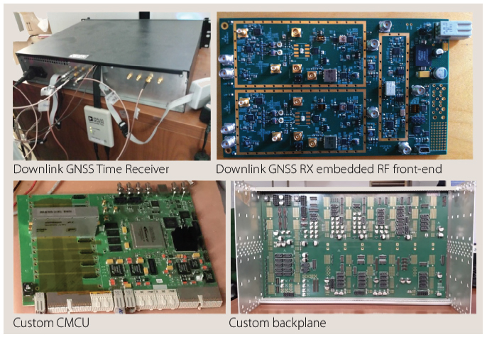
With the support of the European Space Agency (ESA), a European team designed a frequency- and time-transfer process and validated its performance in a complex navigation test bed. This two-way time-transfer technology took advantage of the following:
By Günter W. HeinQ: What is Doppler collision and is it a problem in GNSS?
A: Doppler collision is a physical effect in code-division multiple access (CDMA) systems where code measurement errors are observed due to cross-correlation effects. Doppler collision may occur when the Doppler frequency between signals from two different transmitters is smaller than the code lock loop bandwidth.
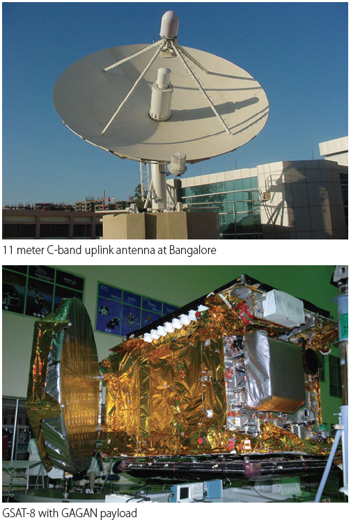
By Inside GNSSThe GPS Aided Geo Augmented Navigation (GAGAN) system was developed by the Indian Space Research Organization (ISRO), together with Airports Authority of India (AAI), to deploy and certify an operational satellite-based augmentation system (SBAS). The system’s service area covers the Indian Flight Information Region (FIR), with the capability of expanding to neighboring FIRs.
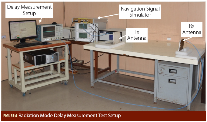
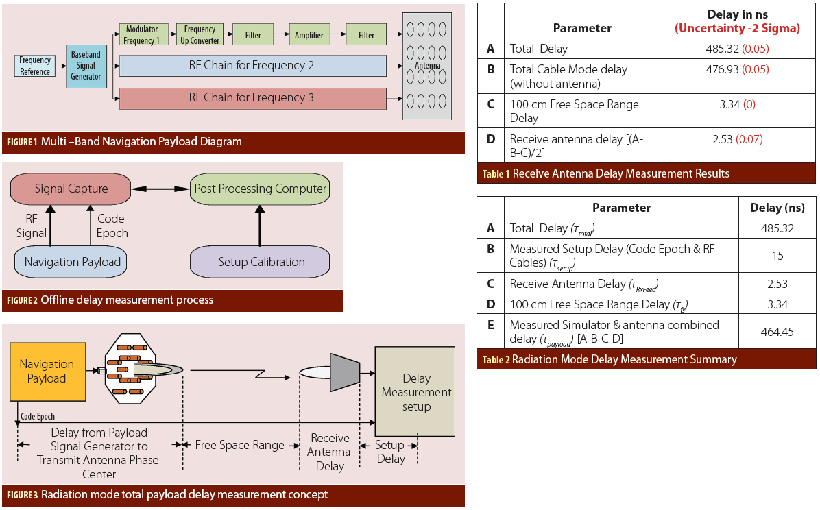
By Inside GNSSIn satellite navigation, the user receiver finds its position by measuring its distance to satellites and knowledge of the satellite position. The distance is measured by ranging, i.e., finding the delay of the signal from the transmitter to the receiver. The delay will comprise of payload hardware delay and the geometric range delay. Hence, the payload delay of the signal from generation to radiation is very important and needs to be transmitted in navigation data.
By Inside GNSSSmall GPS jammers, particularly the “personal privacy devices” readily available on the Internet, pose one of the greatest risks to the nation’s critical infrastructure, according to a now-public Homeland Security assessment.
By Dee Ann DivisHaving settled its lawsuits against a trio of GPS receiver manufacturers, would-be broadband provider New LightSquared is now pointing to those settlements to support its assertion that it is fully addressing GPS interference issues.
By Inside GNSSIt will be a busy few weeks for GNSS satellite launches in January and February.
Up next is the Wednesday (January 20, 2016) is a launch of the fifth spacecraft for the Indian Regional Navigation Satellite System (IRNSS). The Indian Space Research Organization plans to complete the IRNSS constellation with two additional launches in February and March.
By Inside GNSSApproval of a European Union (EU) petition to officially allow Galileo signals to be used in the United States may become an issue during upcoming negotiations over an American request for access to Galileo’s Public Regulated Service (PRS) signal, an EU advisor suggested.
By Inside GNSSNew LightSquared, the firm reconstituted from the original LightSquared wireless broadband company upon its exit from bankruptcy, has proposed a settlement of lawsuits filed against Garmin and Trimble Navigation, which would end most of the company’s legal action against the GPS community.
By Inside GNSSThe National Executive Committee for Space-Based Positioning, Navigation, and Timing (PNT ExCom) has recommended using enhanced Loran (eLoran) as a near-term alternative to GPS for essential timing data while it determines what capabilities are needed for a comprehensive GPS backup, officials told Congress this week.
By Inside GNSS