Return to main article: "Urban Positioning On a Smartphone"
By Inside GNSS
Editor’s Note: On November 19, Senator Roger Wicker (R-Mississippi), a member of the Senate Armed Services Committee, filed an amendment (No. 2185) to the FY 2014 National Defense Authorization Act (S. 1197),
Section 1082, that would limit the construction of satellite
positioning ground monitoring stations controlled by any foreign
government on U.S. soil. Such construction would require certification
 Jules McNeff, Overlook SystemsTechnologies, Inc.
EDITOR’S NOTE: Jules McNeff answers additional questions on the subject of spectrum protection and sharing in a special “GNSS Forum” extension of this installment of the "Thought Leadership Series" in this issue of Inside GNSS.
As Mark Twain once famously told a petitioner for investment advice: “Buy land. They are not making it any more.”
So it is with radio frequency spectrum, a limited and finite resource.
By Inside GNSS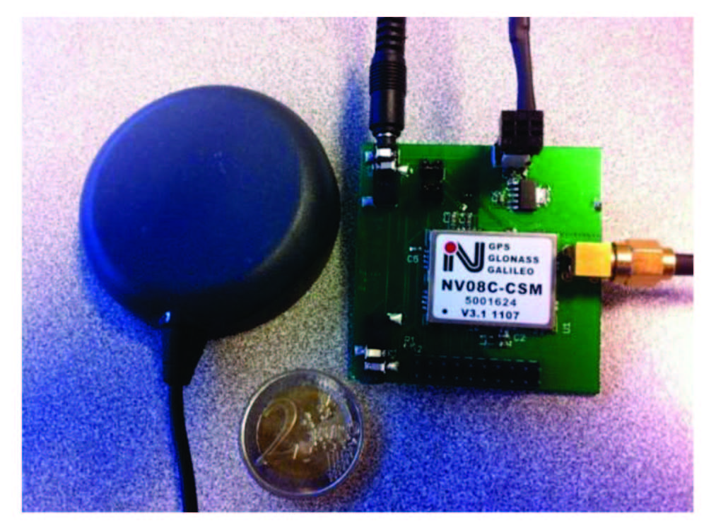 Receiver (on the right) and antenna (on the left) comprised the on-board unit used in both data collections
Working Papers explore the technical and scientific themes that underpin GNSS programs and applications. This regular column is coordinated by Prof. Dr.-Ing. Günter Hein, head of Europe’s Galileo Operations and Evolution.
By Inside GNSSQ: How Does Non-Line-of-Sight Reception Differ From Multipath Interference?
A: It is well known that GNSS signals may be reflected by buildings, walls, vehicles, and the ground. Glass, metal, and wet surfaces are particularly strong reflectors.
By Inside GNSS Main antenna on FOC Galileo satellite
SIDEBAR: Elizabeth Rooney’s Compass Points
Going for her first big job interview after college, Elizabeth Rooney admits she didn’t know what GPS was.
“It was 1995,” she says, “and I was going in to see about this job. I had been looking at some literature from the company I was interviewing with, and there it was, ‘GPS.’ I wondered what the letters meant when I saw them.”
By Inside GNSSSome of the specific technical issues behind the latest delay for Galileo’s first full operational capability (FOC) satellites have already been reported. The story, as it is told, generally starts with a late navigation payload delivery by British firm Surrey Satellite Technology to the German prime contractor, OHB. Next, OHB ran into issues with the payload and the platform, further stretching out the timeline.
By Peter Gutierrez
The GPS program is setting a new space-system standard for cyberdefense, and now the federal government is creating a framework to help operators of critical infrastructure that largely rely on GPS to do the same.
The need to raise the bar is clear. Malicious coders, often backed by hostile nation-states or criminal organizations, are using automated tools to continuously probe for weaknesses:
By Dee Ann Divis Jules McNeff, Overlook SystemsTechnologies, Inc.
EDITOR’S NOTE: The special “GNSS Forum” continues the discussion of spectrum sharing and protection addressed in the “Thought Leadership Series” in this issue of Inside GNSS.
Some research has gone into the possibility of using other parts of the RF spectrum for GNSS services in addition to L-band, for instance, S-band frequencies. What are the most important technical and practical considerations that come to mind in considering such proposals?
By Inside GNSS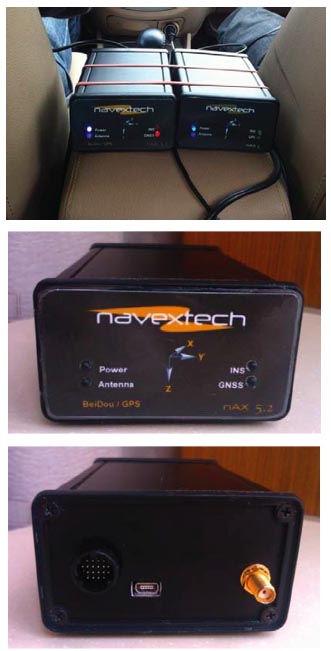 GPS/BeiDou/MEMS configuration and GPS/MEMS configuration (left and right, respectively, top photo), Front view (center photo) and back view (lower photo) of nAX5.2
Due to the huge success of GPS in both military and civil applications, several other GNSSs have been developed, built, and operated in the last few decades. GNSS, regional, and augmentation systems are comprise a growing family that also includes GLONASS, Galileo, BeiDou, and Japan’s Quasi-Zenith Satellite System (QZSS). New members, such as the Global Indian Navigation System (GINS), are preparing to join in next decade.
By Inside GNSS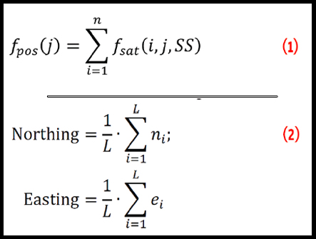
The poor performance of GNSS user equipment in urban canyons in terms of both accuracy and solution availability is a well-known problem that arises where there are tall buildings or narrow streets. This situation is worse in the cross-street direction than in the along-street direction. (See Figure 1.)
By Inside GNSS