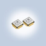
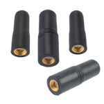
B: Applications Archives - Page 44 of 151 - Inside GNSS - Global Navigation Satellite Systems Engineering, Policy, and Design

B: Applications

LEO Successor to GNSS Comes Knocking

A group of Stanford Ph.D. and Masters graduates, with work experience among them at SpaceX, Ford Motor Systems, Blue Origin, Booz Allen Hamilton and other firms, has launched a start-up to start up a low-Earth orbit successor to GPS and other GNSS. The existing services, they say, are not up to the challenges of autonomy. They founded Xona Space Systems to supplant the venerable satnav systems.

Read More >

By Inside GNSS

Galileo on PATROL for Driver and Road Safety

The Position Authenticated Tachograph foR OSNMA Launch (PATROL) project is developing the first external GNSS facility for smart tachographs, using Galileo’s new Open Service Authentication (OS-NMA). The tachograph, a device fitted to a vehicle that automatically records its speed and distance, together with the driver’s activity selected from a choice of modes, uses Galileo authentication to verify that the navigation data received from satellites is genuine.

Read More >

By Inside GNSS
June 1, 2020

New GPS Performance Document Gives Glimpses of L2C, L5, Expanded Constellation

The U.S. Air Force updated the GPS Standard Positioning System (SPS) Performance Standard (PS) in mid-April, 2020, the first new Performance Standard document since 2008. It includes mention of and  pre-Initial Operating Capability (IOC) performance standards for the new civil GPS signals L2C and L5 for the first time. In another new feature, the document mentions “expanded capabilities which allow the total size of operational constellation to grow beyond the previous maximum of 32 Navstar satellites” for “more robust constellation availability to enhance the overall SPS SIS performance.”

Read More >

By Inside GNSS
[uam_ad id="183541"]
May 25, 2020

5-cm Accuracy in Marine-Certified Receiver: Quad-Band Device Supports PPP Corrections

new marine-certified quad-band GNSS receiver, the LD900 from VERIPOS, delivers accurate, reliable positioning in demanding offshore environments. The LD900 can track four GNSS frequencies simultaneously to ensure a precise position is always available at sea. When combined with Apex5 correction services from VERIPOS, it delivers accuracy levels as precise as 5 cm (95%) to provide robust positioning for the most challenging applications, including deepwater drilling, seismic, construction, and survey.

Read More >

By Inside GNSS
[uam_ad id="183541"]
May 21, 2020

The New Flex Power Mode: From GPS IIR-M and IIF Satellites with Extended Coverage Area

GPS satellites usually transmit their signals with constant power. However, a so-called “Flex Power” is foreseen to increase the strength of individual signals to better fulfill operational constraints. Flex power operations can be detected in carrier-to-noise density ratio (C/N0) observations provided by GNSS receivers of the global tracking network of the International GNSS Service (IGS).

Read More >

By Peter Steigenberger, et al.
May 20, 2020

Positioning, Navigation, and Timing Trust Inference Engine

Critical infrastructure has a compelling need to infer the assurance of PVT estimates—as do users in general. However, traditional PNT platforms do not offer a principled way to infer assurance from multiple anti-spoofing (A-S) techniques, situational awareness (SA) information, and other auxiliary sources such as network data. Here we introduce, a PNT Trust Inference Engine (PNTTING) that can assess PNT trust according to probabilistic models with rigorous semantics.

Read More >

By Andras Molina-Markham & Joseph J. Rushanan

Knives Out

The Federal Communications Commission should really consider updating its motto. “Firm, fast, flexible, and fair” has a bit of an old-fashioned ring. As mottos go, it fails to keep up with the times.

Read More >

By Alan Cameron
1 42 43 44 45 46 151
IGM_e-news_subscribe