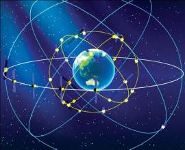
BeiDou’s Applications, Role in Asia Continue to Evolve
Asia is booming, and China’s BeiDou satellite navigation system seems prepped to boom right along with the growing region.
By Inside GNSSAsia is booming, and China’s BeiDou satellite navigation system seems prepped to boom right along with the growing region.
By Inside GNSSChina’s domestically produced satellite navigation system BeiDou has made significant progress in terms of its accuracy, according to reports out of China earlier this month. At a recent press conference, BeiDou engineers claimed that a new accurate positioning chip can now help users arrive at their destinations with an error margin of just one to two meters.
By Inside GNSSThe opening plenary of the annual Satellite Navigation Summit in Munich tends to be a ritzy affair, taking place in the evening in an amazing converted chapel and featuring live musical interludes in between groups of speakers. This year the audience was treated to movie tunes, and the European Commission’s Pierre Delsaux had a suggestion for the play list.
By Inside GNSSChinese navigation satellite BeiDou-3 is scheduled to be launched in July 2017, according to its developer, China Aerospace Science and Technology Corporation (CASC). As reported in January by People’s Daily, a publication of the state news agency, the company claimed that six to eight satellites will be deployed within the year.
By Inside GNSSThe BeiDou Navigation Satellite System (BDS) is China’s contribution to the world in the domain of Global Satellite Navigation System (GNSS). The BDS is being developed by the Chinese government, mainly through military departments, with key considerations for China’s national security, economic interests and social progress.
By Ingo BaumannAt the traditional January media briefing in Paris yesterday (January 18, 2017), European Space Agency (ESA) General Director Jan Woerner was forthright in laying out the knowns and unknowns about the failed rubidium and hydrogen maser clocks onboard orbiting Galileo satellites, clocks that are absolutely crucial for accurate positioning.
By Inside GNSSThe navigation sensors for location-based services (LBS) are complex technical systems. Modern technical science can answer most questions about the optimality of particular position determination methods, signal processing algorithms, electronic circuits or similar well-defined problems, but the rigorous answer to the questions concerning the optimal LBS positioning sensor are still a big problem.
By Inside GNSSA white paper published by the Chinese government earlier this month outlining the action plan for the BeiDou Navigation Satellite System (BDS) and a press conference featuring the director of the BDS management office provided new details on the progress for China’s GNSS program.
By Inside GNSSChina launched another BeiDou satellite on Sunday (June 12, 2016, local time) to support its GNSS constellation.
The satellite, launched from the Xichang Satellite Launch Center in southwest China’s Sichuan Province, was taken into orbit by a Long March-3C carrier rocket. It is the 23rd satellite in the BeiDou Navigation Satellite System (BDS), a new-generation BeiDou-2 spacecraaft, and the seventh geostationary Earth orbit satellite (GEO) in the BeiDou constellation.
By Inside GNSSThe 5th International Intelligent Transportation System and Location-based Services expo will take place in Shenzhen (深圳), China on June 17, 18 and 19, 2016. It will take place in Hall 9 of the Shenzhen Convention and Exhibition Center in the city center.
By Inside GNSSWith little fanfare or prior announcement, China launched another second-generation BeiDou Navigation Satellite System (BDS) satellite last week, the 22nd in the nation’s GNSS program.
The satellite launched from the Xichang Satellite Launch Center in the southwestern province of Sichuan on March 29 local time on board a Long March-3A carrier rocket.
An inclined geosynchronous orbit (IGSO) spacecraft designated Beidou-2 IGSO-6, it is expected to operate at an altitude of about 22,000 miles (35,400 kilometers) with an inclination of about 55 degrees.
By Inside GNSSDangerous Games in Rio, Animal Trackers, Chinese Logistics and The Radiation Club
By Inside GNSSOriginGPS has launched its Multi Micro Spider multi-GNSS module, which features a 5.6 x 5.6-millimeter footprint and 2.65-millimeter height.
Like its predecessor, the Multi Micro Hornet (which measured 10 x 10 x 6.1 millimeters), the ORG4033 uses MediaTek’s MT3333 and is positioned for applications that require minimal power consumption and ultra-small form factors, ranging from wearables to drones. Unlike the Hornet, the Multi Micro Spider supports Europe’s Galileo system as well as GPS, GLONASS, and BeiDou.
By Inside GNSS