ION GNSS+ Returns to Miami in Sept.
ION GNSS+, the world’s largest technical meeting and showcase of GNSS technology, products and services, will take place Sept. 16-20, 2019 at the Hyatt Regency Miami in Miami, Florida.
By Inside GNSSION GNSS+, the world’s largest technical meeting and showcase of GNSS technology, products and services, will take place Sept. 16-20, 2019 at the Hyatt Regency Miami in Miami, Florida.
By Inside GNSSAt an event in the U.S. Capitol last week Senators Ted Cruz (R-TX) and Ed Markey (D-MA) discussed the importance of GPS to America and the need for a backup system when signals are not available.
By Inside GNSSION’s Joint Navigation Conference (JNC 2019) will be held July 8-10, at the Hyatt Regency Long Beach, Long Beach, California; and the U.S. ONLY CLASSIFIED sessions will be held July 11 at The Aerospace Corporation.
By Inside GNSSEnables Complex Military Missions in GNSS Denied Environments
At last week’s Paris Air Show in Le Bourget, France, Safran and Orolia announced the signing of a strategic partnership to offer the latest resilient positioning, navigation and timing (PNT) solutions for military forces, especially in GNSS denied environments.
By Inside GNSSKENNEDY SPACE CENTER, FLORIDA — NASA is poised to demonstrate an advanced atomic clock that could someday markedly improve satellite navigation.
By Dee Ann DivisNew Board Designation Expected This Fall
The leading U.S. panel of satellite navigation experts, the National Space-Based Positioning, Navigation, and Timing Advisory Board (“PNT Advisory Board”) opened its June meeting with a renewed charter, a new chairman and seven new members.
By Dee Ann DivisThe BELS+ Workshop, “GNSS Technologies and Application for a Sustainable Development: the European Contribution to Robust and Precise Positioning”and Training days will be held July 17-19, 2019 in Bandung, West Java, Indonesia.
By Inside GNSS[Editor’s Note: This article was written and submitted by Mark Crews and John Betz.]
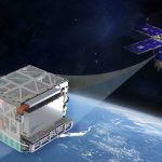
With the launch of the first next-generation GPS III satellite, GPS III Space Vehicle 01 (GPS III SV01), on December 23, 2018, the Global Positioning System (GPS) took a major step in modernizing technology and capability. The U.S. Air Force has continually improved GPS since the launch of the first GPS Block I satellite in 1978, and this ongoing modernization has provided new signals, greater accuracy, and increased robustness for civil and military users. After the first 10 GPS III satellites are launched over the next few years, up to 22 GPS III Follow-on (GPS IIIF) satellites will provide yet another step increase in GPS capabilities.
By Inside GNSSI read with great enthusiasm Dee Ann Divis’ article New Chimera Signal Enhancement Could Spoof-Proof GPS Receivers. Logan Scott is one of the brightest people I know, and I very much enjoyed his presentation about Chimera last week at the National PNT Advisory Board’s public meeting in Alexandria, Virginia.
By Dana A. GowardAn increasing number of applications require accurate, reliable, and traceable signals for time and synchronization. Key fields of application include banking and finance, telecom networks and electricity grids. GMV’s WANTime is a new time service for the city of Madrid, Spain, distributed using the White-Rabbit network protocol over optical fiber. A pilot customer of the service is currently the Madrid Stock Exchange (Bolsa de Madrid), connected to GMV’s datacenter by a network link of around 50 kilometers.
By Inside GNSSNominations are now being accepted for the Institute of Navigation Satellite Division’s prestigious Johannes Kepler Award – the annual award honoring an individual during their lifetime for sustained and significant contributions to the development of satellite navigation and the Bradford W. Parkinson Award – the award recognizing an outstanding graduate student in the field of Global Navigation Satellite Systems (GNSS).
By Inside GNSSThe European Union-funded GNSS.asia H2020 project hosted a major roundtable discussion around the theme of “Europe Meets India” at the recent 2019 Munich Satellite Navigation Summit. The event was aimed at promoting cooperation between the GNSS research and industrial communities in Europe and Asia-Pacific.
By Inside GNSSThe Air Force Research Laboratory (AFRL) is considering a contract for research and development of celestial-aided navigation technologies. The primary focus is to develop a Star Tracker that can reliably perform celestial sightings for sensor altitudes between 30,000 feet and 80,000 feet. The goal is to reduce the risks to guidance, navigation and control in GPS-denied environments, especially for operations over feature-poor terrain such as desert, water, snow and ice where existing terrain-aided methods may not be used for position, navigation, and timing (PNT) updates.
By Inside GNSSSatellite navigation has become a global utility, but one that is vulnerable to interference. The European Space Agency’s new NAVISP research and development program is prioritizing research into countering jamming and spoofing of satnav signals, with partner companies exploring varied approaches.
By Inside GNSSLORD Corporation, a global provider in sensing systems, has partnered with Emesent, an award-winning company in autonomous technology for industrial drones, to bring industry-leading inertial sensors to the Hovermap platform. Hovermap automates the collection and analysis of data in challenging GPS-denied environments, reportedly delivering revolutionary efficiency, safety and operational insights to various industries, including the underground industry. LORD inertial sensors enable Hovermap technology by providing precise position, orientation and velocity information in a small and lightweight package.
By Inside GNSS