
May 11, 2018
WSTS Timing and Sync Workshop Slated for San Jose
The 27th Annual Workshop on Synchronization and Timing Systems (WSTS), sponsored by NIST and ATIS, will take place June 18-21, 2018 in San Jose, California.
By Stan GoffGlobal Navigation Satellite Systems Engineering, Policy, and Design
The 27th Annual Workshop on Synchronization and Timing Systems (WSTS), sponsored by NIST and ATIS, will take place June 18-21, 2018 in San Jose, California.
By Stan Goff
After wrangling over amendments for hours, the House Armed Service Committee passed the National Defense Authorization Act for Fiscal Year 2019 (HR 5515) late Wednesday night approving in the process a mandate for a new M-Code coordinating office.
By Dee Ann Divis
The GPS Innovation Alliance has announced the appointment of J. “David” Grossman as executive director. Grossman will lead the Alliance as it further builds its organizational presence in Washington on behalf of its members and the GNSS industry as a whole.
“David’s appointment ushers in an exciting new chapter for our organization” said Jim Kirkland, president of the GPS Innovation Alliance and senior vice president and general counsel of Trimble Inc.
By Inside GNSS
San Jose, California-based DT Research, a leading designer and manufacturer of purpose-built computing solutions for vertical markets, recently announced the DT301T Rugged RTK Tablet (DT301T-RTK), a lightweight military-grade tablet that is purpose-built for GIS mapping applications with real-time kinematic (RTK) satellite navigation used to enhance the precision of position data derived from satellite-based positioning systems. This tablet enables 3D Point Cloud creation with centimeter-level accuracy — meeting the high standards required for scientific-grade evidence in court.
The DT301T-RTK is military-grade with an IP65 rating, yet lightweight — offering the versatility to be used in the field, office and vehicles. A dual frequency GNSS module is built into the tablet, which uses real-time reference points within 1- to 2-centimeter accuracy to position 3D point clouds created from aerial photogrammetry, using GPS, GLONASS and Galileo receivers. Users can measure with the RTK GNSS positioning directly using a foldable antenna or connect to an external antenna for more robust receiving and survey grade precision.
“We’ve seen a dramatic uptick in the need for rugged tablets to be purpose-built for a range of mapping uses across industries,” said Daw Tsai Sc.D., president of DT Research. “In designing the DT301T with RTK satellite navigation, we also took into consideration the other features and capabilities necessary within a rugged tablet to quickly and easily conduct forensic mapping, land surveying, e-construction, Building Information Modeling and other mapping scenarios.”
The DT301T-RTK tablet is compatible with existing GIS software for mapping applications and brings together the advanced workflow for GIS data capture, accurate positioning and data transmitting. The tablet can be used in a variety of scenarios, including:
Forensic Mapping — Public safety teams, investigators and crash reconstructionists can use the DT301T-RTK Tablet to accurately collect measurements that are scientifically defensible by using the real-time centimeter reference points to position 3D point clouds created from aerial photogrammetry or take stand-alone measurements, according to the company.
“When reconstructing a crime scene, crash scene or natural disaster — forensic mapping needs to have scientific-grade precision in order to stand up as evidence in court,” said Andrew S. Klane, a former Massachusetts State Police Lieutenant who teaches Forensic Mapping and is now the Chief Operating Officer at Forensic Mapping Solutions Inc. “As more drones are being used for mapping, there is a growing need for ground control positioning devices. By using a DT301T-RTK Tablet in combination with a drone, users can more quickly and cost-effectively create a 3D model to deliver an accurate representation of the scene with scientific-grade tolerance that will hold up in a court of law.”
The DT301T-RTK Tablet has been purpose-built for precision mapping in a variety of environments and includes the following features and capabilities:
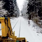
This article focuses on the research project Galileo Online: GO! – which with support from the Federal Ministry for Economic Affairs and Energy (grant number 50NA1510) designs and develops a reliable and high-precision receiver for multi-constellation and dual-frequency GNSS whose suitability and capabilities are tested in railway applications. Project results showcase the advantages of GPS and Galileo if used simultaneously in railway applications.
By Inside GNSS
A $2 billion lawsuit with implications for the ongoing spectrum fight between the GPS community and would-be terrestrial telecom provider Ligado Networks has been stayed — set aside through mutual agreement for nine months — according to court documents.
By Inside GNSS
The Federal Communications Commission (FCC) has declined to take action on concerns expressed by the GPS community, approving an Iridium request to modify its earth station licenses to take advantage of the advanced capabilities of its second-generation constellation.
By Dee Ann Divis
Orolia, through its Spectracom brand, announced the introduction of a Passive GPS/GNSS Anti-Jam Outdoor Antenna with horizon blocking technology. The antenna, Model 8230AJ, is a drop-in replacement for the company’s popular Model 8230 and is ideal for high interference situations where additional resilience is needed.
By Inside GNSS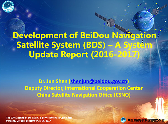
Big news came out of Washington, D.C. earlier this week regarding BeiDou and GPS as the United States and China have negotiated compatible signal characteristics that will both protect and enhance service for users of the U.S. Global Positioning System (GPS) and the equivalent Chinese system.
By Inside GNSS Tower Hall at San Jose State University. Photo source: Wikimedia Commons.
The 26th annual Workshop on Synchronization and Timing Systems (WSTS), sponsored by The National Institute of Standards and Technology (NIST) and ATIS, will take place April 3-6 at the DoubleTree in Jan Jose, California.
By Inside GNSS
Yesterday (December 23, 2016) President Obama signed the National Defense Authorization Act (NDAA) for Fiscal Year 2017, a $619-billion bill with a number of provisions affecting satellite navigation.
The legislation (S. 2943) fully authorizes the administration’s requests for all the elements of the GPS program — and signals indirectly that appropriators eventually will provide comparable support — although the NDAA does put additional requirements on those developing the new GPS ground system.
By Dee Ann Divis
The navigation sensors for location-based services (LBS) are complex technical systems. Modern technical science can answer most questions about the optimality of particular position determination methods, signal processing algorithms, electronic circuits or similar well-defined problems, but the rigorous answer to the questions concerning the optimal LBS positioning sensor are still a big problem.
By Inside GNSS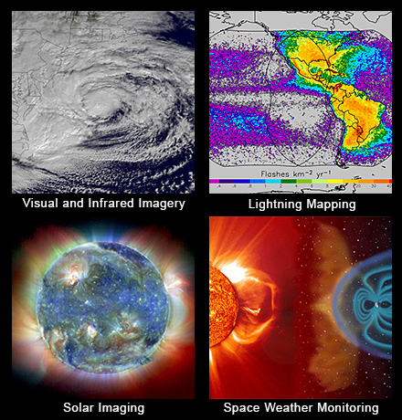 GOES-R primary capabilities. NOAA image
A United Launch Alliance (ULA) Atlas V rocket carrying the Geostationary Operational Environmental Satellite R-series (GOES-R) for National Aeronautics and Space Administration (NASA) and National Oceanic Atmospheric Administration (NOAA) lifted off from Cape Canaveral Air Force Station, Florida, yesterday (November 19, 2016) headed for geosynchronous orbit.
By Inside GNSS
Most folks look to a new year as an opportunity for fresh starts and new projects. For the GPS community, however, the October 1 start of the 2016 federal fiscal year (FY16) will likely be more about the hangover — that is, the issues that are hanging over into the next 12 months, unresolved.
At the top of that list of unfinished business are two system decisions: a go/no-go determination on whether the United States will build eLoran as the U.S. backup to GPS and deciding whether or not to choose a new contractor for the GPS III program.
By Dee Ann Divis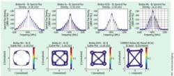
The world’s four GNSS programs aren’t exactly a classical quartet, weaving Mozart stanzas in disciplined execution.
By Inside GNSS