Uncategorized

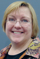
Elizabeth Rooney: ‘Not a typical job for most working mums.’

Main antenna on FOC Galileo satellite

SIDEBAR: Elizabeth Rooney’s Compass Points

Going for her first big job interview after college, Elizabeth Rooney admits she didn’t know what GPS was.

“It was 1995,” she says, “and I was going in to see about this job. I had been looking at some literature from the company I was interviewing with, and there it was, ‘GPS.’ I wondered what the letters meant when I saw them.”

Read More >

By Inside GNSS

Questions in Wake of New Galileo Delay

Some of the specific technical issues behind the latest delay for Galileo’s first full operational capability (FOC) satellites have already been reported. The story, as it is told, generally starts with a late navigation payload delivery by British firm Surrey Satellite Technology to the German prime contractor, OHB. Next, OHB ran into issues with the payload and the platform, further stretching out the timeline.

Read More >

By Peter Gutierrez

OCX and GPS Cybersecurity

The GPS program is setting a new space-system standard for cyberdefense, and now the federal government is creating a framework to help operators of critical infrastructure that largely rely on GPS to do the same.

The need to raise the bar is clear. Malicious coders, often backed by hostile nation-states or criminal organizations, are using automated tools to continuously probe for weaknesses:

Read More >

By Dee Ann Divis
[uam_ad id="183541"]

GNSS Spectrum: Sharing or Protection?

Jules McNeff, Overlook SystemsTechnologies, Inc.

EDITOR’S NOTE: The special “GNSS Forum” continues the discussion of spectrum sharing and protection addressed in the “Thought Leadership Series” in this issue of Inside GNSS.

Some research has gone into the possibility of using other parts of the RF spectrum for GNSS services in addition to L-band, for instance, S-band frequencies. What are the most important technical and practical considerations that come to mind in considering such proposals?

Read More >

By Inside GNSS

Integrated Navigation

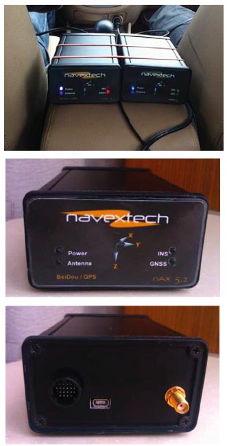
GPS/BeiDou/MEMS configuration and GPS/MEMS configuration (left and right, respectively, top photo), Front view (center photo) and back view (lower photo) of nAX5.2

Due to the huge success of GPS in both military and civil applications, several other GNSSs have been developed, built, and operated in the last few decades. GNSS, regional, and augmentation systems are comprise a growing family that also includes GLONASS, Galileo, BeiDou, and Japan’s Quasi-Zenith Satellite System (QZSS). New members, such as the Global Indian Navigation System (GINS), are preparing to join in next decade.

Read More >

By Inside GNSS

Urban Positioning on a Smartphone

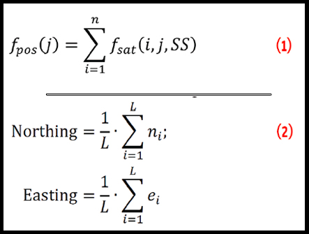
The poor performance of GNSS user equipment in urban canyons in terms of both accuracy and solution availability is a well-known problem that arises where there are tall buildings or narrow streets. This situation is worse in the cross-street direction than in the along-street direction. (See Figure 1.)

Read More >

By Inside GNSS
October 30, 2013

Location Intelligence 2014

Directions Magazine’s Location Intelligence 2014 conference will be held May 19-21, 2014, in Washington, D.C. at the Walter E. Washington Convention Center. The multi-track event includes technical workshops and will be host to Oracle’s Spatial Summit, the HERE Summit and the LocationTech Summit.

The deadline for abstracts is January 31, 2014.

Online registration is open.

Read More >

By Inside GNSS
[uam_ad id="183541"]
September 17, 2013

Galileo Launch Delayed; EU States Begin PRS Tests

As engineers painstakingly work their way through tests of the first full operational capability (FOC) Galileo satellite at the European Space Agency’s European Space Research and Technology Center (ESA/ESTEC) in Noordwijk, The Netherlands, European space sources have acknowledged that the new-generation spacecraft’s maiden voyage will not occur until December 28, and even that date looks highly unlikely.

Read More >

By Inside GNSS
September 14, 2013

GNSS Hotspots | September 2013

One of 12 magnetograms recorded at Greenwich Observatory during the Great Geomagnetic Storm of 1859
1996 soccer game in the Midwest, (Rick Dikeman image)
Nouméa ground station after the flood
A pencil and a coffee cup show the size of NASA’s teeny tiny PhoneSat
Bonus Hotspot: Naro Tartaruga AUV
Pacific lamprey spawning (photo by Jeremy Monroe, Fresh Waters Illustrated)
“Return of the Bucentaurn to the Molo on Ascension Day”, by (Giovanni Antonio Canal) Canaletto
The U.S. Naval Observatory Alternate Master Clock at 2nd Space Operations Squadron, Schriever AFB in Colorado. This photo was taken in January, 2006 during the addition of a leap second. The USNO master clocks control GPS timing. They are accurate to within one second every 20 million years (Satellites are so picky! Humans, on the other hand, just want to know if we’re too late for lunch) USAF photo by A1C Jason Ridder.
Detail of Compass/ BeiDou2 system diagram
Hotspot 6: Beluga A300 600ST

1. EASY RIDER
Milwaukee, Wisconsin USA
√ Not only has century-old American motorcycle manufacturer Harley Davidson used consumer focus groups for the first time to develop its newest “hogs,” it has responded to customers with a voice-activated touch-screen GPS unit, the first on a production model. Now the Easy Riders don’t have to wend their way to trouble, they can ask their chopper where to go.

Read More >

By Inside GNSS

Ismael Colomina’s Compass Points

Ismael Colomina, wife Carmina, and children Jan and Eulalia on vacation in Brazil

Return to main article

I Fell In Love With GNSS When . . .

“Two GNSS-related experiences really impressed me as a young professional and that I’ve never forgotten. The first involved adjusting a GPS-supported (GPS aerial control) aerial triangulation. By getting rid of most ground control points we managed to produce new results.

Read More >

By Inside GNSS
1 34 35 36 37 38 82
IGM_e-news_subscribe