
 Leica’s Jigsaw Positioning System with LocataLite
Locata Corporation and the U.S. Air Force have announced that the Australia-based company has successfully completed the critical Design Review (CDR) contract phase for a Locata network that will enable the U.S. Air Force to deploy a new ground-based, centimeter-accurate "truth-reference level" positioning system for use in GPS-denied environments.
Locata Corporation and the U.S. Air Force have announced that the Australia-based company has successfully completed the critical Design Review (CDR) contract phase for a Locata network that will enable the U.S. Air Force to deploy a new ground-based, centimeter-accurate "truth-reference level" positioning system for use in GPS-denied environments.
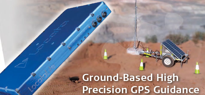
Meanwhile, Leica Geosystems has launched its new Jigsaw Positioning System (Jps), a mine management system that features Locata’s technology to provide equipment monitoring and guidance applications with or without JPS’s integrated GPS.
The USAF 746th Test Squadron (746TS) awarded Locata a multi-year, sole-source contract for the project in July 2010, and the CDR was the last milestone to be met before the USAF committed to a technology demonstration in the USA. Locata’s Non-GPS Based Positioning System (NGBPS) — sold commercially as a LocataNet — will provide accurate positioning when GPS is jammed over 2,500 square miles (6,500 square kilometers) of the White Sands Missile Range (WSMR) in New Mexico.
The project’s most significant milestone to date, completion of the CDR demonstrates the company’s detailed LocataNet design as capable of meeting the non-GPS based positioning component of the 746TS Ultra-High Accuracy Reference System (UHARS). The contract now moves to an initial deployment over approx 600 square miles (1,500 square kilometers) at WSMR for further testing in October 2011.
"I am excited about the potential Locata’s technology has to dramatically improve our reference system’s accuracy in a navigation warfare environment," said Christopher Morin, technical director for the 746TS at Holloman Air Force Base in New Mexico. "The Locata team has made great strides over the last year to develop the hardware and software required to track low- and medium-dynamic flight profiles across the range of altitudes that we test the DoD’s next generation navigation systems.”
Morin said that the prototype tests conducted in Cooma, Australia, and the post-processed reference solution delivered during the CDR “clearly indicate that Locata has captured and is successfully modeling the various sensor, antenna and tropospheric errors.”
He added, “I expect that the technology demonstration scheduled for early FY12 will give us the confidence to field this system throughout the 40 by 60 mile area of WSMR we use for navigation system testing."
The 746TS is scheduled to present a paper on the NGBPS program at the Institute of Navigation (ION) GNSS 2011 conference next week (September 120–22, 2011) in Portland, Oregon. The paper will outline the history of the 746TS positioning capabilities and present results from relevant Locata flight tests.
Based in Griffith ACT, Australia, and led by CEO Nunzio Gambale, Locata’s new radiolocation technology provides precise positioning in many environments — indoors, in rugged terrain, underground — where GPS is either marginal or unavailable.
"The 746TS CDR is probably the most significant technical deployment milestone in Locata’s history to date," said Nunzio Gambale, CEO of Locata. "We are proud to be working so closely with the legendary 746TS, an entity well-known throughout the positioning industry as managers of the tri-service GPS Test Center of Expertise (COE) for the U.S. military. Our CDR success is also a testament to the inventions of Locata co-founder David Small and the outstanding Locata team. . . .”
Locata brought together many years of engineering experience and numerous Locata technical achievements to deliver NGBPS technology to the 746TS in the flight trials, including:
· demonstrating Locata’s autonomous, nanosecond-accurate TimeLoc synchronization capability when Locata transmitters (LocataLites) are placed up to 30 miles (50 kilometers) apart
· demonstrating that TimeLoc can be "cascaded" from one LocataLite to another in multiple "TimeLoc hops" of at least 30 miles (50 kilometers) per hop
· showing that LocataLites can be successfully attached to various high-powered transmit amplifiers to deliver much longer ranges, yet continue to maintain accurate TimeLoc
· demonstrating that Locata receiver tracking loops perform adequately under demanding "military spec" speed, acceleration, and jerk stresses
· demonstrating Locata receivers acquiring and tracking Locata positioning signals at a range of at least 30 miles (50 kilometers)
· showing navigation solutions with tropospheric models that adequately mitigate the large tropospheric errors encountered by terrestrial signals at these long ranges
· demonstrating a carrier-phase "truth-reference" solution to the 746TS of developing, manufacturing and demonstrating new transmitter and aircraft antennas to provide both satisfactory network coverage to the WSMR test area and adequate gain and multipath mitigation capabilities for the aircraft.The new antennas were developed in collaboration with Cooper Antennas Ltd of Marlow, Buckinghamshire, UK.
Locata is pursuing an OEM business model in which they work with product developers and system integrators and derive revenue from licensing fees or royalties from their customers’ product sales, according to Gambale, who has spent more than a decade developing the Locata system with engineering colleagues.
The company sells LocataLite signal transmitters, built by contract manufacturers for the company, only to system integrators, who in turn design and manufacturer the end-user equipment. Currently, Locata-capable receivers are available as field programmable gate array (FPGA) products, but Gambale says that the technology has been integrated into a credit-card–size module, with chip-level designs representing his company’s ultimate goal.
Leica’s Jps system, launched at AIMEX 2011, Asia Pacific’s International Mining Exhibition held September 6–9, 2011, in Sydney, Australia, represents one of Locata’s key partnerships in launching the company’s new technology.
The augmentation product is designed to extend GNSS positioning in open cut mining operations where, as the mine pit is deepened, the steep walls can block GNSS satellite signals. The new Leica Jps system can process signals from GPS, GLONASS, Galileo, and Compass, as well as LocataLites.


