surveying Archives - Inside GNSS - Global Navigation Satellite Systems Engineering, Policy, and Design

surveying

November 27, 2017

GNSS Hotspots | November 2017

One of 12 magnetograms recorded at Greenwich Observatory during the Great Geomagnetic Storm of 1859
1996 soccer game in the Midwest, (Rick Dikeman image)
Nouméa ground station after the flood
A pencil and a coffee cup show the size of NASA’s teeny tiny PhoneSat
Bonus Hotspot: Naro Tartaruga AUV
Pacific lamprey spawning (photo by Jeremy Monroe, Fresh Waters Illustrated)
“Return of the Bucentaurn to the Molo on Ascension Day”, by (Giovanni Antonio Canal) Canaletto
The U.S. Naval Observatory Alternate Master Clock at 2nd Space Operations Squadron, Schriever AFB in Colorado. This photo was taken in January, 2006 during the addition of a leap second. The USNO master clocks control GPS timing. They are accurate to within one second every 20 million years (Satellites are so picky! Humans, on the other hand, just want to know if we’re too late for lunch) USAF photo by A1C Jason Ridder.
Detail of Compass/ BeiDou2 system diagram
Hotspot 6: Beluga A300 600ST

1. Mapping Air Traffic, Rainy Seasons, and More
Sahel, Africa

Read More >

By Inside GNSS
September 26, 2017

GNSS Hotspots | September 2017

One of 12 magnetograms recorded at Greenwich Observatory during the Great Geomagnetic Storm of 1859
1996 soccer game in the Midwest, (Rick Dikeman image)
Nouméa ground station after the flood
A pencil and a coffee cup show the size of NASA’s teeny tiny PhoneSat
Bonus Hotspot: Naro Tartaruga AUV
Pacific lamprey spawning (photo by Jeremy Monroe, Fresh Waters Illustrated)
“Return of the Bucentaurn to the Molo on Ascension Day”, by (Giovanni Antonio Canal) Canaletto
The U.S. Naval Observatory Alternate Master Clock at 2nd Space Operations Squadron, Schriever AFB in Colorado. This photo was taken in January, 2006 during the addition of a leap second. The USNO master clocks control GPS timing. They are accurate to within one second every 20 million years (Satellites are so picky! Humans, on the other hand, just want to know if we’re too late for lunch) USAF photo by A1C Jason Ridder.
Detail of Compass/ BeiDou2 system diagram
Hotspot 6: Beluga A300 600ST

1. Mangrove Tree-Planting Drones
Myanmar (Southeast Asia)

Read More >

By Inside GNSS
December 9, 2016

Septentrio Rolls Out High-Precision Firmware for Its GNSS Receivers

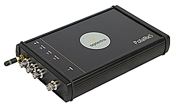
Septentrio’s PolaRx5 GNSS receiver. Image source: Septentrio.

Septentrio has released its 5.1.0 firmware for the PolaRx5 product line of GNSS reference receivers. The PolaRx5 GNSS reference receivers include the PolaRx5 for Continuously Operating Reference Station (CORS) and network operations, time and frequency transfer, and space weather applications.

The 5.1.0 firmware includes new features for file management, usability, security, and seismic monitoring, the company said.

Read More >

By Inside GNSS
[uam_ad id="183541"]
November 17, 2016

FIG Working Week 2017

Paasitorni by the Sea, Helsinki

The International Federation of Surveyors (FIG) FIG Working Week 2017 will take place on May 29 – June 2, 2017, at the Messukeskus Expo and Convention Centre in Helsinki, Finland.

Registration will open in November, 2016. Abstract submissions are now closed.

Read More >

By Inside GNSS
October 11, 2016

Applanix Announces POSPac MMS 8 Software

Applanix has released its POSPac MMS 8 GNSS-aided inertial post-processing software for georeferencing data collected from cameras, LIDARs, multi-beam sonars, and other sensors on mobile platforms.

The unit, introduced at the InterGEO trade fair in Hamburg, Germany, uses Trimble’s CenterPoint RTX subscription service. The Trimble CenterPoint RTX service allows land, air, marine, and unmanned aerial vehicle (UAV) platforms to achieve centimeter-level accuracy within one hour after data collection with just an internet connection, the company said.

Read More >

By Inside GNSS
October 7, 2016

Trimble Rolls Out SX10 Scanning Total Station

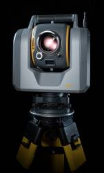
Trimble has released the SX10 scanning total station that merges high-speed 3D scanning, imaging technology, and total station measurements for surveyors, the company said.

"This is the top one or two [products] we have launched in the 20 years I’ve been here," said Ron Bisio, Trimble geospatial division vice president, at a media day in Westminster, Colorado, October 5.

Read More >

By Inside GNSS
June 15, 2016

Trimble Dimensions 2016

The 2016 Trimble Dimensions user conference and exhibition will take place at the Venetian Hotel in Las Vegas on November 7, 8 and 9.

The annual event gathers users of Trimble’s products including positioning technology for unmanned systems as well as mapping, GIS, surveying, photgrammetry and remote sensing and other technologies of interest to readers of Inside GNSS.

Four hundred and fifty technical sessions and networking events give attendees an opportunity to network widely within and among industry groups.

Read More >

By Inside GNSS
[uam_ad id="183541"]
December 29, 2015

FIG Working Week 2016

Earthquake recovery in Christchurch

The topic of the International Federation of Surveyors (FIG) working week 2016 is "Recovery from Disaster." It will take place at the Horncastle arena and Addington Events Centre in Christchurch, New Zealand from May 2 through May 6. Appropriately enough, Christchurch has deep familiarity with recovery from disaster after the 2010-11 earthquake sequence that took place there.

Abstract submissions are now closed.

Read More >

By Inside GNSS
December 28, 2015

InterGEO 2016

The 2016 InterGEO Trade Fair and Conference for Geodesy, Geoinformation and Land Management will take place at the fairgrounds —Hamburg Messe und Congress (HMC)—in Hamburg, Germany on October 11, 12 and 13.

Now 22 years old, the fair attracts 16,000 visitors from 92 countries who process, use or analyze geodata online or in the field.

The conference will cover the latest developments in surveying, geoinformation, remote sensing and photogrammetry and allied technologies. Proceedings are conducted in German and English.

Read More >

By Inside GNSS
June 29, 2015

ISGNSS and CGSIC 2015: International Symposium on Global Satellite Navigation Systems and Asia/Pacific Rim meeting of the CGSIC

Fushimi Inari Taisha, Kyoto, Japan

The 16th International Symposium On GNSS 2015 will be held November 16 – 19, 2015 at Miyakomesse in Kyoto, Japan.

ISGNSS 2015 will be co-located with the Asia and Pacific Rim meeting of the CGIC (Civil GPS Service Interface Committee) to help improve understanding of the world trends in developing and deploying GNSS. The program will include keynote addresses, oral presentations, interactive poster sessions, panel sessions, open interactive forums and a trade exhibition.

Read More >

By Inside GNSS
May 26, 2015

Farm Vehicle Automation

Francisco Rovira-Más, Agricultural Robotics Laboratory, Universidad Politécnica de Valencia

Now that we have had GNSS-driven precision in the fields for nearly 20 years, with widespread and growing acceptance by farm vehicle manufacturers and farmers, what lies ahead for precision agriculture?

Read More >

By Inside GNSS
March 8, 2015

NOAA’s National Geodetic Survey (NGS) Geospatial Summit 2015

Arlington, Virginia

NOAA’s National Geodetic Survey (NGS) Geospatial Summit will be held at the Crystal City Hilton in Arlington, Virginia on April 13-14, 2015.

Registration is now open. Early registration ends March 13, 2015.

NGS will be hosting three events, each one providing a venue for NGS to share information about its products and services as well as hear from its customers across the public and private sectors.

Read More >

By Inside GNSS
July 21, 2014

Environmental Sensing

In the past 20 years GPS has simultaneously revolutionized both our modern infrastructure (by providing real-time navigation, mapping, and timing support) and our geodetic/surveying capabilities (by providing millimeter/centimeter-level positioning). At this point, most of the GNSS innovations we expect to see in the next decade will come from calculating positions more accurately and faster, while expanding from GPS to use of all available GNSS signals.

Read More >

By Inside GNSS
1 2 3 5
IGM_e-news_subscribe