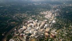
 Arlington, Virginia
NOAA’s National Geodetic Survey (NGS) Geospatial Summit will be held at the Crystal City Hilton in Arlington, Virginia on April 13-14, 2015.
Registration is now open. Early registration ends March 13, 2015.
NGS will be hosting three events, each one providing a venue for NGS to share information about its products and services as well as hear from its customers across the public and private sectors.
NGS Geospatial Summit
NGS will provide updates regarding the planned replacement of its two primary geodetic datums: the North American Datum of 1983 (NAD 83) and the North American Vertical Datum of 1988 (NAVD 88). The summit will be an opportunity for federal and state agencies, as well other constituents, to share their comments, questions and concerns regarding the new geometric and geopotential datums, which are planned to be published in 2022.
Federal Geodetic Control Subcommittee’s Quarterly Meeting
A venue for federal agencies to coordinate and plan the execution of geodetic surveys, the development of related standards and specifications, and the exchange of other technical information. This open meeting is an opportunity to hear how federal agencies are exercising their responsibilities to address today’s surveying and mapping issues.
Annual National Height Modernization Program Partner Meeting
State and university partners will explain the best practices they develop and challenges they encounter when determining accurate heights in their local regions or communities. The meeting is also an opportunity for stakeholders to express their requirements as NGS continues to develop geodetic models and tools in preparation for the replacement of NAD 83 and NAVD 88.
Attendees are encouraged to register for the full conference to take advantage of the National Society of Professional Surveyors (NSPS) and the Management Association for Private Photogrammetric Surveyors (MAPPS) programs as well as the exhibit hall.
Register for NGS events at no cost by selecting the "Government Program" registration option, found at the bottom of the registration page. The "Government Program" registration is for attendance at the NGS, Fish and Wildlife Service (FWS) or Department of Homeland Security (DHS) sessions ONLY. It does not include any food or beverage functions or other overall conference sessions.
General conference and hotel information is available through the NSPS conference web site. NGS also has a web page for information about the events it is hosting.
For additional questions about NGS events, please use the email address listed below.


