Main Categories

October 31, 2010

China Launches Another Compass/Beidou-2 GEO Satellite

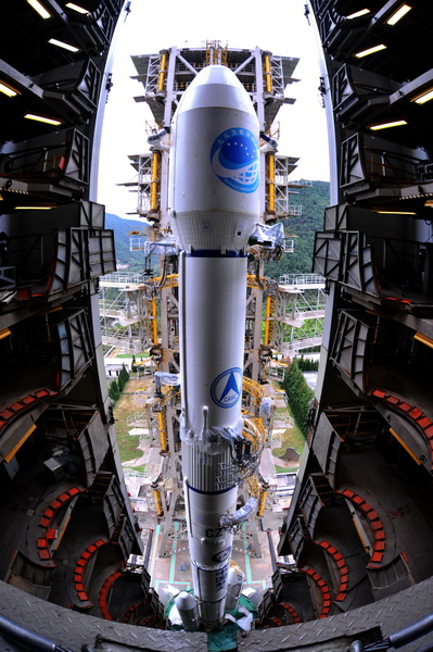
Compass G4 satellite and Long March rocket on Xichang launch pad displays new Beidou logo.

[UPDATED Oct. 31, 2010) China has launched its fourth Compass/Beidou-2 satellite this year, shortly after midnight today (November 1, 2010, local time) from the Xichang Satellite Launch Center in Sichuan Province.

This is the sixth satellite in the second-generation Beidou constellation. The spacecraft will join three other GEOs, a middle Earth orbiting spacecraft, and an inclined geosynchronous orbiting (IGSO) satellite.

Read More >

By Inside GNSS

Galileo Operations Contract, EGNOS SoL Service Move Ahead

At European Space Policy Conference: From left, Jean-Jacques Dordain, ESA Director General, Mercedes Bresso, President of the European Committee of the Regions, Vittori Prodi, Member of the European Parliament. ESA photo – S. Corvaja, 2010

Amid continuing debate over how to handle budgetary shortfalls in building a European GNSS, the European Space Agency (ESA) signed a €194 million ($270.5 million) contract on October 25 with Spaceopal to provide space- and ground-based services to operate the Galileo constellation once it has been fully deployed.

Read More >

By Inside GNSS
October 30, 2010

Asia Multi-GNSS Demonstration Project Schedules Second Workshop in November

Organizers of an ambitious project in the Asia/Oceania region demonstrating the benefits and opportunities for using multiple GNSS systems are moving ahead in their effort to design and implement a five-year campaign.

The 2nd Asia Oceania Regional Workshop on GNSS will be held in Melbourne, Australia, on November  21–22, in the two days before the Asia-Pacific Regional Space Agency Form (APRSAF) annual meeting in the city.

Read More >

By Inside GNSS
[uam_ad id="183541"]

Topcon Adds Mapping System

Topcon Positioning Systems (TPS), Livermore, California, has announced the addition of the IP-S2 HD Mapping System to its line of mobile mapping solutions.

The IP-S2 HD is a vehicle-mounted surveying and mapping system featuring a high-definition LiDAR scanner from Velodyne Lidar, Inc. The system incorporates high-precision GNSS receivers, an inertial measurement unit, vehicle wheel encoder, 360-degree digital cameras and Velodyne’s HDL-64E S2.2 LiDAR scanner.

Read More >

By Inside GNSS
[uam_ad id="183541"]
IGM_e-news_subscribe