Topcon Positioning Systems (TPS), Livermore, California, has announced the addition of the IP-S2 HD Mapping System to its line of mobile mapping solutions.
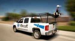
The IP-S2 HD is a vehicle-mounted surveying and mapping system featuring a high-definition LiDAR scanner from Velodyne Lidar, Inc. The system incorporates high-precision GNSS receivers, an inertial measurement unit, vehicle wheel encoder, 360-degree digital cameras and Velodyne’s HDL-64E S2.2 LiDAR scanner.
Topcon Positioning Systems (TPS), Livermore, California, has announced the addition of the IP-S2 HD Mapping System to its line of mobile mapping solutions.
The IP-S2 HD is a vehicle-mounted surveying and mapping system featuring a high-definition LiDAR scanner from Velodyne Lidar, Inc. The system incorporates high-precision GNSS receivers, an inertial measurement unit, vehicle wheel encoder, 360-degree digital cameras and Velodyne’s HDL-64E S2.2 LiDAR scanner.
Designed to allow vehicle operators to drive at normal traffic speeds, the unit enables users to collect precise vehicle position/bearing data and spherical imagery of sidewalks, building, tunnels, bridges, overpasses and the like.
Headquartered in Morgan Hill, California, Velodyne LiDAR’s HDL-64E sensor is used in a variety of military and commercial autonomous vehicle applications as well as 3-D mapping, surveying and other applications


