GNSS (all systems) Archives - Page 90 of 150 - Inside GNSS - Global Navigation Satellite Systems Engineering, Policy, and Design

GNSS (all systems)

How is Public Safety reliant on GNSS and is this a concern?

Q: How is Public Safety reliant on GNSS and is this a concern?

A: Much like many industries and organizations, as the nature of Public Safety grows and evolves, its members have looked to leverage available technologies that help them achieve their goals. In this case, the goals are first and foremost Public Safety followed closely by Member Safety whether it be police, fire or others.

Read More >

By Inside GNSS
July 26, 2017

International Flight Inspection Symposium 2018

Sponsored by the International Committee for Airspace Standards and Calibration (ICASC) and hosted by the Institute of Navigation (ION), IFIS 2018 is the 20th International Flight Inspection Symposium and serves as a credible international forum that promotes a better understanding of the technologies and environmental issues impacting global flight inspection operations.

Read More >

By Inside GNSS
July 25, 2017

Australia’s First GPS Infrastructure Officially in Space

This has been a productive year so far for Australia in terms of GPS breakthroughs, but plans are in place for the country to continue to make big strides in GPS technology and precise positioning programs.

Spatial Source — Australia and New Zealand’s first website covering the geospatial, surveying, GIS and mapping communities — reports that Australia officially has its first GPS infrastructure in space, according to the nation’s Minister for Defence Industry Christopher Pyne.

Read More >

By Inside GNSS
[uam_ad id="183541"]

The International Navigation Conference (INC) 2017

The Clock Tower in Brighton, Brighton and Hove, East Sussex, England, United Kingdom. Wikimedia Commons Photo.

The International Navigation Conference 2017 will bring together the Positioning, Navigation and Timing community around three major themes: Autonomy, Robust PNT, and Sensor & Data Fusion.

Read More >

By Inside GNSS
July 21, 2017

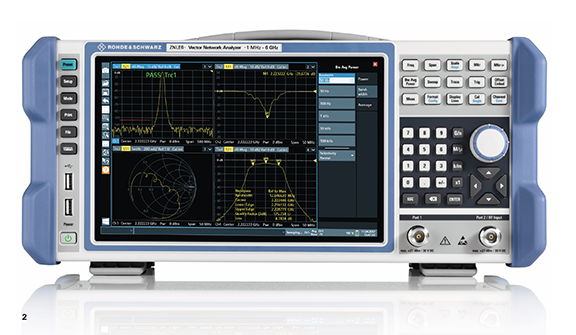
Rohde & Schwarz Launches Compact, Lightweight R&S ZNLE Vector Network Analyzer

The R&S ZNLE vector network analyzer. Photo: Rohde & Schwarz

Rohde & Schwarz has launched the R&S ZNLE vector network analyzer to address the requirements of customers looking to perform RF measurements to characterize components such as antennas, attenuators, filters and PCBs. The new standalone instrument weighs 6 kilograms and has a footprint of just 408 millimeters x 235 millimeters, saving up to two thirds of space on the workbench compared with competitive VNAs, according to the company.

Read More >

By Inside GNSS
[uam_ad id="183541"]
July 18, 2017

Fall 2017 GPS / GNSS Courses

NavtechGPS has been a leader in GPS/GNSS education and training since 1984, and their GPS courses are taught by some of the top technical professionals in the industry. All courses can be taught on-site at students’ locations — select a specific class or a combination of classes to be tailored to your needs. Additionally, NavtechGPS offers their most requested courses at different public venues during the year, including the following courses in the Washington, DC area in early December.

Read More >

By Inside GNSS
July 8, 2017

Trimble Catalyst Now Offering High-Accuracy, On-Demand Positioning-as-a-Service

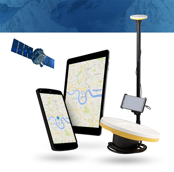
Trimble Catalyst software-defined GNSS receiver for Android devices. Photo source: Trimble.

Trimble just announced that its Trimble Catalyst software-defined GNSS receiver for Android devices is now available through the company’s global distribution network. Customers can now access Positioning-as-a-Service to collect geo-location data with Trimble or third-party apps on smartphones, tablets and mobile handhelds.

Read More >

By Inside GNSS
July 7, 2017

Launch Doubles Size of Iridium NEXT Fleet; Space-Based ADS-B Network Evolving

Iridium Communications’ recent successful second launch of its next-generation network, Iridium NEXT, has further implemented a space-based automatic dependent surveillance–broadcast (ADS-B) developed by Aireon. This payload of 10 satellites deployed into Low Earth Orbit (LEO) approximately one hour after a SpaceX Falcon 9 rocket lifted off from Vandenberg Air Force Base in California on Sunday, June 25.

Read More >

By Inside GNSS
July 6, 2017

Sygic Incorporates Augmented Reality Into its GPS Navigation App

Sygic has added a new augmented reality (AR) feature to its advanced GPS navigation app. Photo source: Sygic.

Bratislava, Slovakia-based Sygic has added a new augmented reality (AR) feature to its advanced GPS navigation app. More than 200 million Sygic users worldwide can now engage with AR for an improved navigation experience on the road, the company said.

Sygic’s new AR feature uses a smartphone’s GPS and camera to implement an augmented reality-powered GPS navigation system. With the AR feature, drivers no longer need to follow a map on their phones. Instead, they’re guided by a virtual path on the smartphone camera preview.

Read More >

By Inside GNSS

Tersus Launches the NeoRTK System to Enhance Surveying

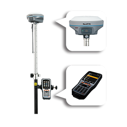
The NeoRTK System from Tersus GNSS Inc.

Tersus GNSS Inc. has launched the NeoRTK System with multi technology integrated for surveyors.

The NeoRTK System is described as a new generation system by the company and is applied with multi-constellation and a multi-frequency GNSS engine and various communication protocols which aim at providing high performance and stable signal reception to meet surveyors’ demands. Featuring a high-end GNSS antenna inside, the NeoRTK can speed up the Time to First Fix (TTFF) and improve the capability of anti-jamming.

Read More >

By Inside GNSS
1 88 89 90 91 92 150
IGM_e-news_subscribe