March 30, 2012
Figures 11 & 12: GNSS Jamming in the Name of Privacy
Return to main article: "GNSS Jamming in the Name of Privacy"
By Inside GNSSGlobal Navigation Satellite Systems Engineering, Policy, and Design
Return to main article: "GNSS Jamming in the Name of Privacy"
By Inside GNSS
RF interference (RFI) has been and will continue to be a significant worry for GNSS users.
Because the signals from GNSS satellites are very weak by the time that user equipment receives and processes them, they are especially vulnerable to RFI. Signals that overlap GNSS frequencies are likely to come from transmitters much closer than the satellites and, consequently, can easily overpower GNSS signals and render them unusable.
By Inside GNSS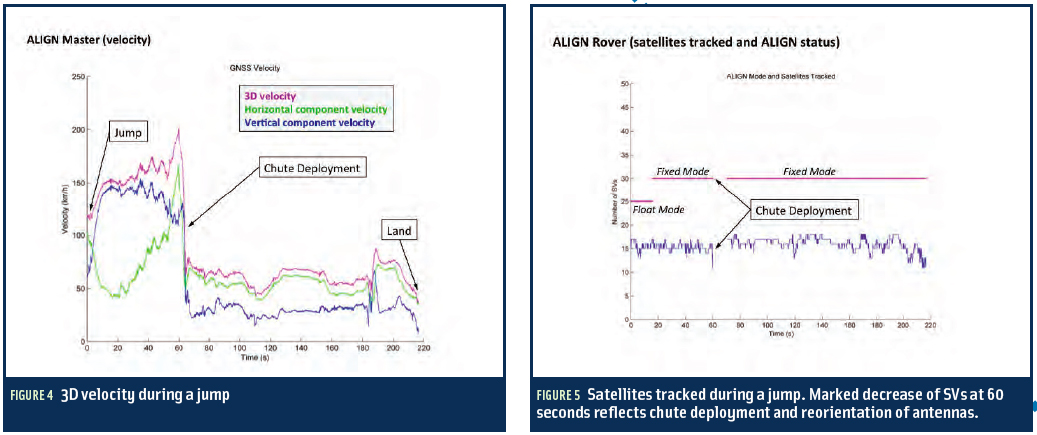
Return to main article: "Winging It"
GNSS technology is used in various ways to find attitude or trajectory. The simplest method relies on measuring the velocity of a single receiver and interpreting the direction of that vector as the vehicle’s heading.
This works for applications where a vehicle’s motion is constrained to only one axis – either absolutely, as with a train, or in the typical case of a car — when being driven responsibly!
By Inside GNSS
Return to main article: "Winging It"
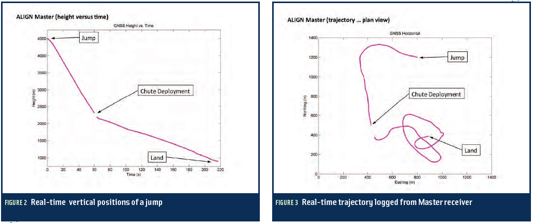
With high-quality data sets obtained in the foot-to-foot configuration, we set about on postprocessing the data to extract more information about the NovAtel wingsuit system’s performance in the free-fall environment.
This was a multi-step process involving several NovAtel utilities and techniques, which we will describe here.
By Inside GNSS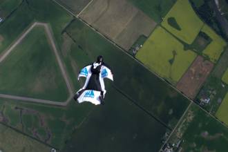
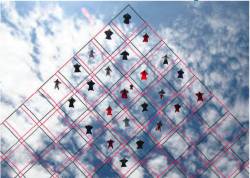 FIGURE 1: Competitive group skydiving is currently judged by overlaying a grid on a photo and evaluating location of divers within its cells. Photo by Mark Harris.
»NovAtel Inc. wingsuit video
In 1589, at the age of 25, Galileo Galilei toiled up the 294 steps of a 55-meter bell tower in Pisa, Italy, where he was tutoring math students at the time.
According to his pupil and later biographer, Vincenzo Viviani, Galileo carried with him two cannonballs, one twice the weight of the other. When he reached the top of the tower, he went to the lower balcony of the tilted structure and dropped the two balls simultaneously.
By Inside GNSS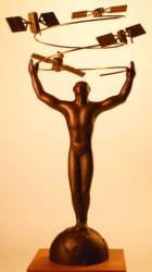 The Arthurs. Named after science fiction icon Arthur C. Clarke, the custom-designed statuettes were awarded to the top five finalists in the USA Challenge. In 1956, Clarke foresaw the development of satellite-based positioning and navigation, writing to a friend that within 30 years an “orbital relay system” could take over all existing surface [communication] networks: “ . . .three stations in the 24-hour orbit could . . . make possible a position-finding grid whereby anyone on earth could locate himself by means of a couple of dials on an instrument about the size of a watch . . . no one on the planet need ever get lost.”
Return to main article: "True3D HUD Wins Global SatNav Competition"
The ideas ranged from the family friendly — a smartphone app that reads historical markers and travel tidbits as you drive by — to the seriously scientific — a new secure time reference authentication method (TRANM) for GNSS receivers.
By Inside GNSS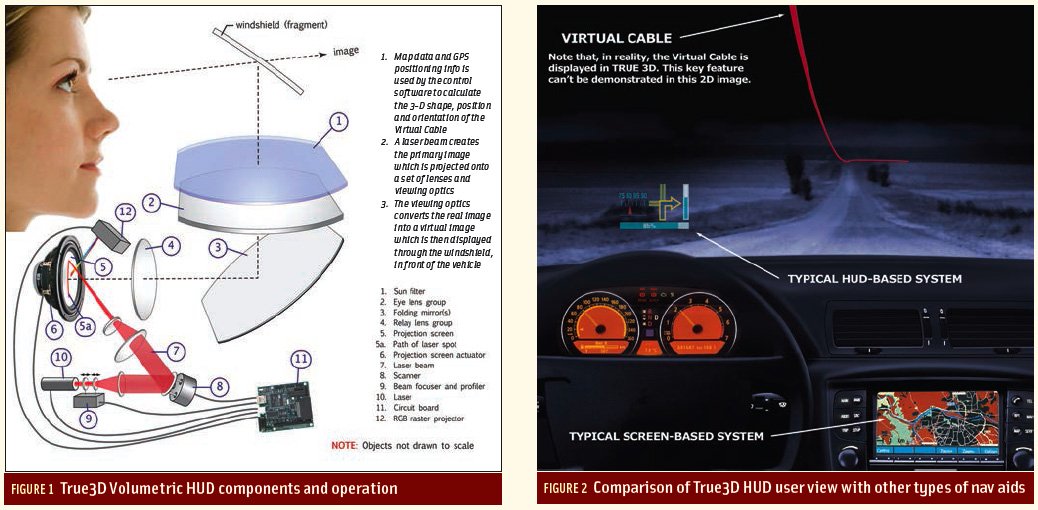 FIGURES 1 & 2: True3D Volumetric HUD components and operation (left), Comparison of True3D HUD user view with other types of nav aids (right)
Return to main article: "True3D HUD Wins Global SatNav Competition"
Many technologies are created before their best applications are even thought about. This leads to a business phenomenon known as “technology push” in contrast to “consumer pull.” The True3D Volumetric HUD technology did not share this path.
By Inside GNSS