July 1, 2011
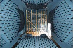
Anechoic chamber test site at U.S. Naval Air Systems Command (NAVAIR) facility in Patuxent River, Maryland
GPS Interference Testing
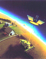
Anechoic chamber test site at U.S. Naval Air Systems Command (NAVAIR) facility in Patuxent River, MarylandInterference can pose a threat to the reception of GNSS signals in a variety of ways. Even low-level signals have the potential to interfere with GNSS receivers, which require very high sensitivity for acceptable performance due to the extremely low received GPS signal power at the Earth’s surface.
By Inside GNSS