
Table 3: GNSS Evolutions for Maritime
Return to main article: “GNSS Evolutions for Maritime”
By Inside GNSSGlobal Navigation Satellite Systems Engineering, Policy, and Design
Return to main article: “GNSS Evolutions for Maritime”
By Inside GNSS
Return to main article: “GNSS Evolutions for Maritime”
By Inside GNSS
Return to main article: “GNSS Evolutions for Maritime”
By Inside GNSS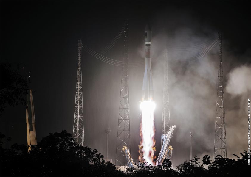
The European GNSS program added two more spacecraft to its constellation this morning (May 24, 2016) with the launch of Galileo satellites 13 and 14. They lifted off together at 08:48 GMT (10:48 CEST, 05:48 local time) atop a Soyuz rocket from French Guiana.
This seventh Galileo launch went by the book: the first three Soyuz stages placed the satellites safely into low orbit, after which their Fregat upper stage hauled them the rest of the way into their target medium-altitude orbit in plane A, slots 2 and 6.
By Inside GNSS
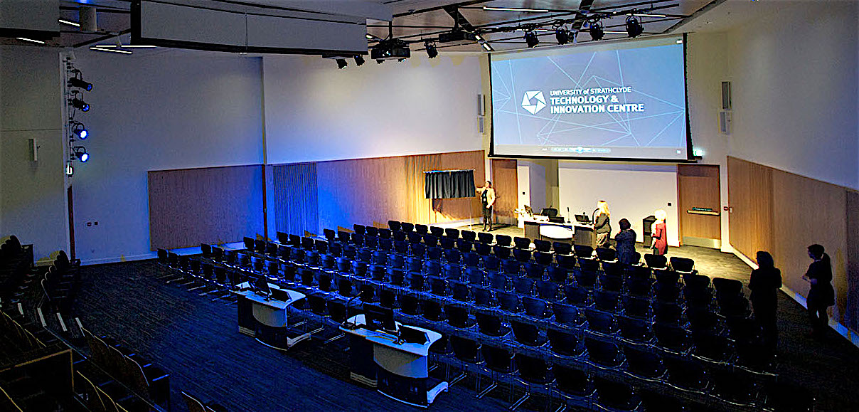 Main auditorium, Strathclyde Conference Centre
The Royal Institute of Navigation’s International Navigation Conference 2016 will be held at the University of Strathclyde Conference Centre in Glasgow, Scotland from November 8 – 10, 2016.
A number of keynote speakers will discuss topics from Virgin Galactic’s voyage to space to quantum sensors for inertial navigation to autonomous cars, android phones, train control and even "Three dimensional thinking: from rats to humans, via Klingons."
Poster and demonstration abstracts are due by May 30. Full paper submission is due on June 15.
By Inside GNSS
Alessandra Fiumara is the liaison officer on GNSS Evolution Program for the European Space Agency.
She has been working in the space sector for 25 years, both in public and private contexts, and has acquired a deep knowledge of the related political, strategic and financial aspects. As an electronic engineer, she started with technical and scientific activities in the radar application domain, then moved to strategic planning and financial control responsibilities as well as international relations.
By Inside GNSSNovAtel Inc. has submitted comments to the Federal Communications Commission (FCC) regarding Ligado Networks LLC’s (formerly New LightSquared LLC) License Modification Applications in which the company raises deep concerns about the testing methodology used and conclusions presented by Ligado regarding the impact of their proposed usage of L-band frequencies for a terrestrial wireless network.
By Inside GNSSSo, if everything had gone as planned, we would have a new ground control segment (OCX) operating a new generation of satellites (GPS III) as they launch into an expanded constellation in support of modernized military GPS user equipment (MGUE).
But then the best-laid plans. . . .
By Inside GNSS Carlo des Dorides, GSA Executive Director
Last October, the European GNSS Agency (GSA) Administrative Board reelected Carlo des Dorides as executive director of the GSA, giving him a second — and final — four-year term in charge of this key agency responsible for supporting the effective operation, maintenance, and security of Europe’s satellite navigation systems. We met with him recently at the GSA office in Prague to learn how he plans to see out his mandate.
By Peter Gutierrez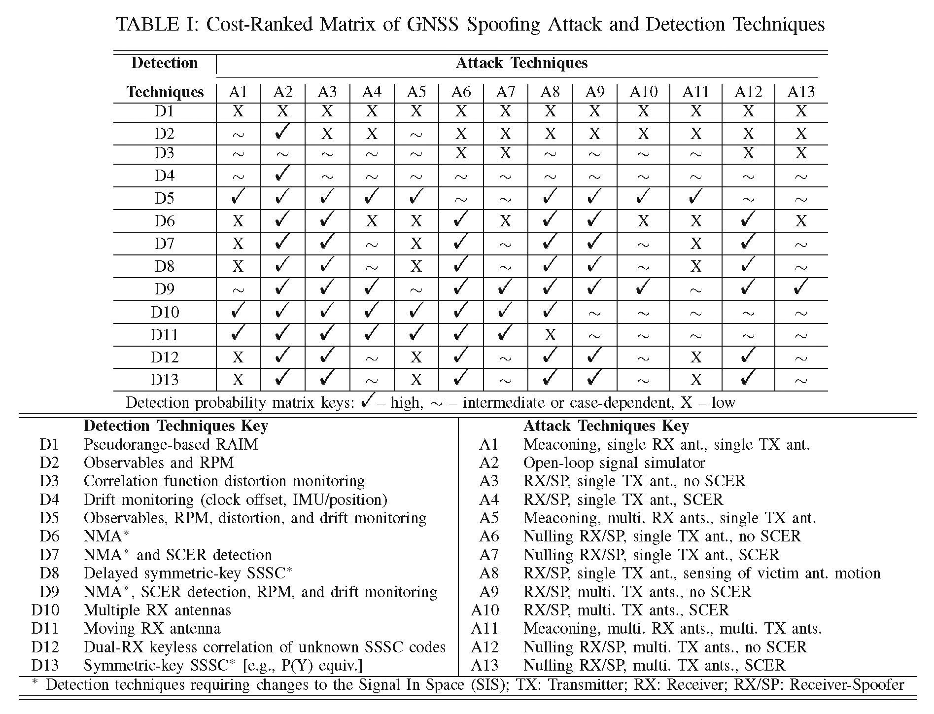
Advanced military receivers using the sort of modern multi-channel, multi-constellation capabilities already available commercially, could enable the Air Force to focus its anti-jam efforts on the ground, simplifying future GPS satellites and lowering their cost. Moreover, experts told Inside GNSS, the cutting-edge receivers could be deployed years before the anti-jam capability planned for the new GPS III satellites would be fully available.
By Dee Ann Divis
 Symbols and Acronyms
Modernized GPS satellites give civil users the ability to achieve dual L1/L2 PY accuracy using dual L1CA/L2C ionosphere-free measurements and, with IIF satellites, dual L1/L5 signals. Because broadcast GPS ephemeris data is based on an ionosphere-free pseudorange calculated from dual L1PY/L2PY measurements and the civil signals are not all perfectly aligned to it, new broadcast parameters and a new modernized dual-frequency algorithm are needed in order to align new signals with the dual L1/L2 PY signal.
By Inside GNSS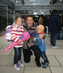 Belabbas with his children, Laila and Lunis.
Boubeker Belabbas’ Compass Points
Boubeker Belabbas, an expert in aerospace mechanics and safety-critical GNSS applications, grew up in Bordeaux, a city of wine, and works in Munich, a city of beer. But he started out in the land of mint tea: a small village in the north of Algeria in the region called Kabylia.
By Inside GNSS
GNSS signals are vulnerable to interference due to being extremely weak when received on Earth’s surface. Therefore, even a low-power interference signal can easily disrupt the operation of commercial GNSS receivers within a range of several kilometers.
By Inside GNSS