Global Navigation Satellite Systems Engineering, Policy, and Design
Global Navigation Satellite Systems Engineering, Policy, and Design
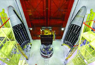
A January 14 launch of 10 Iridium NEXT satellites will help implement a space-based automatic dependent surveillance–broadcast (ADS-B) developed by Aireon, in partnership with leading Air Navigation Service Providers (ANSPs) from around the world, and designed to provide real-time GNSS tracking of aircraft over oceanic regions.
By Inside GNSS Air Force Secretary Deborah Lee James. (Photo source: DoD).
Though the schedule is still uncertain, progress is being made on completing the new GPS ground system, said Air Force Secretary Deborah Lee James, who credited a crack group of private-sector computer wizards with helping get the program back on course.
Calling the GPS Next Generation Operational Control System (OCX), a "terribly, terribly important program," James said, however, she still did not consider the software-focused effort to be "out of the woods."
By Dee Ann Divis UAV demonstration at the 2016 INTERGEO conference
INTERGEO, the 2017 European geodesy, geoinformation and land management conference and trade fair, will take place at Messe Berlin, South Entrance in Berlin, Germany on September 26, 27 and 28.
By Inside GNSS
 GPS III satellites in production. Image Source: Lockheed Martin.
The U.S. Air Force Space and Missile Systems Center (SMC) says it continues to work on GPS III ceramic capacitor testing and plans to have an updated launch schedule published late next month.
As Inside GNSS reported, the first GPS III satellite’s delivery, originally scheduled for August, was delayed by four months because of a Lockheed Martin subcontractor’s failure to test a ceramic capacitor.
By Inside GNSS
Yesterday (December 23, 2016) President Obama signed the National Defense Authorization Act (NDAA) for Fiscal Year 2017, a $619-billion bill with a number of provisions affecting satellite navigation.
The legislation (S. 2943) fully authorizes the administration’s requests for all the elements of the GPS program — and signals indirectly that appropriators eventually will provide comparable support — although the NDAA does put additional requirements on those developing the new GPS ground system.
By Dee Ann Divis
This week’s Navitec Conference, entitled “Navigating the Future of Transportation,” delivered good news to an appreciative crowd at the European Space Agency’s European Space Research and Technology Centre (ESA/ESTEC) in Noordwijk, the Netherlands.
By Inside GNSS
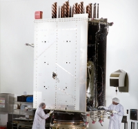 GPS III satellites in production. Image Source: Lockheed Martin.
The U.S. Air Force has approved Lockheed Martin’s current GPS satellite ground control system upgrade to enable it to operate with more powerful and accurate GPS III satellites, the company said.
The Air Force’s Critical Design Review (CDR) for the Contingency Operations (COps) contract, completed on November 17, allows Lockheed Martin to proceed with the modification of the existing Architecture Evolution Plan (AEP) Operational Control Segment. The AEP, maintained by Lockheed Martin, controls the 31 GPS IIR, IIR-M and IIF satellites in orbit.
By Inside GNSS The Air Force’s Global Positioning Systems Directorate contracted the CUP2 upgrade.
Lockheed Martin has announced a major upgrade to modernize the GPS ground control system, the company said. The commercial-off-the-shelf (COTS) upgrade no. 2 (CUP2) project, which became operational in mid-October to manage the 31 GPS satellites, is the latest step in the U.S. Air Force’s plan to refresh technology and transform the legacy operational control segment, also known as the Architecture Evolution Plan (AEP), the company said.
By Inside GNSS
Government watchdogs said in a new report that schedule slippages in the new GPS ground system — which in October had another four months added to its repeatedly extended schedule — are more of a factor in delays to GPS modernization than technical problems with the satellite’s payload.
By Dee Ann Divis
Congress is back in Washington with a December 9 deadline to pass the 2017 Fiscal Year (FY17) federal budget and avoid a government shutdown.
Lawmakers are widely expected to pass another continuing resolution, or CR, leaving the final decisions on the FY17 budget until after President-elect Donald Trump takes office in January — an approach that could both help and hurt the Pentagon’s GPS modernization effort.
By Dee Ann Divis
 Equations
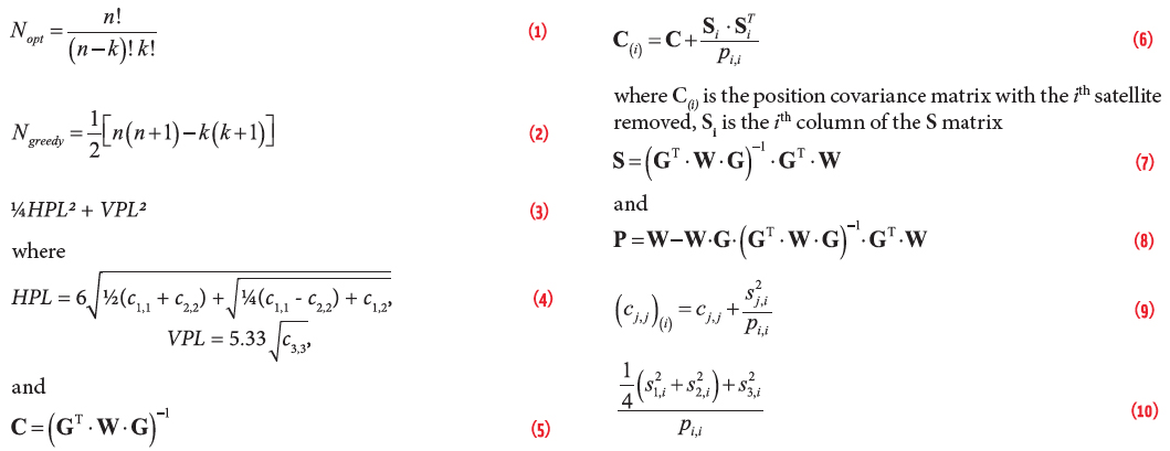 Equations
Working Papers explore the technical and scientific themes that underpin GNSS programs and applications. This regular column is coordinated by Prof. Dr.-Ing. Günter Hein, head of Europe’s Galileo Operations and Evolution.
By Günter W. Hein Figures 1 & 2
Spacecraft in low Earth orbit (LEO), at altitudes below 3,000 kilometers, remain within the main Global Positioning System (GPS) signals’ Earth coverage. Spacecraft employing GPS at these altitudes enjoy signal availability and navigation and timing performance emulating that of terrestrial users.
By Inside GNSS