In a letter made public late Friday, the point person for all federal agency use of frequencies told commercial spectrum regulators his agency could not support approval of Ligado Networks’ request to use satellite frequencies for a terrestrial wireless network.
Calling all automotive engineers — and anyone involved in designing or promulgating the fast-oncoming world of autonomous driving.
For driverless vehicles, current GNSS meter-level positioning accuracy still serves for lane-level detection. But hazardous misleading information poses a serious, disruptive and critical safety concern.
Professor David Last described his life in crime during the Institute of Navigation’s GNSS+ 2012 conference. He was late coming to that line of work, he noted, having only been tapped by the police after his retirement from teaching at the University of Wales.
The Defense Department urged spectrum regulators this week to reject a proposal by Virginia-based Ligado Networks to build a wireless terrestrial communication system that could, it said, interfere with GPS.
The Department of Transportation (DOT) selected 11 firms to demonstrate technologies that could be used to back up the services provided by GPS should GPS signals be jammed, spoofed or unavailable.
The grapevine was abuzz on Halloween with chatter that the Federal Communications Commission (FCC) might soon act on a long-pending request from Ligado Networks to use spectrum near the GPS frequencies to support terrestrial communications.
The GPS III Contingency Operations Program (COps) successfully connected with the first GPS III satellite on orbit on October 21. The Air Force can now operationally command and control the powerful new GPS III satellites
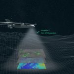
Direct georeferencing improves the efficiency and accuracy of mapping from both manned and unmanned platforms. An upcoming 2-day workshop on this topic is designed for:
The Cyclone Global Navigation Satellite System (CYGNSS) constellation operated by the U.S. National Aeronautics and Space Administration (NASA) consists of eight miniature satellites that use GPS signals bounced off the sea surface to measure wind speeds. One after the other at 12-minute intervals, the satellites pass over tropical storms, gathering data that can be used to predict the storms’ path and their intensity.
The Army is in the midst of testing new assured position, navigation and timing equipment (A-PNT) as it searches for more ways to thwart jamming and spoofing and stay operational if GPS is denied or unavailable.
For the first time, a sophisticated GPS-guided Naval Strike Missile fired from the deck of a U.S. combat ship sailing in the Indo-Pacific region.
The USS Gabrielle Giffords launched the precision strike weapon, which “can find and destroy enemy ships at distances up to 100 nautical miles away,” according to a U.S. Navy statement. The NSM flies at high subsonic speed an “at sea-skimming altitude, has terrain-following capability and uses an advanced seeker for precise targeting in challenging conditions.”
The NSM can navigate by GPS, inertial and terrain reference systems. It is able to fly over and around landmasses, travel in sea skim mode, and make random avoidance maneuvers in the terminal phase. An imaging infrared (IIR) seeker and an onboard target database give NSM independent detection, recognition, and discrimination capabilities for targets at sea or on the coast. Its design and materials endow it with stealth capabilities. It weighs slightly over 400 kg (880 pounds) and has a range of at least 185 km (100 nm).
The Navy Strike Missile launch was part of exercise Pacific Griffin, in the Philippine Sea near Guam, an exercise conducted with the Singaporean navy. It marked the second time such a missile was launched, but the first time it was fired in the Indo-Pacific region, according to the Navy.
The Navy awarded Raytheon a contract in 2018 for the weapons system, developed around the missile designed by Norwegian firm Kongsberg Defence & Aerospace.
Ivan Revnivykh’s life and experience encompass the far frontiers of his homeland, Russia, from the magnifi cent landscapes of the country’s Pacifi c coast to research stations in Antarctica, to the great capital city of Moscow where he lives and works today. To everything he does he brings a sense of excitement and adventure.
Every GNSS has experienced a failure. On January 26, 2016, an error in the GPS data upload system caused incorrect data to be transmitted from the satellites on the L1 band used by most commercial GPS receivers. Th e problem was resolved within six hours, although some users experienced problems for as much as twelve hours. Th e next day, the US Air Force (USAF) released a full statement explaining that the problem was caused by ground system soft ware when one satellite was decommissioned.