Direct georeferencing improves the efficiency and accuracy of mapping from both manned and unmanned platforms. An upcoming 2-day workshop on this topic is designed for:
- providers of aerial mapping services
- manufacturers of sensor systems for the manned and unmanned mapping space. It will also be of interest to those, in the UAS space, that are
- manufacturers of UAVs for aerial mapping,
- system integrators of UAV platforms for survey, mapping and GIS business segments, and
- anyone in the aerial mapping and survey industry who can profit from greater accuracy achieved by their sensor payloads, while saving both time and money.
Sessions, demonstrations and customer case studies from multiple speakers will provide valuable instruction and information towards maximum return on investment for efforts, services and products. Attendees will learn how medium-format aerial imagery, combined with GNSS solutions, offers precise positioning data and enables completion of geospatial projects in a more efficient and cost-effective manner.
The workshop takes place November 13 & 14, 2019 at the Rocky Mountain Metropolitan Airport, just under 30 minutes away from Denver International Airport. The package includes an NBA Night Out attending the game between Denver Nuggets and Atlanta Hawks on Tuesday, November 12.
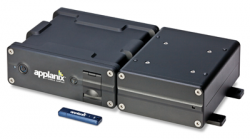
Specific products of focus include Applanix GNSS-inertial solutions and technology, Trimble POSPac post-processed CenterPoint® RTX™ solution for high-accuracy airborne mapping without base stations, and Phase One Industrial cameras integrated into systems for complete mapping, monitoring, and data collection projects.
Register here for the November 13–14 Workshop on Airborne Mapping and Surveying.
Photo: Trimble/Applanix.


