GPS Archives - Page 111 of 136 - Inside GNSS - Global Navigation Satellite Systems Engineering, Policy, and Design

GPS

September 10, 2010

Oregon: More GPS Product Design and GNSS-related Industry Here Than You May Think

The Portland skyline with a GPSIIF satellite is featured in the Inside GNSS booth at ION GNSS 2010

by Glen Gibbons

Few would mistake Oregon for the beating heart of GNSS. Still,  for a medium-sized U.S. metro area in the Pacific Northwest, Portland  and Oregon’s I-5 corridor has enough relevant involvement with the industry to justify hosting the Institute of Navigation’s 2010 GNSS conference and exhibition.

Oregon has FLIR Systems, Cloud Cap Technology, TriQuint, Intel, Garmin and Inside GNSS magazine.

Read More >

By Inside GNSS
September 7, 2010

When GNSS Goes Blind

A completely GPS-based navigation solution is generally not feasible in GNSS signal–challenged environments such as urban canyons. However, even in these difficult environments a partial set of GPS signal measurements may still be available. For instance, one or two satellites are generally still visible even in dense urban canyons.

Read More >

By Inside GNSS
[uam_ad id="183541"]
August 27, 2010

SVN62, the First GPS IIF Satellite, Is Set Healthy

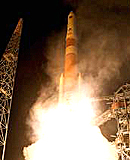
SVN62 launch (ULA)

The U.S. Air Force declared the first GPS Block IIF satellite (SVN62) operational today (August 27, 2010), changing the spacecraft’s navigation signal status to healthy at about 10:10 a.m. (EDT or 4:10 a.m. UTC). 

Launched May 28, the satellite became the responsibility of the USAF 50th Space Wing on August 26,

Read More >

By Inside GNSS
[uam_ad id="183541"]

Applanix Releases Updated POS for Land Vehicles

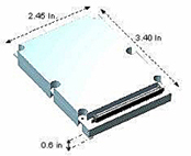
Applanix recently released Version 5 of its Position and Orientation System for Land Vehicles (POS LV).

According to the company, the system uses integrated inertial technology and is designed to generate stable, reliable and repeatable positioning solutions for land-based vehicle applications such as road geometry, pavement inspection, GIS database and asset management, road surveying and vehicle dynamics. The company says the unit is designed to operate under the most difficult GPS conditions in urban and suburban environments.

Read More >

By Inside GNSS
August 24, 2010

CDR Passed: GPS III Ready for Build Phase

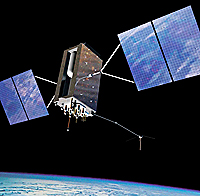
Artist’s rendering of GPS III satellite. Lockheed Martin image

More than two years into a multi-billion-dollar contract, the Lockheed Martin team developing the U.S. Air Force’s next-generation GPS Block III satellites continues to defy the physics of large aerospace programs by successfully completing the program’s Critical Design Review (CDR) phase last week — two months ahead of the baseline schedule.

Read More >

By Inside GNSS
August 19, 2010

Air Force Approves 3 GPS Technical Specs

The GPS Wing has authorized publication of three technical documents with updated specifications for the U.S. Global Positioning System, including the next-generation GPS Block IIIA satellites now in development, the L5 radio link, and the new L1 civil signal  (L1C) that will be available with the GPS III spacecraft.

Read More >

By Inside GNSS
August 17, 2010

GPS IIF-1 Satellite

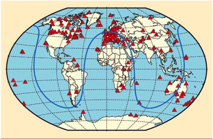
FIGURE 1: Geographical overview of the 170 IGS stations tracking SVN62/PRN25 during its current 90-day checkout period. The blue curve illustrates the ground track of the spacecraft on August 9, 2010.

For the complete story, including figures, graphs, and images, please download the PDF of the article, above.

On May 27, 2010, the U.S. Air Force successfully launched the first satellite of the Block II “follow-on” (Block IIF) series, the fourth generation of GPS spacecraft that features more precise and powerful signals, an extended design life, and several other technical advances.

Read More >

By Inside GNSS
IGM_e-news_subscribe