GNSS (all systems) Archives - Page 122 of 150 - Inside GNSS - Global Navigation Satellite Systems Engineering, Policy, and Design

GNSS (all systems)

March 9, 2013

The PNT Boom

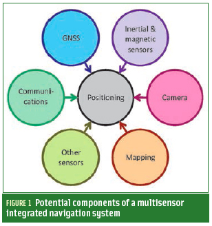
FIGURE 1: Potential components of a multisensor integrated navigation system

The navigation world is booming with new ideas at the moment to meet some of the greatest positioning challenges of our times. To realize demanding applications — such as reliable pedestrian navigation, lane identification, and robustness against interference, jamming and spoofing — we need to bring these different ideas together.

Read More >

By Inside GNSS

From Fledgling to Flight

Allure Shadow (top), structural clearances (bottom)

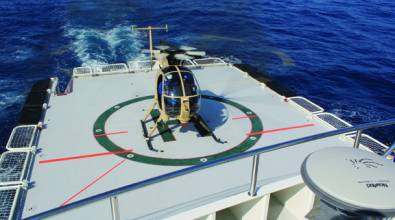
The Boeing Company initiated the Unmanned Little Bird (ULB) program in the fall of 2003 to create a developmental platform for an optionally manned, vertical takeoff and landing (VTOL) unmanned aerial vehicle (UAV). Initial flight test activity employed a modified MD530FF helicopter, with the first flight taking place on September 8, 2004. Six weeks later the program achieved a fully autonomous multiple waypoint demonstration flight from takeoff through landing.

Read More >

By Inside GNSS
February 28, 2013

Czech GNSS Showcase

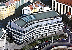
GSA Headquarters in Prague (Image: MDCR)

The European GNSS Agency (GSA) will sponsor a half-day workshop on GNSS for the regional business community at GSA headquarters, Janovkeho 438, in Prague at 8:30 a.m. on March 27.

The workshop is part of an effort to engage small and medium-sized enterprises from the Czech Republic in opportunities offered by the EU’s space programs.

In addition to SME’s, the audiece will include larger industries, representatives of foreign companies established in the Czech Republic and the press.

The agenda includes:

Read More >

By Inside GNSS

[uam_ad id="183541"]
February 21, 2013

Broadcom Introduces GNSS Location Chip with Geofence Capabilities

Broadcom Corporation has introduced a GNSS chip with an architecture designed to enable geofence capabilities while preserving battery life.

Geofence technology provides virtual perimeter — the geofence — awareness in a geographical area of interest. The geofence feature enables an application to receive a notification when a user enters or exits a virtual perimeter.

Read More >

By Inside GNSS

ITS America 2013: Intelligent Transportation Society Annual Meeting & Expo

The Intelligent Transportation Society of America’s 23rd annual meeting and exposition will take place at the Gaylord Opryland convention center near Nashville, Tennessee on April 22, 23 and 24, 2013.

Discussions will focus on funding infrastructure, reducing gridlock and using ITS to improve safety of the nation’s vehicles and public transportation systems.

The opening plenary includes remarks by U.S. Transportation Secretary Ray LaHood and a roundtable keynote discussion on the future of telematics.

Read More >

By Inside GNSS
February 20, 2013

IFCS / EFTF 2013: Frequency Control Symposium and European Frequency and Time Forum

Brahe and Kepler statue in Prague

This combined meeting in Prague, Czech Republic – the 2013 Joint UFFC, EFTF and PFM Symposium – will take place at the Prague Congress Centre on July 21-25.

It includes the International Frequency Control Symposium and the European Time and Frequency Forum and several other IEEE scientific and academic gatherings.

The IFCS/EFTF plenary presentation takes place on  Wednesday, July 24. The speaker will be Daniel Kleppner, Massachusetts Institute of Technology (USA).

Read More >

By Inside GNSS
[uam_ad id="183541"]

2013 Space Weather Workshop

In 1997, AT&T’s Telstar 401 satellite failed, probably due to magnetic storms

The annual Space Weather Workshop will take place on April 16-19 2013 at Millennium Harvest House Hotel in Boulder, Colorado. Registration opens on February 15.

Sunday, March 31 is the registration and abstract submission deadline.

This meeting will bring together customers, forecasters, vendors, and researchers of space weather information.

Read More >

By Inside GNSS

Spectracom Announces BeiDou Upgrade Plans for Its Simulators

Spectracom has announced the upgrade capability of its GNSS simulators to China’s BeiDou system.

The Spectracom GSG Series 5 and Series 6 GNSS simulators, released last year, are designed to be field upgradeable to simulate current and future GNSS constellations.

The recent release of the Beidou ICD specification has enabled Spectracom to ensure that its GSG Series 5 and Series 6 equipment will be able to simulate these satellites with a simple field-upgradeable firmware update.

Read More >

By Inside GNSS
January 25, 2013

GNSS Hotspots | January 2013

One of 12 magnetograms recorded at Greenwich Observatory during the Great Geomagnetic Storm of 1859
1996 soccer game in the Midwest, (Rick Dikeman image)
Nouméa ground station after the flood
A pencil and a coffee cup show the size of NASA’s teeny tiny PhoneSat
Bonus Hotspot: Naro Tartaruga AUV
Pacific lamprey spawning (photo by Jeremy Monroe, Fresh Waters Illustrated)
“Return of the Bucentaurn to the Molo on Ascension Day”, by (Giovanni Antonio Canal) Canaletto
The U.S. Naval Observatory Alternate Master Clock at 2nd Space Operations Squadron, Schriever AFB in Colorado. This photo was taken in January, 2006 during the addition of a leap second. The USNO master clocks control GPS timing. They are accurate to within one second every 20 million years (Satellites are so picky! Humans, on the other hand, just want to know if we’re too late for lunch) USAF photo by A1C Jason Ridder.
Detail of Compass/ BeiDou2 system diagram
Hotspot 6: Beluga A300 600ST

1. TIMING IS EVERYTHING
Washington, D.C.

Read More >

By Inside GNSS

GNSS and Ubiquity

Chris Rizos, University of New South Wales

GNSS is in a class of its own and the positioning/navigation/timing (PNT) technology of choice for most applications. Why wouldn’t we always use it?

It is affordable, it is a mature technology with many form factors, and its level of performance spans several orders of magnitude — millimeters to meters. There are a bewildering number of permutations of user equipment, augmentation solutions, processing algorithms, and operational procedures to choose from.

However. . . .

Read More >

By Inside GNSS
January 23, 2013

The GNSS Merry Go Round

The whole GNSS world should have a warm spot in its heart for centripetal forces.

After all, a centripetal force — in this case, gravity — is what keeps planets in rotation around our Sun and satellites, around the Earth.

Centrifugal force, of course, is what throws us off a merry-go-round or carousel. Centripetal force is what keeps us on board.

For those on a merry-go-round, the centripetal force is not gravity, but rather the tensile strength of our arms pulling us toward the center of rotation, at right angles to the motion of our seats.

Read More >

By Inside GNSS
IGM_e-news_subscribe