Three different low-cost sensor integrations, covering vehicle navigation in a range of environments, will be covered in a February 12 webinar, “Automotive-Grade GNSS + Inertial for Robust Navigation.”
Global Navigation Satellite Systems Engineering, Policy, and Design
Three different low-cost sensor integrations, covering vehicle navigation in a range of environments, will be covered in a February 12 webinar, “Automotive-Grade GNSS + Inertial for Robust Navigation.”

The chairman of the Federal Communications Commission (FCC) told two U.S. Senators in January that his agency could not complete a decision on Ligado Network’s license modification by the end of 2019 because of a late-in-the-year response from a key federal agency.
By Dee Ann Divis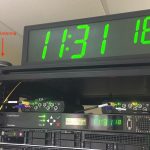
A recent test demonstrated that the combination of the SecureSync time server manufactured by Orolia and the Satellite Time and Location (STL) service provided by Satelles can deliver extremely accurate timing as compared to Coordinated Universal Time (UTC).
By Inside GNSS
2017 and 2018 saw unprecedented GNSS interference activity, from the eastern Mediterranean to Norway and Finland. Syria emerged as a testbed for electronic warfare capabilities. In April 2018, General Raymond Thomas, commander, U.S. Special Operations Command, referred to the region as “the most aggressive electronic warfare environment on the planet.”
By Inside GNSS
An Android mobile application, GNSS Compare can provide a real-time position using Galileo and GPS dual frequencies. It directly logs data from the real-time algorithms, and the retrieved files are used for analysis.
By Ciuban & Krainski, et al.
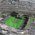
The European GNSS Agency (GSA) has published the Q3 2019 performance report. This report covers the period when a technical incident caused by an equipment malfunction in Galileo last July resulted in a six-day interruption in Galileo navigation and timing services.
By Inside GNSS
Echo Ridge LLC of Sterling, Virginia has been working with the Air Force Research Laboratory Center for Rapid Innovation to develop a way to determine position from non-GPS satellite signals in different frequency bands.
By Inside GNSS
Microchip Technology Inc. has released a smaller-footprint, higher-performance atomic clock to meet core telecomm, military and critical infrastructure requirements for wider thermal range, quicker lock and higher stability.
By Inside GNSS
John Brian Schleppe of Calgary, Alberta, Canada, passed away on January 7, 2020 after a short illness. From 2006 until his passing, he worked at NovAtel, Inc. of Calgary (now Hexagon|NovAtel) progressively as team leader software receiver development, engineering fellow, manager of research and NovAtel research fellow.
By Inside GNSS
A wheel-mounted inertial measurement unit provides high-rate (2 kHz) bias-free data for vehicle navigation, road-quality measurement systems and instantaneous wheel dynamics estimation for vehicle stability control.
By Oleg Mezentsev & Jussi Collin
The Galileo Return Link Service, which sends an automatic acknowledgement message to people activating a distress signal, in distress to receive automatic acknowledgement that their signal has been received, was declared operational on January 21.
By Inside GNSS
In the years since civil and commercial use of GPS and GNSS became common in the mid-1990s, a variety of software tools have been developed to perform offline analyses of GNSS performance and data collected from GNSS receivers. Some of these tools are part of commercial software packages such as Matlab [1] or STK [2]. This article focuses on tools that are freely available (as of early 2020) and are standalone or work with commercial software.
By Sam Pullen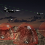
BAE Systems has entered a definitive Asset Purchase Agreement to acquire Collins Aerospace’s Military GPS business for $1.925 billion, and Raytheon’s Airborne Tactical Radios division for $275 million.
By Inside GNSS