Galileo Archives - Page 41 of 71 - Inside GNSS - Global Navigation Satellite Systems Engineering, Policy, and Design

Galileo

January 19, 2014

Ionospheric Scintillation

Ionospheric scintillations are rapid temporal fluctuations in both amplitude and phase of trans-ionospheric GNSS signals caused by the scattering of irregularities in the distribution of electrons encountered along the radio propagation path. The occurrence of scintillation has large day-to-day variability. The most severe scintillations are observed near the poles (at auroral latitudes) and near the equator (within ± 20 degrees of geomagnetic equator).

Read More >

By Inside GNSS

Reaching for the STARx

Equation 1

GNSS modernization includes not only the global coverage capabilities of GPS, GLONASS, Galileo, and BeiDou, but also regional GNSS enhancement systems such as Japan’s Quasi-Zenith Satellite System (QZSS), the Indian Regional Navigation Satellite System (IRNSS), and the European Geostationary Navigation Overlay Service (EGNOS).

Read More >

By Inside GNSS
[uam_ad id="183541"]
January 16, 2014

Galileo Funding, Satellite Tests Move Program Back on Track

Approval by the European Parliament of the new 2014-2020 European Union (EU) budget last November was widely seen as a step in the right direction for the 28-nation union, after more than a year of sometimes bitter monetary wrangling.

The Parliament quickly followed the move by voting to approve the financing and governance of Europe’s satellite navigation program over the same period. The measure passed the Parliamentary ballot by an impressive margin, with 603 votes in favor, 29 against, and 59 abstentions.

Read More >

By Inside GNSS
January 11, 2014

2014 Geospatial World Forum

The Geospatial World Forum and industry exhibition will be held at the Centre International de Conférences Genève (CICG), Geneva, Switzerland on May 5-9, 2014.

The call for abstracts has closed. Early registration is open until February 15, late registration will be from February 16 to April 25. Spot registration is available after April 25.

This year’s theme is "geoSMART Planet: Resources + Infrastructure & YOU!" Program highlights include:

Read More >

By Inside GNSS
January 9, 2014

Baška GNSS Conference 2014

The 8th annual conference on the Croatian Adriatic aims at GNSS experts and and focuses on GNSS resilience and GNSS applications development. It will take place at Baška on the resort island of Krk in Croatia from May 7 to May 9, 2014.

The deadline for abstracts is March 1, 2014.

Topics include:

  • core satellite navigation systems’ developments and modernisation,
  • satellite-based augmentation systems (SBAS),
  • space weather and ionospheric effects on GNSS performance and operation,
  • GNSS applications for air, marine, land and personal navigation, Location-Based Services, Intelligent Transport Systems, and Search and Rescue (SaR) operations,
  • resilience development againts natural (space weather and ionospheric) and artificial (jamming, spoofing and meaconing) disruptions of GNSS services
  • statistical and digital signal processing for electronic navigation and weak signal detection,
  • GNSS receiver design (including Software-Defined and Cognitive Radio),
  • GNSS education and professional advancement,
  • advanced multidisciplinary GNSS applications (in geomatics, transport, predictive analytics, remote sensing, agriculture, geodesy, forestry, tourism, environment protection, meteorology and science),
  • GNSS advancements, parallels and alternatives,
  • regulatory and legal aspects of GNSS utilisation,
  • Special session: space weather effects on GNSS performance and operation
  • Special session: statistical signal processing and Bayesian estimation for satellite navigation, and
  • Special session: Intelligent Transport Systems (ITS)

The Royal Institute of Navigation, London, UK, Faculty of Maritime Studies, University of Rijeka, Croatia and Faculty of Transport and Traffic Sciences, University of Zagreb, Croatia, and is technically co-sponsored by Beihang University of Aeronautics and Astronautics, Beijing, China.

For more information, contact Ms. Sally-Anne Cooke, the RIN conference and events manager at conference@rin.org.uk

By Inside GNSS
[uam_ad id="183541"]
December 12, 2013

Sixth Conference on European Union Space Policy

The 6th Conference on European Union Space Policy will take place at the European Commission’s Charlemagne Building, in Brussels, Belgium on January 28 and 29, 2014.

Registration is now open. Online registration closes January 22, 2014.

The theme is "What Direction for Europe in Space Between Now and 2020?." The conference is sponsored by the presidents of the European Commission, the European Council and the European Parliament.

Read More >

By Inside GNSS

GSA Invites Proposals for European GNSS R&D Projects

Horizon 2020 (H2020), the new incarnation of European Commission–funded research and innovation programs, has issued its first call for applications in satellite navigation.

The relatively modest — €38 million (US$52 million) out of a total of  €70 billion (US$92 billion) for the period 2014–2020 — represents an initial round of invitations for R&D proposals that previously were distributed under the framework programs (FPs). The deadline for submitting proposals is April 3, 2014.

Read More >

By Inside GNSS
November 30, 2013

GNSS Hotspots | November 2013

One of 12 magnetograms recorded at Greenwich Observatory during the Great Geomagnetic Storm of 1859
1996 soccer game in the Midwest, (Rick Dikeman image)
Nouméa ground station after the flood
A pencil and a coffee cup show the size of NASA’s teeny tiny PhoneSat
Bonus Hotspot: Naro Tartaruga AUV
Pacific lamprey spawning (photo by Jeremy Monroe, Fresh Waters Illustrated)
“Return of the Bucentaurn to the Molo on Ascension Day”, by (Giovanni Antonio Canal) Canaletto
The U.S. Naval Observatory Alternate Master Clock at 2nd Space Operations Squadron, Schriever AFB in Colorado. This photo was taken in January, 2006 during the addition of a leap second. The USNO master clocks control GPS timing. They are accurate to within one second every 20 million years (Satellites are so picky! Humans, on the other hand, just want to know if we’re too late for lunch) USAF photo by A1C Jason Ridder.
Detail of Compass/ BeiDou2 system diagram
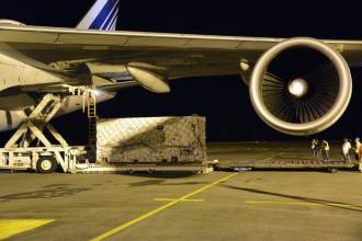
Hotspot 6: Beluga A300 600ST

1. PAPER, PLEASE.
Silver Spring, Maryland USA
√ The USA will stop printing nautical charts next April, the end of a 150 year tradition. Why? “Declining demand, electronic and digital charts and federal budget realities,” said NOAA’s Office of Coast Survey. They will maintain and update PDFs of more than a thousand coastal charts and refer those who admire traditional lithography to private printers who can do the job.

Read More >

By Inside GNSS
November 27, 2013

Auto Regulators Seek to Shape Navigation Devices and Apps

Highway safety officials are crafting guidelines aimed at pushing manufacturers to make portable electronic devices — including cell phones, hand-held navigation receivers, and navigation apps — less likely to distract drivers. They may face some push back, however, from members of Congress who are already questioning whether GNSS devices should be included under the proposed standards.
 

Read More >

By Inside GNSS
1 39 40 41 42 43 71
IGM_e-news_subscribe