inertial Archives - Page 4 of 4 - Inside GNSS - Global Navigation Satellite Systems Engineering, Policy, and Design

August 12, 2020

Get with the Inertial Program: An Advanced Engineering Archive

An extensive and significant body of technical information on inertial navigation, including detailed instruction, technical papers and use cases, has appeared online. This valuable resource is openly available to engineers, designers, integrators, and specifiers working on UAVs, aerial and ground survey and mapping, construction, surveillance and reconnaissance, satellite communications, military and much more. 

Read More >

By Inside GNSS
July 6, 2020

Silicon MEMS Accelerometer: the Latest Disruptor

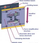
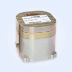
MEMS has moved into the high-end market, and the latest disruptor to take into account is silicon MEMS. That’s micro-electromechanical systems based in silicon chips, for short. Accelerometers with up to 100g range and 70µg bias in a very small form factor — 6 cubic centimeters — are exploding the horizons for inertial applications.

Read More >

By Inside GNSS
May 18, 2020

Photonic Technology Brings a Cutting Edge to Inertial

Order-of-magnitude advances in inertial technology seem to take place roughly every 20 years, and the industry is poised at such a point now. New developments in photonic technology make high-performance inertial measurement accessible at lower size, weight and power. Many applications from driverless cars to UAVs can now take advantage of positioning that can independently bridge GPS outages from 2 minutes up to 10 minutes.

Read More >

By Inside GNSS
January 2, 2020

Bootstrapping Location for Army Patrols

Forward-deployed U.S. military personnel will soon benefit from warfighter localization sensor units that provide tracking information in GPS-denied environments in a bootstrap mode. The Army Product Manager Sets, Kits Outfits and Tools awarded a $16.5 million contract to Robotic Research of Clarksburg, Maryland for WarLoc units to equip four deployed U.S. Army Brigade Combat Teams in various locations. The first batch of systems has already been shipped, and should enable soldiers on foot to keep track of each other in terrain where GPS systems are less effective.

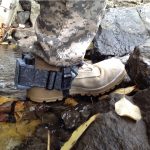
WarLoc provides localization and positioning data for teams of warfighters or first responders in signal-denied environments such as underground facilities and inside buildings and mega-cities, according to the company. The small sensor mounts on footwear. Multiple systems work together to further enhance accuracy and maintain the localization of teams.

[Heel-mounted warfighter localization sensor units, also known as WarLoc. Photo: Robotic Research.]

The tracking system augments its GPS receiver with an inertial measurement unit. The device connects with a smartphone through Bluetooth. Robotic Research fields two form factors of the WaLoc, one mounted over the top of the boot and another that wraps around the heel. Users view data readouts through an Android-based Tactical Assault Kit. The algorithms are reportedly robust to communications failures and dropouts, and the distributed nature works well in challenging communication environments.


By Inside GNSS
November 5, 2019

Inertial Breakthroughs Guide the Autonomous Vehicle

The complex and mission-critical needs of the autonomous vehicle market demand innovation at higher levels in several different sensors and in sensor integration. A new photonic chip technology offers promise in providing high-volume, low-cost manufacture of high-end, tactical-grade performance fiber-optic gyros (FOGs)for inertial navigation in GNSS-obstructed environments.

Read More >

By Inside GNSS
IGM_e-news_subscribe