Forward-deployed U.S. military personnel will soon benefit from warfighter localization sensor units that provide tracking information in GPS-denied environments in a bootstrap mode. The Army Product Manager Sets, Kits Outfits and Tools awarded a $16.5 million contract to Robotic Research of Clarksburg, Maryland for WarLoc units to equip four deployed U.S. Army Brigade Combat Teams in various locations. The first batch of systems has already been shipped, and should enable soldiers on foot to keep track of each other in terrain where GPS systems are less effective.
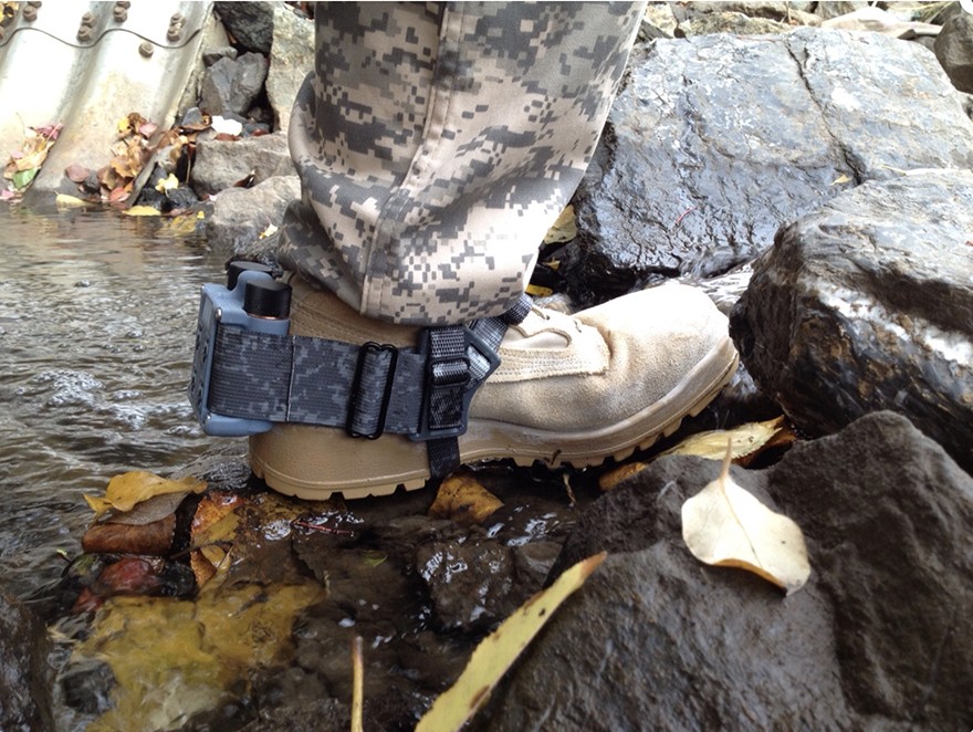
WarLoc provides localization and positioning data for teams of warfighters or first responders in signal-denied environments such as underground facilities and inside buildings and mega-cities, according to the company. The small sensor mounts on footwear. Multiple systems work together to further enhance accuracy and maintain the localization of teams.
[Heel-mounted warfighter localization sensor units, also known as WarLoc. Photo: Robotic Research.]
The tracking system augments its GPS receiver with an inertial measurement unit. The device connects with a smartphone through Bluetooth. Robotic Research fields two form factors of the WaLoc, one mounted over the top of the boot and another that wraps around the heel. Users view data readouts through an Android-based Tactical Assault Kit. The algorithms are reportedly robust to communications failures and dropouts, and the distributed nature works well in challenging communication environments.


_web.jpg "Canadian Army to Test NovAtel’s GAJT GPS Anti-Jam Antenna")

